TopoQuest Logo
Do you find TopoQuest useful?
Help keep TopoQuest running and adding new maps/features by donating!
Bitcoin:  19c7KJd3qBynnjoSw5npx9KScwjBe4ifkT
Litecoin:  LXs6TkuXGGXo1vDsWCkWVdjQX94eUKd6ui
Home View Maps Find Maps Find Places Resources & Links


Log Mountain, Idaho Topographic Map

USGS Map Title: Log Mountain, ID
USGS Map MRC: 44115G5
DRG (GeoTIFF) Download: o44115g5.tif


Neighboring USGS Topographic Map Quads:


  Teapot Mountain, ID  
44115H6
 

  Caton Lake, ID  
44115H5
 

  Yellow Pine, ID  
44115H4
 

  White Rock Peak, ID  
44115G6
 

  Log Mountain, ID  
44115G5
 

  Chilcoot Peak, ID  
44115G4
 

  Warm Lake, ID  
44115F6
 

  Landmark, ID  
44115F5
 

  Pistol Lake, ID  
44115F4


Map MRC Location:

N45°
W116°
N45°
W115°
H8 H7 H6 H5 H4 H3 H2 H1
G8 G7 G6 G5 G4 G3 G2 G1
F8 F7 F6 F5 F4 F3 F2 F1
E8 E7 E6 E5 E4 E3 E2 E1
D8 D7 D6 D5 D4 D3 D2 D1
C8 C7 C6 C5 C4 C3 C2 C1
B8 B7 B6 B5 B4 B3 B2 B1
A8 A7 A6 A5 A4 A3 A2 A1
N44°
W116°
N44°
W115°

Log Mountain, ID USGS 1:24K Topographic Map Preview:
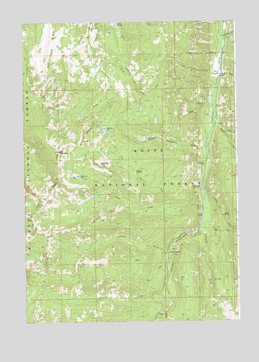
Log Mountain, ID USGS Topographic Map
Click on map above to begin viewing in our Map Viewer.

This topographic map contains these locations and features:
Feature Name Type Latitude Longitude GNIS ID View Map
Barrel SpringSpringN44.7943°W115.5083°396074View Map
Bear CreekStreamN44.8332°W115.5132°377115View Map
Buck CreekStreamN44.7921°W115.5184°378368View Map
Burntlog CreekStreamN44.7991°W115.5198°378568View Map
Caton Lake TrailTrailN44.8613°W115.5682°379052View Map
Caton MeadowFlatN44.8741°W115.5715°379053View Map
Coffee CreekStreamN44.7771°W115.5384°379491View Map
Cox CreekStreamN44.8541°W115.5090°379978View Map
Ditch CreekStreamN44.7993°W115.5198°396405View Map
Ditch Creek TrailTrailN44.8152°W115.5634°380629View Map
Forstrum CreekStreamN44.8627°W115.5082°381936View Map
Halfway CreekStreamN44.7830°W115.5384°382814View Map
Halfway StationLocaleN44.7782°W115.5412°382824View Map
Hanson CreekStreamN44.8693°W115.5079°382878View Map
Kitchen CreekStreamN44.8543°W115.5090°384265View Map
Log MountainSummitN44.8213°W115.6046°396812View Map
Moose CreekStreamN44.8524°W115.5087°387175View Map
Rainbow LakeLakeN44.8304°W115.5777°389043View Map
Round MeadowFlatN44.8124°W115.5604°389654View Map
Rustican CreekStreamN44.7638°W115.5423°389742View Map
Shell Rock LakeLakeN44.8108°W115.5932°390285View Map
Shell Rock PeakSummitN44.8160°W115.5809°390286View Map
Trapper CreekStreamN44.8313°W115.5137°392350View Map
Trout CreekStreamN44.7532°W115.5432°392415View Map
Twin Bridges CampgroundLocaleN44.8057°W115.5218°392495View Map
Valley CountyCivilN44.7666°W115.5663°399756View Map
Wardenhoff CreekStreamN44.8218°W115.5184°392832View Map
Wardenhoff MeadowsFlatN44.8266°W115.5543°392833View Map
Whitehorse RapidsRapidsN44.7852°W115.5343°393385View Map

Note: Coordinates in the location and feature list above are referenced to NAD83 datum.


Copyright (C) 2008-2025 Ryan Niemi / Sunset Dynamics ... All Rights Reserved