TopoQuest Logo
Do you find TopoQuest useful?
Help keep TopoQuest running and adding new maps/features by donating!
Bitcoin:  19c7KJd3qBynnjoSw5npx9KScwjBe4ifkT
Litecoin:  LXs6TkuXGGXo1vDsWCkWVdjQX94eUKd6ui
Home View Maps Find Maps Find Places Resources & Links


Lanes Bridge, California Topographic Map

USGS Map Title: Lanes Bridge, CA
USGS Map MRC: 36119H7
DRG (GeoTIFF) Download: o36119h7.tif


Neighboring USGS Topographic Map Quads:


  Daulton, CA  
37119A8
 

  Little Table Mountain, CA  
37119A7
 

  Millerton Lake West, CA  
37119A6
 

  Gregg, CA  
36119H8
 

  Lanes Bridge, CA  
36119H7
 

  Friant, CA  
36119H6
 

  Herndon, CA  
36119G8
 

  Fresno North, CA  
36119G7
 

  Clovis, CA  
36119G6


Map MRC Location:

N37°
W120°
N37°
W119°
H8 H7 H6 H5 H4 H3 H2 H1
G8 G7 G6 G5 G4 G3 G2 G1
F8 F7 F6 F5 F4 F3 F2 F1
E8 E7 E6 E5 E4 E3 E2 E1
D8 D7 D6 D5 D4 D3 D2 D1
C8 C7 C6 C5 C4 C3 C2 C1
B8 B7 B6 B5 B4 B3 B2 B1
A8 A7 A6 A5 A4 A3 A2 A1
N36°
W120°
N36°
W119°

Lanes Bridge, CA USGS 1:24K Topographic Map Preview:
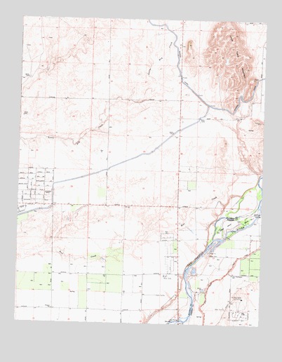
Lanes Bridge, CA USGS Topographic Map
Click on map above to begin viewing in our Map Viewer.

This topographic map contains these locations and features:
Feature Name Type Latitude Longitude GNIS ID View Map
Arnold Ranch Airport (historical)AirportN36.9136°W119.7907°1653466View Map
Bonadelle Ranchos NinePopulated PlaceN36.9599°W119.7982°1812784View Map
Bonadelle Ranchos-Madera Ranchos Census Designated PlaceCensusN36.9281°W119.8748°2407879View Map
Cobbs IslandIslandN36.9158°W119.7699°221285View Map
Deep Well School (historical)SchoolN36.9233°W119.8215°1666149View Map
Fort Washington Census Designated PlaceCensusN36.8793°W119.7613°2583015View Map
Fort Washington Country ClubLocaleN36.8855°W119.7599°1654258View Map
Fort Washington SchoolSchoolN36.8955°W119.7654°223711View Map
Island Number OneIslandN36.9188°W119.7574°254828View Map
Lanes BridgeBridgeN36.8763°W119.7918°252037View Map
Little Dry CreekStreamN36.9266°W119.7504°262593View Map
Madera County Fire Department Station 9BuildingN36.9088°W119.8008°2623905View Map
Rolling HillsPopulated PlaceN36.9033°W119.7976°1812811View Map
Rolling Hills Census Designated PlaceCensusN36.9040°W119.7967°2628784View Map
Sumner HillPopulated PlaceN36.9555°W119.7501°1812814View Map
Valley Children's HospitalHospitalN36.8839°W119.8003°1812815View Map
Webster SchoolSchoolN36.8808°W119.8574°237389View Map

Note: Coordinates in the location and feature list above are referenced to NAD83 datum.


Copyright (C) 2008-2024 Ryan Niemi / Sunset Dynamics ... All Rights Reserved