TopoQuest Logo
Do you find TopoQuest useful?
Help keep TopoQuest running and adding new maps/features by donating!
Bitcoin:  19c7KJd3qBynnjoSw5npx9KScwjBe4ifkT
Litecoin:  LXs6TkuXGGXo1vDsWCkWVdjQX94eUKd6ui
Home View Maps Find Maps Find Places Resources & Links


Little Table Mountain, California Topographic Map

USGS Map Title: Little Table Mountain, CA
USGS Map MRC: 37119A7
DRG (GeoTIFF) Download: o37119a7.tif


Neighboring USGS Topographic Map Quads:


  Raymond, CA  
37119B8
 

  Knowles, CA  
37119B7
 

  O'Neals, CA  
37119B6
 

  Daulton, CA  
37119A8
 

  Little Table Mountain, CA  
37119A7
 

  Millerton Lake West, CA  
37119A6
 

  Gregg, CA  
36119H8
 

  Lanes Bridge, CA  
36119H7
 

  Friant, CA  
36119H6


Map MRC Location:

N38°
W120°
N38°
W119°
H8 H7 H6 H5 H4 H3 H2 H1
G8 G7 G6 G5 G4 G3 G2 G1
F8 F7 F6 F5 F4 F3 F2 F1
E8 E7 E6 E5 E4 E3 E2 E1
D8 D7 D6 D5 D4 D3 D2 D1
C8 C7 C6 C5 C4 C3 C2 C1
B8 B7 B6 B5 B4 B3 B2 B1
A8 A7 A6 A5 A4 A3 A2 A1
N37°
W120°
N37°
W119°

Little Table Mountain, CA USGS 1:24K Topographic Map Preview:
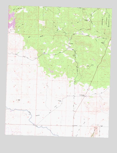
Little Table Mountain, CA USGS Topographic Map
Click on map above to begin viewing in our Map Viewer.

This topographic map contains these locations and features:
Feature Name Type Latitude Longitude GNIS ID View Map
Adobe HillSummitN37.0338°W119.8618°217994View Map
Bates StationLocaleN37.0902°W119.8024°218727View Map
Davis RanchLocaleN37.0799°W119.8327°222057View Map
Four CornersLocaleN37.0105°W119.7938°223736View Map
Lake Jane 686 DamDamN37.0616°W119.8227°1664014View Map
Little Table MountainSummitN37.0088°W119.7668°227386View Map
Marysdale School (historical)SchoolN37.0080°W119.7624°1670199View Map
Morris Ranch (historical)LocaleN37.0430°W119.7813°1670200View Map
Shannon RanchLocaleN37.0763°W119.8621°1670204View Map
Shaubach RanchLocaleN37.0913°W119.7596°232880View Map
Twentytwo Mile HouseLocaleN37.0394°W119.7813°236682View Map
Urrutia FeedlotLocaleN37.0117°W119.7589°2611999View Map
Urrutia RanchLocaleN37.0113°W119.7613°236936View Map
Wide Awake RanchLocaleN37.0341°W119.8088°237727View Map
Zebra StationLocaleN37.1130°W119.7785°238309View Map

Note: Coordinates in the location and feature list above are referenced to NAD83 datum.


Copyright (C) 2008-2025 Ryan Niemi / Sunset Dynamics ... All Rights Reserved