TopoQuest Logo
Do you find TopoQuest useful?
Help keep TopoQuest running and adding new maps/features by donating!
Bitcoin:  19c7KJd3qBynnjoSw5npx9KScwjBe4ifkT
Litecoin:  LXs6TkuXGGXo1vDsWCkWVdjQX94eUKd6ui
Home View Maps Find Maps Find Places Resources & Links


Laneville, Texas Topographic Map

USGS Map Title: Laneville, TX
USGS Map MRC: 31094H7
DRG (GeoTIFF) Download: o31094h7.tif


Neighboring USGS Topographic Map Quads:


  Gum Springs, TX  
32094A8
 

  Berryhill Creek, TX  
32094A7
 

  Minden, TX  
32094A6
 

  New Salem, TX  
31094H8
 

  Laneville, TX  
31094H7
 

  Mount Enterprise, TX  
31094H6
 

  Reklaw, TX  
31094G8
 

  Cushing, TX  
31094G7
 

  Trawick, TX  
31094G6


Map MRC Location:

N32°
W95°
N32°
W94°
H8 H7 H6 H5 H4 H3 H2 H1
G8 G7 G6 G5 G4 G3 G2 G1
F8 F7 F6 F5 F4 F3 F2 F1
E8 E7 E6 E5 E4 E3 E2 E1
D8 D7 D6 D5 D4 D3 D2 D1
C8 C7 C6 C5 C4 C3 C2 C1
B8 B7 B6 B5 B4 B3 B2 B1
A8 A7 A6 A5 A4 A3 A2 A1
N31°
W95°
N31°
W94°

Laneville, TX USGS 1:24K Topographic Map Preview:
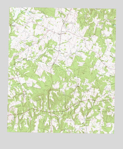
Laneville, TX USGS Topographic Map
Click on map above to begin viewing in our Map Viewer.

This topographic map contains these locations and features:
Feature Name Type Latitude Longitude GNIS ID View Map
Blanton CemeteryCemeteryN31.8896°W94.8655°1330851View Map
Blanton CemeteryCemeteryN31.9216°W94.7947°1330852View Map
Booker CemeteryCemeteryN31.9702°W94.7577°1331065View Map
Buckner CreekStreamN31.9485°W94.8472°1331515View Map
Cushman LakeReservoirN31.9820°W94.8698°1333836View Map
Dansby CemeteryCemeteryN31.8924°W94.8572°1334038View Map
Elkins - Bagley CemeteryCemeteryN31.9219°W94.8316°1329922View Map
Elkins MountainsRangeN31.9107°W94.8352°1335317View Map
FreeneytownPopulated PlaceN31.9516°W94.8683°1378327View Map
Gage CemeteryCemeteryN31.9985°W94.7810°1336332View Map
GlenfawnPopulated PlaceN31.9138°W94.8569°1378363View Map
Glenfawn CemeteryCemeteryN31.9057°W94.8585°1336589View Map
Gould CemeteryCemeteryN31.9221°W94.7941°1336751View Map
Holleman CemeteryCemeteryN31.9435°W94.7741°1337948View Map
Hunter Lowry Airport (historical)AirportN31.8974°W94.8669°1387050View Map
Irwin BranchStreamN31.9585°W94.8222°1338511View Map
Johnson BranchStreamN31.8760°W94.7963°1338774View Map
Jones - Seagroves CemeteryCemeteryN31.9082°W94.8497°1338841View Map
Jones Lake DamDamN31.9852°W94.7519°1861248View Map
Kilgore Public LibraryBuildingN31.9585°W94.8694°2014897View Map
LanevillePopulated PlaceN31.9743°W94.8138°1339614View Map
Laneville DivisionCivilN31.9447°W94.8555°1938908View Map
Laneville Post OfficePost OfficeN31.9723°W94.8149°2732086View Map
Laneville Volunteer Fire DepartmentBuildingN31.9767°W94.8068°2655334View Map
Lyles-Sanders CemeteryCemeteryN31.9182°W94.7802°1340751View Map
McCune CemeteryCemeteryN31.9721°W94.7783°1341176View Map
Mount Zion ChurchChurchN31.9129°W94.8085°1342142View Map
Oak FlatsPopulated PlaceN31.9474°W94.7669°1378778View Map
Parker BranchStreamN31.9896°W94.7605°1343594View Map
Pine Grove ChurchChurchN31.9132°W94.7558°1344047View Map
Pirtle BranchStreamN31.9668°W94.8722°1344132View Map
Riddle LakesReservoirN31.9949°W94.8508°1345195View Map
Sawmill BranchStreamN31.9960°W94.8616°1346736View Map
Scoober CreekStreamN31.9874°W94.8705°1346806View Map
Shiloh CemeteryCemeteryN31.8879°W94.8172°1347041View Map
Simon CemeteryCemeteryN31.8829°W94.7833°1347150View Map
Sirls MountainSummitN31.9156°W94.7981°1348108View Map
Sulphur SpringSpringN31.8991°W94.7691°1348055View Map
Sulphur SpringsPopulated PlaceN31.8966°W94.7652°1379130View Map
Valley GrovePopulated PlaceN31.8791°W94.8085°1379202View Map

Note: Coordinates in the location and feature list above are referenced to NAD83 datum.


Copyright (C) 2008-2025 Ryan Niemi / Sunset Dynamics ... All Rights Reserved