TopoQuest Logo
Do you find TopoQuest useful?
Help keep TopoQuest running and adding new maps/features by donating!
Bitcoin:  19c7KJd3qBynnjoSw5npx9KScwjBe4ifkT
Litecoin:  LXs6TkuXGGXo1vDsWCkWVdjQX94eUKd6ui
Home View Maps Find Maps Find Places Resources & Links


Mount Butler, Oregon Topographic Map

USGS Map Title: Mount Butler, OR
USGS Map MRC: 42124G3
DRG (GeoTIFF) Download: o42124g3.tif


Neighboring USGS Topographic Map Quads:


  Langlois, OR  
42124H4
 

  Calf Ranch Mountain, OR  
42124H3
 

  Dement Creek, OR  
42124H2
 

  Sixes, OR  
42124G4
 

  Mount Butler, OR  
42124G3
 

  Barklow Mountain, OR  
42124G2
 

  Port Orford, OR  
42124F4
 

  Father Mountain, OR  
42124F3
 

  Ophir Mountain, OR  
42124F2


Map MRC Location:

N43°
W125°
N43°
W124°
H8 H7 H6 H5 H4 H3 H2 H1
G8 G7 G6 G5 G4 G3 G2 G1
F8 F7 F6 F5 F4 F3 F2 F1
E8 E7 E6 E5 E4 E3 E2 E1
D8 D7 D6 D5 D4 D3 D2 D1
C8 C7 C6 C5 C4 C3 C2 C1
B8 B7 B6 B5 B4 B3 B2 B1
A8 A7 A6 A5 A4 A3 A2 A1
N42°
W125°
N42°
W124°

Mount Butler, OR USGS 1:24K Topographic Map Preview:
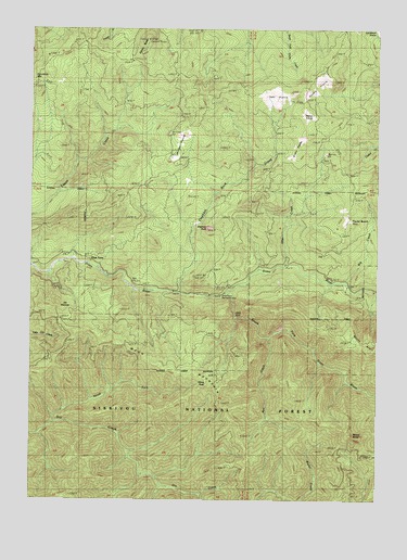
Mount Butler, OR USGS Topographic Map
Click on map above to begin viewing in our Map Viewer.

This topographic map contains these locations and features:
Feature Name Type Latitude Longitude GNIS ID View Map
Bea CreekStreamN42.8054°W124.3401°1154693View Map
Bee CreekStreamN42.7932°W124.2901°1137871View Map
Big CreekStreamN42.8079°W124.2623°1138000View Map
Brushy PrairiesAreaN42.8437°W124.2809°1134998View Map
China PeakSummitN42.7807°W124.3128°1139690View Map
Double PrairieAreaN42.8596°W124.2734°1134996View Map
Edson ButteSummitN42.8723°W124.3341°1141686View Map
Elephant RockPillarN42.8220°W124.3127°1141729View Map
Elephant Rock CreekStreamN42.8043°W124.3229°1141731View Map
Elk WallowsBasinN42.8015°W124.3626°1141806View Map
Grassy CreekStreamN42.7668°W124.3720°1154691View Map
Hells GateGapN42.7990°W124.3023°1135000View Map
Hilltop PrairieAreaN42.8521°W124.2770°1134997View Map
Inman MineMineN42.8046°W124.3043°1144100View Map
Lily B CreekStreamN42.8082°W124.2651°1154694View Map
Moon MountainSummitN42.7807°W124.3128°1146422View Map
Mount AverySummitN42.7903°W124.2508°1137357View Map
Mount ButlerSummitN42.7673°W124.2603°1139052View Map
North Fork Dry CreekStreamN42.7707°W124.3679°1146946View Map
Otter CreekStreamN42.8123°W124.2840°1147288View Map
Plum TreesPopulated PlaceN42.8140°W124.3568°1147806View Map
Sixes River Recreation SiteParkN42.8042°W124.3083°1154695View Map
South Fork Sixes RiverStreamN42.8043°W124.3062°1150015View Map
Taylor RanchLocaleN42.8251°W124.2620°1150923View Map
Tent PrairieFlatN42.8554°W124.2907°1150982View Map
Wilson PrairieAreaN42.8443°W124.3234°1134999View Map

Note: Coordinates in the location and feature list above are referenced to NAD83 datum.


Copyright (C) 2008-2025 Ryan Niemi / Sunset Dynamics ... All Rights Reserved