TopoQuest Logo
Do you find TopoQuest useful?
Help keep TopoQuest running and adding new maps/features by donating!
Bitcoin:  19c7KJd3qBynnjoSw5npx9KScwjBe4ifkT
Litecoin:  LXs6TkuXGGXo1vDsWCkWVdjQX94eUKd6ui
Home View Maps Find Maps Find Places Resources & Links


Lanham, Mississippi Topographic Map

USGS Map Title: Lanham, MS
USGS Map MRC: 31089E1
DRG (GeoTIFF) Download: o31089e1.tif


Neighboring USGS Topographic Map Quads:


  Laurel West, MS  
31089F2
 

  Laurel East, MS  
31089F1
 

  Myrick, MS  
31088F8
 

  Ellisville, MS  
31089E2
 

  Lanham, MS  
31089E1
 

  Strengthford, MS  
31088E8
 

  Barrontown, MS  
31089D2
 

  Ovett, MS  
31089D1
 

  Rhodes, MS  
31088D8


Map MRC Location:

N32°
W90°
N32°
W89°
H8 H7 H6 H5 H4 H3 H2 H1
G8 G7 G6 G5 G4 G3 G2 G1
F8 F7 F6 F5 F4 F3 F2 F1
E8 E7 E6 E5 E4 E3 E2 E1
D8 D7 D6 D5 D4 D3 D2 D1
C8 C7 C6 C5 C4 C3 C2 C1
B8 B7 B6 B5 B4 B3 B2 B1
A8 A7 A6 A5 A4 A3 A2 A1
N31°
W90°
N31°
W89°

Lanham, MS USGS 1:24K Topographic Map Preview:
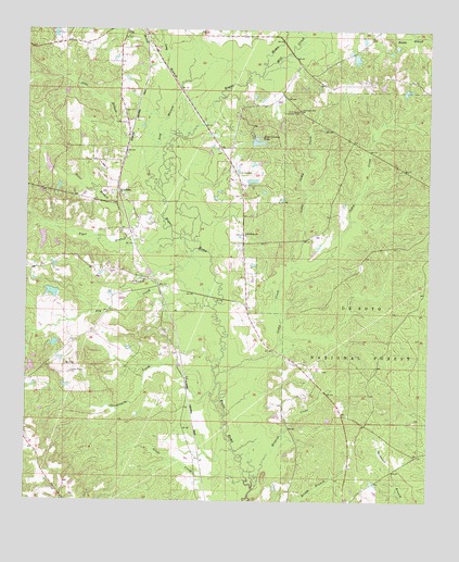
Lanham, MS USGS Topographic Map
Click on map above to begin viewing in our Map Viewer.

This topographic map contains these locations and features:
Feature Name Type Latitude Longitude GNIS ID View Map
Abbs BranchStreamN31.5874°W89.0873°692372View Map
Arnold Landrum Pond DamDamN31.5835°W89.0551°695404View Map
Bill Deavors Lake DamDamN31.5702°W89.1184°695402View Map
Bill Deavors Pond DamDamN31.5685°W89.1151°695401View Map
Camp CreekStreamN31.5329°W89.0656°692813View Map
Chinquapin CreekStreamN31.5313°W89.0653°692894View Map
CrottsPopulated PlaceN31.5571°W89.0839°705113View Map
Dry CreekStreamN31.5510°W89.0667°693121View Map
Ellisville JunctionLocaleN31.5788°W89.0973°705114View Map
Flat BranchStreamN31.6154°W89.0820°693226View Map
Gator BranchStreamN31.5699°W89.0895°693288View Map
Geer Lake DamDamN31.6168°W89.0317°695407View Map
Glade BranchStreamN31.6099°W89.0773°693300View Map
Glade CreekStreamN31.5054°W89.0564°693301View Map
Good Hope ChurchChurchN31.5704°W89.0570°693320View Map
Jones County LakeReservoirN31.5954°W89.0532°693635View Map
Jones County Lake DamDamN31.5935°W89.0551°695405View Map
Landrum School (historical)SchoolN31.5474°W89.0542°705120View Map
LanhamPopulated PlaceN31.5832°W89.0970°693686View Map
Little Camp CreekStreamN31.5624°W89.0426°693750View Map
Long BranchStreamN31.5843°W89.0845°693819View Map
Marlow Shoemake DamDamN31.6068°W89.0084°695406View Map
Mill CreekStreamN31.6157°W89.0509°693996View Map
MonarchPopulated PlaceN31.5127°W89.0728°705122View Map
Mount Moriah CemeteryCemeteryN31.5585°W89.0889°707368View Map
Mount Moriah Landmark Missionary Baptist ChurchChurchN31.5588°W89.0887°694063View Map
Mount Moriah School (historical)SchoolN31.5588°W89.0878°707369View Map
Pine Burr Ranch LakeDamN31.5552°W89.1134°695400View Map
Point Laurel Lookout TowerTowerN31.6035°W89.0403°711294View Map
TallahomoPopulated PlaceN31.5327°W89.0756°705124View Map
Tiger BranchStreamN31.5696°W89.0795°694978View Map
Tucker CemeteryCemeteryN31.6004°W89.0942°695013View Map
Wildcat CreekStreamN31.5032°W89.0542°695174View Map

Note: Coordinates in the location and feature list above are referenced to NAD83 datum.


Copyright (C) 2008-2025 Ryan Niemi / Sunset Dynamics ... All Rights Reserved