TopoQuest Logo
Do you find TopoQuest useful?
Help keep TopoQuest running and adding new maps/features by donating!
Bitcoin:  19c7KJd3qBynnjoSw5npx9KScwjBe4ifkT
Litecoin:  LXs6TkuXGGXo1vDsWCkWVdjQX94eUKd6ui
Home View Maps Find Maps Find Places Resources & Links


Latah, Washington Topographic Map

USGS Map Title: Latah, WA
USGS Map MRC: 47117C2
DRG (GeoTIFF) Download: o47117c2.tif


Neighboring USGS Topographic Map Quads:


  Spangle East, WA  
47117D3
 

  Fairfield, WA  
47117D2
 

  Setters, ID  
47117D1
 

  Spring Valley, WA  
47117C3
 

  Latah, WA  
47117C2
 

  Tekoa Mountain, WA  
47117C1
 

  Rosalia, WA  
47117B3
 

  Oakesdale, WA  
47117B2
 

  Tekoa, WA  
47117B1


Map MRC Location:

N48°
W118°
N48°
W117°
H8 H7 H6 H5 H4 H3 H2 H1
G8 G7 G6 G5 G4 G3 G2 G1
F8 F7 F6 F5 F4 F3 F2 F1
E8 E7 E6 E5 E4 E3 E2 E1
D8 D7 D6 D5 D4 D3 D2 D1
C8 C7 C6 C5 C4 C3 C2 C1
B8 B7 B6 B5 B4 B3 B2 B1
A8 A7 A6 A5 A4 A3 A2 A1
N47°
W118°
N47°
W117°

Latah, WA USGS 1:24K Topographic Map Preview:
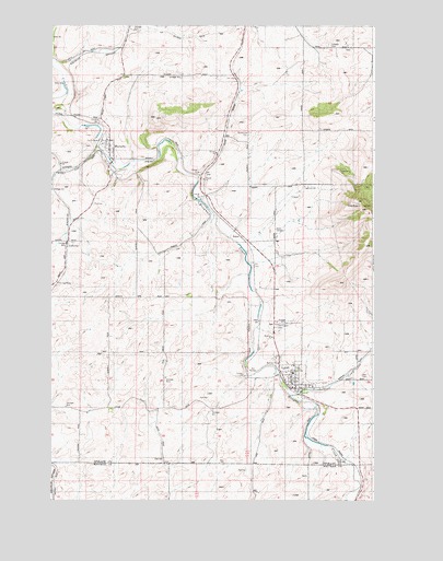
Latah, WA USGS Topographic Map
Click on map above to begin viewing in our Map Viewer.

This topographic map contains these locations and features:
Feature Name Type Latitude Longitude GNIS ID View Map
Cove CreekStreamN47.2774°W117.1568°1504205View Map
CurlewLocaleN47.3682°W117.2385°1514732View Map
Evergreen CemeteryCemeteryN47.2960°W117.1634°1504831View Map
Fairfield CemeteryCemeteryN47.3699°W117.1430°1504802View Map
Gelbert MountainSummitN47.3293°W117.1313°1505103View Map
JeffersonLocaleN47.3174°W117.2444°1509734View Map
LatahPopulated PlaceN47.2816°W117.1555°1512380View Map
Latah CemeteryCemeteryN47.2821°W117.1271°1506089View Map
Latah Post OfficePost OfficeN47.2795°W117.1565°2781687View Map
RahmPopulated PlaceN47.3196°W117.1763°1513189View Map
Rosewood CemeteryCemeteryN47.3471°W117.1735°1507923View Map
Spokane County Fire District 12BuildingN47.2794°W117.1552°2643805View Map
Spokane County Fire District 12BuildingN47.3432°W117.2276°2643769View Map
Town of LatahCivilN47.2820°W117.1555°2412879View Map
Town of WaverlyCivilN47.3381°W117.2312°2413458View Map
WaverlyPopulated PlaceN47.3427°W117.2280°1512783View Map
Waverly Post OfficePost OfficeN47.3424°W117.2281°2781638View Map
West FairfieldPopulated PlaceN47.3707°W117.2213°1511418View Map

Note: Coordinates in the location and feature list above are referenced to NAD83 datum.


Copyright (C) 2008-2024 Ryan Niemi / Sunset Dynamics ... All Rights Reserved