TopoQuest Logo
Do you find TopoQuest useful?
Help keep TopoQuest running and adding new maps/features by donating!
Bitcoin:  19c7KJd3qBynnjoSw5npx9KScwjBe4ifkT
Litecoin:  LXs6TkuXGGXo1vDsWCkWVdjQX94eUKd6ui
Home View Maps Find Maps Find Places Resources & Links


Oakesdale, Washington Topographic Map

USGS Map Title: Oakesdale, WA
USGS Map MRC: 47117B2
DRG (GeoTIFF) Download: o47117b2.tif


Neighboring USGS Topographic Map Quads:


  Spring Valley, WA  
47117C3
 

  Latah, WA  
47117C2
 

  Tekoa Mountain, WA  
47117C1
 

  Rosalia, WA  
47117B3
 

  Oakesdale, WA  
47117B2
 

  Tekoa, WA  
47117B1
 

  Steptoe, WA  
47117A3
 

  Garfield, WA  
47117A2
 

  Farmington, WA  
47117A1


Map MRC Location:

N48°
W118°
N48°
W117°
H8 H7 H6 H5 H4 H3 H2 H1
G8 G7 G6 G5 G4 G3 G2 G1
F8 F7 F6 F5 F4 F3 F2 F1
E8 E7 E6 E5 E4 E3 E2 E1
D8 D7 D6 D5 D4 D3 D2 D1
C8 C7 C6 C5 C4 C3 C2 C1
B8 B7 B6 B5 B4 B3 B2 B1
A8 A7 A6 A5 A4 A3 A2 A1
N47°
W118°
N47°
W117°

Oakesdale, WA USGS 1:24K Topographic Map Preview:
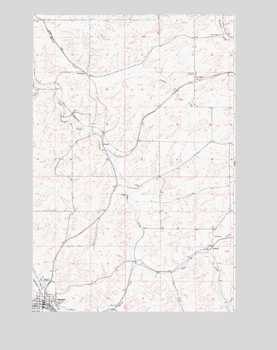
Oakesdale, WA USGS Topographic Map
Click on map above to begin viewing in our Map Viewer.

This topographic map contains these locations and features:
Feature Name Type Latitude Longitude GNIS ID View Map
FairbanksPopulated PlaceN47.2243°W117.2152°1510960View Map
FletcherLocaleN47.1343°W117.1913°1514697View Map
Geary (historical)LocaleN47.1674°W117.2055°1512961View Map
John Wayne TrailTrailN47.2291°W117.2496°1513015View Map
Kelley CreekStreamN47.1263°W117.1980°1510712View Map
Lone PinePopulated PlaceN47.2227°W117.1502°1511103View Map
Lone Pine CemeteryCemeteryN47.2254°W117.1498°1506264View Map
OakesdalePopulated PlaceN47.1282°W117.2427°1507134View Map
Oakesdale AirportAirportN47.1435°W117.2372°2443443View Map
Oakesdale CemeteryCemeteryN47.1373°W117.2415°1507135View Map
Oakesdale Elementary and High SchoolSchoolN47.1266°W117.2432°1515589View Map
Oakesdale Post OfficePost OfficeN47.1284°W117.2433°2781582View Map
SeaburyLocaleN47.1955°W117.2066°1511463View Map
Spring CreekStreamN47.1457°W117.1863°1508633View Map
Town of OakesdaleCivilN47.1305°W117.2465°2413067View Map
WarnerPopulated PlaceN47.1532°W117.1374°1513233View Map
Whitman County Fire District 10 OakesdaleBuildingN47.1290°W117.2430°2643704View Map
Willow CreekStreamN47.1502°W117.1468°1509549View Map

Note: Coordinates in the location and feature list above are referenced to NAD83 datum.


Copyright (C) 2008-2025 Ryan Niemi / Sunset Dynamics ... All Rights Reserved