TopoQuest Logo
Do you find TopoQuest useful?
Help keep TopoQuest running and adding new maps/features by donating!
Bitcoin:  19c7KJd3qBynnjoSw5npx9KScwjBe4ifkT
Litecoin:  LXs6TkuXGGXo1vDsWCkWVdjQX94eUKd6ui
Home View Maps Find Maps Find Places Resources & Links


Tekoa, Washington Topographic Map

USGS Map Title: Tekoa, WA
USGS Map MRC: 47117B1
DRG (GeoTIFF) Download: o47117b1.tif


Neighboring USGS Topographic Map Quads:


  Latah, WA  
47117C2
 

  Tekoa Mountain, WA  
47117C1
 

  Plummer, ID  
47116C8
 

  Oakesdale, WA  
47117B2
 

  Tekoa, WA  
47117B1
 

  Tensed, ID  
47116B8
 

  Garfield, WA  
47117A2
 

  Farmington, WA  
47117A1
 

  Mission Mountain, ID  
47116A8


Map MRC Location:

N48°
W118°
N48°
W117°
H8 H7 H6 H5 H4 H3 H2 H1
G8 G7 G6 G5 G4 G3 G2 G1
F8 F7 F6 F5 F4 F3 F2 F1
E8 E7 E6 E5 E4 E3 E2 E1
D8 D7 D6 D5 D4 D3 D2 D1
C8 C7 C6 C5 C4 C3 C2 C1
B8 B7 B6 B5 B4 B3 B2 B1
A8 A7 A6 A5 A4 A3 A2 A1
N47°
W118°
N47°
W117°

Tekoa, WA USGS 1:24K Topographic Map Preview:
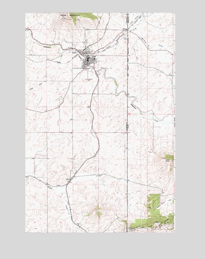
Tekoa, WA USGS Topographic Map
Click on map above to begin viewing in our Map Viewer.

This topographic map contains these locations and features:
Feature Name Type Latitude Longitude GNIS ID View Map
City of TekoaCivilN47.2247°W117.0731°2412043View Map
Goldenrod CemeteryCemeteryN47.2117°W117.0745°1505171View Map
Hn(os(oskwe' SpringSpringN47.1371°W117.0174°2081997View Map
Hnchdmine'kwe' (historical)LocaleN47.2392°W117.0342°2081994View Map
Liberty ButteSummitN47.1660°W117.0043°373568View Map
Little Hangman CreekStreamN47.2241°W117.0766°373634View Map
Lovell ValleyValleyN47.2424°W117.0385°386206View Map
Moctileme CreekStreamN47.2396°W117.0366°387065View Map
SelticePopulated PlaceN47.1555°W117.0871°1511301View Map
St'umt'umm MountainSummitN47.1372°W117.0672°2081993View Map
TekoaPopulated PlaceN47.2232°W117.0721°1508933View Map
Tekoa Ambulance ServiceBuildingN47.2220°W117.0737°2643696View Map
Tekoa DivisionCivilN47.1924°W117.1029°1939653View Map
Tekoa Fire DepartmentBuildingN47.2270°W117.0737°2619398View Map
Tekoa Post OfficePost OfficeN47.2230°W117.0733°2769268View Map
TilmoLocaleN47.2413°W117.0371°399591View Map
Whittman County Sheriff Department TekoaBuildingN47.2226°W117.0731°2721992View Map
WillardPopulated PlaceN47.2405°W117.0391°398360View Map
WillardPopulated PlaceN47.2402°W117.0396°1511432View Map
Willard FieldAirportN47.2357°W117.0432°1533995View Map

Note: Coordinates in the location and feature list above are referenced to NAD83 datum.


Copyright (C) 2008-2025 Ryan Niemi / Sunset Dynamics ... All Rights Reserved