TopoQuest Logo
Do you find TopoQuest useful?
Help keep TopoQuest running and adding new maps/features by donating!
Bitcoin:  19c7KJd3qBynnjoSw5npx9KScwjBe4ifkT
Litecoin:  LXs6TkuXGGXo1vDsWCkWVdjQX94eUKd6ui
Home View Maps Find Maps Find Places Resources & Links


Vernalis, California Topographic Map

USGS Map Title: Vernalis, CA
USGS Map MRC: 37121F3
DRG (GeoTIFF) Download: o37121f3.tif


Neighboring USGS Topographic Map Quads:


  Union Island, CA  
37121G4
 

  Lathrop, CA  
37121G3
 

  Manteca, CA  
37121G2
 

  Tracy, CA  
37121F4
 

  Vernalis, CA  
37121F3
 

  Ripon, CA  
37121F2
 

  Lone Tree Creek, CA  
37121E4
 

  Solyo, CA  
37121E3
 

  Westley, CA  
37121E2


Map MRC Location:

N38°
W122°
N38°
W121°
H8 H7 H6 H5 H4 H3 H2 H1
G8 G7 G6 G5 G4 G3 G2 G1
F8 F7 F6 F5 F4 F3 F2 F1
E8 E7 E6 E5 E4 E3 E2 E1
D8 D7 D6 D5 D4 D3 D2 D1
C8 C7 C6 C5 C4 C3 C2 C1
B8 B7 B6 B5 B4 B3 B2 B1
A8 A7 A6 A5 A4 A3 A2 A1
N37°
W122°
N37°
W121°

Vernalis, CA USGS 1:24K Topographic Map Preview:
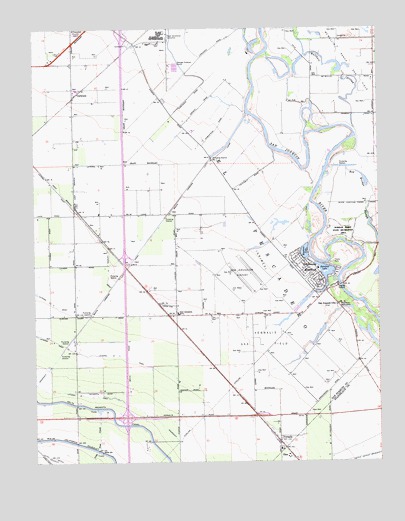
Vernalis, CA USGS Topographic Map
Click on map above to begin viewing in our Map Viewer.

This topographic map contains these locations and features:
Feature Name Type Latitude Longitude GNIS ID View Map
33 Strip AirportAirportN37.6702°W121.3303°1654061View Map
Banta Carbona CanalCanalN37.6877°W121.3355°233459View Map
CochranePopulated PlaceN37.7310°W121.3597°252651View Map
Deuel Vocational InstitutionBuildingN37.7471°W121.3283°2739952View Map
Deuel Vocational InstitutionSchoolN37.7480°W121.3294°222276View Map
Deuel Vocational Institution Fire DepartmentBuildingN37.7463°W121.3318°2624682View Map
East Branch LateralCanalN37.7041°W121.3611°222856View Map
Hetch Hetchy AqueductCanalN37.6260°W121.3699°243393View Map
Lateral Five EastCanalN37.6552°W121.3438°254898View Map
Lateral Six EastCanalN37.6438°W121.3552°254900View Map
Lateral Three WestCanalN37.6910°W121.3533°255089View Map
Lone Tree CreekStreamN37.6399°W121.3533°227526View Map
McMullin Ranch Gas FieldOilfieldN37.7408°W121.2605°277342View Map
New Jerusalem AirportAirportN37.6796°W121.3045°1654060View Map
New Jerusalem Elementary SchoolSchoolN37.6674°W121.3236°229498View Map
OhmPopulated PlaceN37.6266°W121.2841°1659285View Map
Pumping Station Number OneLocaleN37.7122°W121.3111°1654394View Map
Red Bridge SloughGutN37.6997°W121.2541°231314View Map
San Joaquin CityLocaleN37.6699°W121.2661°232408View Map
San Joaquin River ClubPopulated PlaceN37.6808°W121.2730°1659578View Map
Skydive California AirportAirportN37.7296°W121.3328°2770477View Map
Tracy Fire Department Station 93BuildingN37.6676°W121.3249°2624663View Map
VernalisPopulated PlaceN37.6308°W121.2872°252823View Map
Vernalis Gas FieldOilfieldN37.6602°W121.2930°277347View Map
West Branch LateralCanalN37.6988°W121.3619°237432View Map
Yarmouth (historical)Populated PlaceN37.6866°W121.3483°1662198View Map

Note: Coordinates in the location and feature list above are referenced to NAD83 datum.


Copyright (C) 2008-2024 Ryan Niemi / Sunset Dynamics ... All Rights Reserved