TopoQuest Logo
Do you find TopoQuest useful?
Help keep TopoQuest running and adding new maps/features by donating!
Bitcoin:  19c7KJd3qBynnjoSw5npx9KScwjBe4ifkT
Litecoin:  LXs6TkuXGGXo1vDsWCkWVdjQX94eUKd6ui
Home View Maps Find Maps Find Places Resources & Links


Laughlin Range, California Topographic Map

USGS Map Title: Laughlin Range, CA
USGS Map MRC: 39123C3
DRG (GeoTIFF) Download: o39123c3.tif


Neighboring USGS Topographic Map Quads:


  Burbeck, CA  
39123D4
 

  Willits, CA  
39123D3
 

  Foster Mountain, CA  
39123D2
 

  Greenough Ridge, CA  
39123C4
 

  Laughlin Range, CA  
39123C3
 

  Redwood Valley, CA  
39123C2
 

  Bailey Ridge, CA  
39123B4
 

  Orrs Springs, CA  
39123B3
 

  Ukiah, CA  
39123B2


Map MRC Location:

N40°
W124°
N40°
W123°
H8 H7 H6 H5 H4 H3 H2 H1
G8 G7 G6 G5 G4 G3 G2 G1
F8 F7 F6 F5 F4 F3 F2 F1
E8 E7 E6 E5 E4 E3 E2 E1
D8 D7 D6 D5 D4 D3 D2 D1
C8 C7 C6 C5 C4 C3 C2 C1
B8 B7 B6 B5 B4 B3 B2 B1
A8 A7 A6 A5 A4 A3 A2 A1
N39°
W124°
N39°
W123°

Laughlin Range, CA USGS 1:24K Topographic Map Preview:
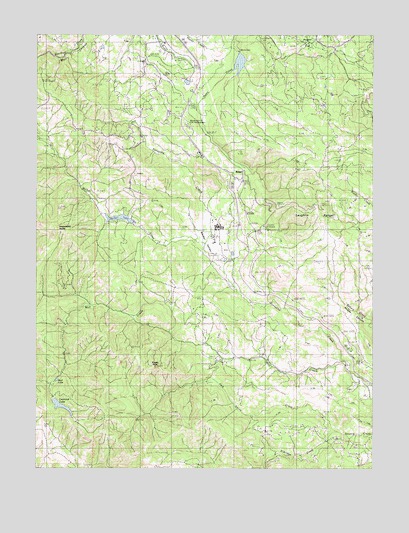
Laughlin Range, CA USGS Topographic Map
Click on map above to begin viewing in our Map Viewer.

This topographic map contains these locations and features:
Feature Name Type Latitude Longitude GNIS ID View Map
California Department of Forestry and Fire Protection Mendocino Unit HeadquartersBuildingN39.3462°W123.3190°2622227View Map
Camp CheerioLocaleN39.3591°W123.3183°1653000View Map
Eagle PeakSummitN39.2793°W123.3328°222823View Map
Eldridge CreekStreamN39.2607°W123.2656°223079View Map
Harris QuarryMineN39.3367°W123.3117°2677846View Map
Hopper FlatFlatN39.3707°W123.2742°225579View Map
Impassable RocksSummitN39.3199°W123.3700°1658810View Map
Jack Smith CreekStreamN39.2610°W123.2650°226042View Map
KUKI-FM (Ukiah)TowerN39.3266°W123.2711°1663126View Map
La Vida Charter SchoolSchoolN39.3210°W123.3105°2516073View Map
Laughlin RangeSummitN39.3257°W123.2708°226933View Map
Leonard LakeReservoirN39.2679°W123.3668°227028View Map
Mendocino County C D F HeadquarterLocaleN39.3496°W123.3214°228500View Map
Mill CreekStreamN39.2785°W123.2611°228670View Map
Morris DamLakeN39.3672°W123.3006°229072View Map
Mud LakeLakeN39.2755°W123.3683°229236View Map
RidgePopulated PlaceN39.3366°W123.3011°1659509View Map
Ridgewood 382 DamDamN39.3208°W123.3403°1663847View Map
Ridgewood ParkPopulated PlaceN39.3307°W123.3414°1724247View Map
Ridgewood RanchLocaleN39.3168°W123.3095°1653102View Map
Walker CreekStreamN39.3066°W123.3070°237171View Map
Walker LakeReservoirN39.3218°W123.3428°237177View Map
Walker ValleyValleyN39.3074°W123.3070°237189View Map

Note: Coordinates in the location and feature list above are referenced to NAD83 datum.


Copyright (C) 2008-2025 Ryan Niemi / Sunset Dynamics ... All Rights Reserved