TopoQuest Logo
Do you find TopoQuest useful?
Help keep TopoQuest running and adding new maps/features by donating!
Bitcoin:  19c7KJd3qBynnjoSw5npx9KScwjBe4ifkT
Litecoin:  LXs6TkuXGGXo1vDsWCkWVdjQX94eUKd6ui
Home View Maps Find Maps Find Places Resources & Links


Bailey Ridge, California Topographic Map

USGS Map Title: Bailey Ridge, CA
USGS Map MRC: 39123B4
DRG (GeoTIFF) Download: o39123b4.tif


Neighboring USGS Topographic Map Quads:


  Comptche, CA  
39123C5
 

  Greenough Ridge, CA  
39123C4
 

  Laughlin Range, CA  
39123C3
 

  Navarro, CA  
39123B5
 

  Bailey Ridge, CA  
39123B4
 

  Orrs Springs, CA  
39123B3
 

  Cold Spring, CA  
39123A5
 

  Philo, CA  
39123A4
 

  Boonville, CA  
39123A3


Map MRC Location:

N40°
W124°
N40°
W123°
H8 H7 H6 H5 H4 H3 H2 H1
G8 G7 G6 G5 G4 G3 G2 G1
F8 F7 F6 F5 F4 F3 F2 F1
E8 E7 E6 E5 E4 E3 E2 E1
D8 D7 D6 D5 D4 D3 D2 D1
C8 C7 C6 C5 C4 C3 C2 C1
B8 B7 B6 B5 B4 B3 B2 B1
A8 A7 A6 A5 A4 A3 A2 A1
N39°
W124°
N39°
W123°

Bailey Ridge, CA USGS 1:24K Topographic Map Preview:
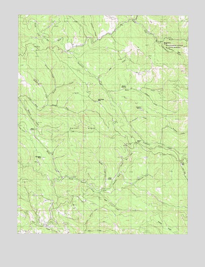
Bailey Ridge, CA USGS Topographic Map
Click on map above to begin viewing in our Map Viewer.

This topographic map contains these locations and features:
Feature Name Type Latitude Longitude GNIS ID View Map
Bailey CreekStreamN39.1566°W123.4670°218524View Map
Bailey RidgeRidgeN39.1824°W123.4517°218531View Map
Bailey SummitGapN39.1845°W123.4888°218532View Map
Bear CreekStreamN39.1482°W123.4406°218808View Map
Bottom CreekStreamN39.1985°W123.4781°219677View Map
Bridge CreekStreamN39.1502°W123.4361°219818View Map
Castle GardenFlatN39.1563°W123.4304°220687View Map
Dark GulchValleyN39.2471°W123.4153°233756View Map
Daugherty CreekStreamN39.2285°W123.4636°222554View Map
Gates CreekStreamN39.2063°W123.4345°224100View Map
Hansen SchoolSchoolN39.2304°W123.4645°224888View Map
Horsethief CreekStreamN39.1888°W123.4189°225657View Map
Horsethief OpeningFlatN39.1957°W123.4097°225658View Map
Hungry Hollow CreekStreamN39.1266°W123.4495°225776View Map
Johnson CreekStreamN39.2060°W123.4103°226299View Map
Johnson CreekStreamN39.2360°W123.4420°226303View Map
Leonard RanchLocaleN39.2352°W123.4442°1653059View Map
Low GapGapN39.1660°W123.3803°227740View Map
Low Gap CreekStreamN39.1435°W123.3753°234204View Map
McCarvey CreekStreamN39.1535°W123.4158°228288View Map
MontgomeryPopulated PlaceN39.2335°W123.3897°1659164View Map
Montgomery CreekStreamN39.2341°W123.3950°228977View Map
Montgomery FlatFlatN39.2313°W123.3933°228978View Map
Montgomery Woods State Natural ReserveReserveN39.2266°W123.3833°228982View Map
Nivens Ranch (historical)LocaleN39.1496°W123.3970°1653079View Map
Old Bailey PlacePopulated PlaceN39.1680°W123.4825°1659286View Map
Rose CreekStreamN39.1402°W123.3761°231884View Map
Sawyer CreekStreamN39.2032°W123.4789°232629View Map
Scott RanchLocaleN39.1313°W123.4795°1653110View Map
Shingle Mill CreekStreamN39.1596°W123.4250°233014View Map
Snuffins CreekStreamN39.1771°W123.3953°234794View Map
Soda CreekStreamN39.2135°W123.4411°234824View Map
Spooner CreekStreamN39.2082°W123.4731°235213View Map
Squaw OpeningFlatN39.2096°W123.4250°235318View Map
Wohlys PassGapN39.1768°W123.4131°238085View Map

Note: Coordinates in the location and feature list above are referenced to NAD83 datum.


Copyright (C) 2008-2024 Ryan Niemi / Sunset Dynamics ... All Rights Reserved