TopoQuest Logo
Do you find TopoQuest useful?
Help keep TopoQuest running and adding new maps/features by donating!
Bitcoin:  19c7KJd3qBynnjoSw5npx9KScwjBe4ifkT
Litecoin:  LXs6TkuXGGXo1vDsWCkWVdjQX94eUKd6ui
Home View Maps Find Maps Find Places Resources & Links


Laurel, Iowa Topographic Map

USGS Map Title: Laurel, IA
USGS Map MRC: 41092H8
DRG (GeoTIFF) Download: o41092h8.tif


Neighboring USGS Topographic Map Quads:


  LaMoille, IA  
42093A1
 

  Marshalltown, IA  
42092A8
 

  Le Grand, IA  
42092A7
 

  Melbourne, IA  
41093H1
 

  Laurel, IA  
41092H8
 

  Gilman, IA  
41092H7
 

  Baxter SE, IA  
41093G1
 

  Alloway Creek, IA  
41092G8
 

  Newburg, IA  
41092G7


Map MRC Location:

N42°
W93°
N42°
W92°
H8 H7 H6 H5 H4 H3 H2 H1
G8 G7 G6 G5 G4 G3 G2 G1
F8 F7 F6 F5 F4 F3 F2 F1
E8 E7 E6 E5 E4 E3 E2 E1
D8 D7 D6 D5 D4 D3 D2 D1
C8 C7 C6 C5 C4 C3 C2 C1
B8 B7 B6 B5 B4 B3 B2 B1
A8 A7 A6 A5 A4 A3 A2 A1
N41°
W93°
N41°
W92°

Laurel, IA USGS 1:24K Topographic Map Preview:
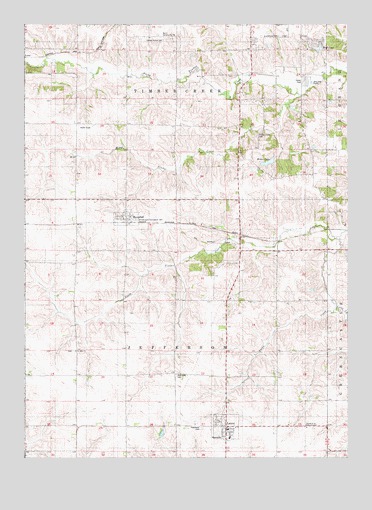
Laurel, IA USGS Topographic Map
Click on map above to begin viewing in our Map Viewer.

This topographic map contains these locations and features:
Feature Name Type Latitude Longitude GNIS ID View Map
Burns Community CenterBuildingN41.9961°W92.9460°1823465View Map
Center School CemeteryCemeteryN41.9956°W92.9463°455307View Map
Church of the Bible CovenantChurchN41.8836°W92.8910°455412View Map
City of HaverhillCivilN41.9441°W92.9607°2394328View Map
City of LaurelCivilN41.8841°W92.9222°2395643View Map
East Marshall Primary SchoolSchoolN41.8808°W92.9208°1997182View Map
Faith Evangelical ChurchChurchN41.8864°W92.9233°1997187View Map
Faith Evangelical ChurchChurchN41.8867°W92.9230°456530View Map
Goose CreekStreamN41.9272°W92.9710°465444View Map
Graceland CemeteryCemeteryN41.8836°W92.9321°457002View Map
HaverhillPopulated PlaceN41.9450°W92.9608°457323View Map
Haverhill (historical)LocaleN41.9425°W92.9605°1997192View Map
Haverhill Fire DepartmentBuildingN41.9444°W92.9634°1997190View Map
Haverhill First RespondersBuildingN41.9444°W92.9634°2599866View Map
Haverhill Post OfficePost OfficeN41.9450°W92.9608°1997189View Map
Immaculate Conception CemeteryCemeteryN41.9439°W92.9566°457751View Map
Immaculate Conception ChurchChurchN41.9447°W92.9588°457753View Map
LaurelPopulated PlaceN41.8842°W92.9221°458239View Map
Laurel (historical)LocaleN41.8842°W92.9221°1997181View Map
Laurel City HallBuildingN41.8833°W92.9219°1997186View Map
Laurel Fire DepartmentBuildingN41.8837°W92.9218°2577208View Map
Laurel LibraryBuildingN41.8833°W92.9219°1997185View Map
Laurel Post OfficePost OfficeN41.8833°W92.9227°1997184View Map
Laurel United Methodist ChurchChurchN41.8825°W92.9227°1997188View Map
LurayPopulated PlaceN41.9905°W92.9999°464634View Map
Luray (historical)LocaleN41.9903°W92.9996°1997254View Map
Luray Post Office (historical)Post OfficeN41.9903°W92.9996°1997255View Map
Lutes CreekStreamN41.9183°W92.8794°458683View Map
Matthew Edel Blacksmith ShopBuildingN41.9450°W92.9608°1997191View Map
Methodist CemeteryCemeteryN41.8987°W92.9416°1823464View Map
Middle Timber CreekStreamN41.9797°W92.8930°459057View Map
Mohrs LakeLakeN41.9602°W92.9059°459164View Map
Saint John ChurchChurchN41.9058°W92.9805°461001View Map
Saint John's United Church of Christ CemeteryCemeteryN41.9060°W92.9809°1997245View Map
Timber Creek CemeteryCemeteryN41.9679°W92.9106°462246View Map
Timber Creek Post Office (historical)Post OfficeN41.9458°W92.8844°466650View Map
Timber Valley Mobile Home ParkPopulated PlaceN41.9833°W92.8919°1997125View Map
Township of JeffersonCivilN41.9060°W92.9414°468143View Map
Township of Timber CreekCivilN41.9919°W92.9416°468790View Map
Wolf LakeReservoirN41.9930°W92.8864°463171View Map
Wolf Lake AdditionPopulated PlaceN41.9953°W92.8858°464810View Map
Zion United Methodist ChurchChurchN41.8842°W92.9310°1997183View Map

Note: Coordinates in the location and feature list above are referenced to NAD83 datum.


Copyright (C) 2008-2025 Ryan Niemi / Sunset Dynamics ... All Rights Reserved