TopoQuest Logo
Do you find TopoQuest useful?
Help keep TopoQuest running and adding new maps/features by donating!
Bitcoin:  19c7KJd3qBynnjoSw5npx9KScwjBe4ifkT
Litecoin:  LXs6TkuXGGXo1vDsWCkWVdjQX94eUKd6ui
Home View Maps Find Maps Find Places Resources & Links


Gilman, Iowa Topographic Map

USGS Map Title: Gilman, IA
USGS Map MRC: 41092H7
DRG (GeoTIFF) Download: o41092h7.tif


Neighboring USGS Topographic Map Quads:


  Marshalltown, IA  
42092A8
 

  Le Grand, IA  
42092A7
 

  Garwin, IA  
42092A6
 

  Laurel, IA  
41092H8
 

  Gilman, IA  
41092H7
 

  Montour, IA  
41092H6
 

  Alloway Creek, IA  
41092G8
 

  Newburg, IA  
41092G7
 

  Grinnell North, IA  
41092G6


Map MRC Location:

N42°
W93°
N42°
W92°
H8 H7 H6 H5 H4 H3 H2 H1
G8 G7 G6 G5 G4 G3 G2 G1
F8 F7 F6 F5 F4 F3 F2 F1
E8 E7 E6 E5 E4 E3 E2 E1
D8 D7 D6 D5 D4 D3 D2 D1
C8 C7 C6 C5 C4 C3 C2 C1
B8 B7 B6 B5 B4 B3 B2 B1
A8 A7 A6 A5 A4 A3 A2 A1
N41°
W93°
N41°
W92°

Gilman, IA USGS 1:24K Topographic Map Preview:
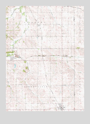
Gilman, IA USGS Topographic Map
Click on map above to begin viewing in our Map Viewer.

This topographic map contains these locations and features:
Feature Name Type Latitude Longitude GNIS ID View Map
Brush CreekStreamN41.9544°W92.8627°454890View Map
Christian Bible ChurchChurchN41.9372°W92.8669°1997206View Map
City of FergusonCivilN41.9386°W92.8630°2394759View Map
City of GilmanCivilN41.8788°W92.7881°2394900View Map
DillonPopulated PlaceN41.9769°W92.8241°455922View Map
DillonLocaleN41.9769°W92.8241°1997048View Map
Dillon ParkParkN41.9778°W92.8238°1997021View Map
Dillon Post Office (historical)Post OfficeN41.9769°W92.8241°1997049View Map
DunbarPopulated PlaceN41.9408°W92.7966°464524View Map
Dunbar (historical)LocaleN41.9408°W92.7966°1997047View Map
Dunbar Post Office (historical)Post OfficeN41.9408°W92.7966°1997046View Map
East Marshall Elementary SchoolSchoolN41.9357°W92.8668°458151View Map
East Marshall Middle SchoolSchoolN41.8778°W92.7835°1997205View Map
East Marshall Middle SchoolSchoolN41.8779°W92.7841°461503View Map
Esbeck Field (historical)AirportN41.8755°W92.7507°1823462View Map
FergusonPopulated PlaceN41.9369°W92.8658°456573View Map
Ferguson (historical)LocaleN41.9397°W92.8655°1997208View Map
Ferguson Elementary SchoolSchoolN41.9358°W92.8669°1997209View Map
Ferguson Fire DepartmentBuildingN41.9373°W92.8665°2577203View Map
Ferguson Post OfficePost OfficeN41.9380°W92.8655°1997207View Map
Ferguson QuarryMineN41.9397°W92.8503°2611877View Map
GilmanPopulated PlaceN41.8789°W92.7894°456902View Map
Gilman (historical)LocaleN41.8800°W92.7891°1997200View Map
Gilman Community ChurchChurchN41.8778°W92.7913°1997199View Map
Gilman Fire DepartmentBuildingN41.8800°W92.7871°2577513View Map
Gilman Post OfficePost OfficeN41.8792°W92.7869°1997204View Map
Gilman Public LibraryBuildingN41.8792°W92.7869°1997202View Map
Gilman Town HallBuildingN41.8792°W92.7869°1997203View Map
Gilman United Methodist ChurchChurchN41.8808°W92.7844°1997198View Map
Gilman WaterworksLocaleN41.9061°W92.7849°1823463View Map
Green Castle Recreation AreaParkN41.9292°W92.8585°1997020View Map
L D F Community SchoolSchoolN41.9417°W92.7983°458152View Map
North Timber CreekStreamN41.9989°W92.8519°459635View Map
PickeringPopulated PlaceN41.9408°W92.8166°464699View Map
PickeringLocaleN41.9408°W92.8166°1997045View Map
Pickering Post Office (historical)Post OfficeN41.9408°W92.8166°1997044View Map
Prairie View CemeteryCemeteryN41.8871°W92.7961°460424View Map
Saint Joseph's German Lutheran CemeteryCemeteryN41.9583°W92.8113°1997228View Map
South Timber CreekStreamN41.9372°W92.8658°461815View Map
Stavanger ChurchChurchN41.9669°W92.8013°461972View Map
Stavanger Friends CemeteryCemeteryN41.9672°W92.7861°461969View Map
Strand Lutheran CemeteryCemeteryN41.9420°W92.7793°462027View Map
Strand Lutheran ChurchChurchN41.9422°W92.7963°462028View Map
Township of GreencastleCivilN41.9059°W92.8245°467970View Map
Township of Le GrandCivilN41.9922°W92.8247°468202View Map
Trinity Lutheran CemeteryCemeteryN41.9646°W92.8232°462320View Map
Trinity Lutheran ChurchChurchN41.9644°W92.8230°462322View Map

Note: Coordinates in the location and feature list above are referenced to NAD83 datum.


Copyright (C) 2008-2025 Ryan Niemi / Sunset Dynamics ... All Rights Reserved