TopoQuest Logo
Do you find TopoQuest useful?
Help keep TopoQuest running and adding new maps/features by donating!
Bitcoin:  19c7KJd3qBynnjoSw5npx9KScwjBe4ifkT
Litecoin:  LXs6TkuXGGXo1vDsWCkWVdjQX94eUKd6ui
Home View Maps Find Maps Find Places Resources & Links


Bartlett, Kansas Topographic Map

USGS Map Title: Bartlett, KS
USGS Map MRC: 37095A2
DRG (GeoTIFF) Download: o37095a2.tif


Neighboring USGS Topographic Map Quads:


  Altamont, KS  
37095B3
 

  Labette, KS  
37095B2
 

  Oswego, KS  
37095B1
 

  Edna, KS  
37095A3
 

  Bartlett, KS  
37095A2
 

  Chetopa, KS  
37095A1
 

  Hollow, OK  
36095H3
 

  Welch NW, OK  
36095H2
 

  Welch North, OK  
36095H1


Map MRC Location:

N38°
W96°
N38°
W95°
H8 H7 H6 H5 H4 H3 H2 H1
G8 G7 G6 G5 G4 G3 G2 G1
F8 F7 F6 F5 F4 F3 F2 F1
E8 E7 E6 E5 E4 E3 E2 E1
D8 D7 D6 D5 D4 D3 D2 D1
C8 C7 C6 C5 C4 C3 C2 C1
B8 B7 B6 B5 B4 B3 B2 B1
A8 A7 A6 A5 A4 A3 A2 A1
N37°
W96°
N37°
W95°

Bartlett, KS USGS 1:24K Topographic Map Preview:
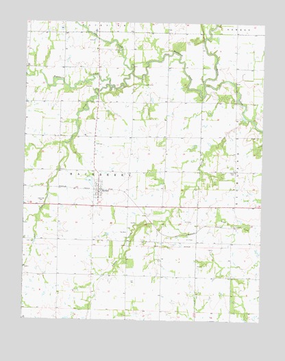
Bartlett, KS USGS Topographic Map
Click on map above to begin viewing in our Map Viewer.

This topographic map contains these locations and features:
Feature Name Type Latitude Longitude GNIS ID View Map
BartlettPopulated PlaceN37.0548°W95.2108°469298View Map
Bartlett Christian ChurchChurchN37.0563°W95.2112°2688809View Map
Bartlett Co - Operative Association Grain Elevator Number 1LocaleN37.0544°W95.2100°2695360View Map
Bartlett DamDamN37.0601°W95.2152°479942View Map
Bartlett Grade SchoolSchoolN37.0575°W95.2129°481213View Map
Bartlett United Methodist ChurchChurchN37.0514°W95.2112°2688810View Map
Bartlett Wastewater Treatment PlantLocaleN37.0621°W95.2143°2691905View Map
Baylor School (historical)SchoolN37.0187°W95.1869°483684View Map
Big HillCliffN37.0628°W95.1377°469215View Map
Cecil (historical)LocaleN37.0337°W95.2497°481844View Map
Cecil CemeteryCemeteryN37.0330°W95.2491°469297View Map
Cecil Church (historical)ChurchN37.0328°W95.2494°483698View Map
City of BartlettCivilN37.0550°W95.2114°2394072View Map
Cook School (historical)SchoolN37.0187°W95.1508°483702View Map
Deer CreekStreamN37.1040°W95.1947°469302View Map
Foland School (historical)SchoolN37.0628°W95.1758°483714View Map
Hackberry CemeteryCemeteryN37.0992°W95.1858°469300View Map
Hackberry CreekStreamN37.0992°W95.1561°469317View Map
Hackberry School (historical)SchoolN37.0917°W95.1841°483718View Map
Hackberry Township Fire DepartmentBuildingN37.0531°W95.2112°2111125View Map
Hyatt School (historical)SchoolN37.1206°W95.1858°483722View Map
Lake CreekStreamN37.0981°W95.2039°469319View Map
Lake Creek CemeteryCemeteryN37.0490°W95.2411°469299View Map
Lake Creek School (historical)SchoolN37.0478°W95.2419°483725View Map
Liggett School (historical)SchoolN37.0187°W95.2416°483729View Map
Lockard School (historical)SchoolN37.0876°W95.2314°483730View Map
Newell School (historical)SchoolN37.1206°W95.2397°483741View Map
Phillips CemeteryCemeteryN37.1134°W95.2032°469301View Map
Township of HackberryCivilN37.0604°W95.2132°469318View Map
Turkey CreekStreamN37.0848°W95.1327°469307View Map

Note: Coordinates in the location and feature list above are referenced to NAD83 datum.


Copyright (C) 2008-2024 Ryan Niemi / Sunset Dynamics ... All Rights Reserved