TopoQuest Logo
Do you find TopoQuest useful?
Help keep TopoQuest running and adding new maps/features by donating!
Bitcoin:  19c7KJd3qBynnjoSw5npx9KScwjBe4ifkT
Litecoin:  LXs6TkuXGGXo1vDsWCkWVdjQX94eUKd6ui
Home View Maps Find Maps Find Places Resources & Links


Labette, Kansas Topographic Map

USGS Map Title: Labette, KS
USGS Map MRC: 37095B2
DRG (GeoTIFF) Download: o37095b2.tif


Neighboring USGS Topographic Map Quads:


  Parsons West, KS  
37095C3
 

  Parsons East, KS  
37095C2
 

  McCune, KS  
37095C1
 

  Altamont, KS  
37095B3
 

  Labette, KS  
37095B2
 

  Oswego, KS  
37095B1
 

  Edna, KS  
37095A3
 

  Bartlett, KS  
37095A2
 

  Chetopa, KS  
37095A1


Map MRC Location:

N38°
W96°
N38°
W95°
H8 H7 H6 H5 H4 H3 H2 H1
G8 G7 G6 G5 G4 G3 G2 G1
F8 F7 F6 F5 F4 F3 F2 F1
E8 E7 E6 E5 E4 E3 E2 E1
D8 D7 D6 D5 D4 D3 D2 D1
C8 C7 C6 C5 C4 C3 C2 C1
B8 B7 B6 B5 B4 B3 B2 B1
A8 A7 A6 A5 A4 A3 A2 A1
N37°
W96°
N37°
W95°

Labette, KS USGS 1:24K Topographic Map Preview:
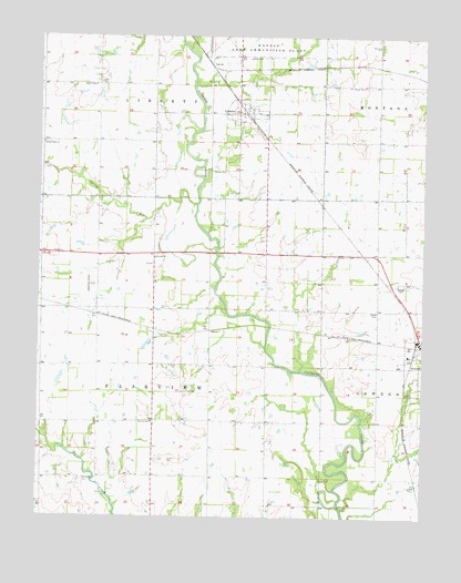
Labette, KS USGS Topographic Map
Click on map above to begin viewing in our Map Viewer.

This topographic map contains these locations and features:
Feature Name Type Latitude Longitude GNIS ID View Map
Bartlett Co - Operative Association Grain Elevator Number 5LocaleN37.1679°W95.1283°2695364View Map
Bowman School (historical)SchoolN37.1423°W95.2302°483690View Map
Campbell School (historical)SchoolN37.1356°W95.1394°483693View Map
Catalpa School (historical)SchoolN37.2298°W95.2308°483697View Map
City of LabetteCivilN37.2300°W95.1836°2395576View Map
Dickerman School (historical)SchoolN37.1495°W95.1864°483704View Map
Eclipse School (historical)SchoolN37.1753°W95.1402°483707View Map
El Dorado Correctional Facility Southwest Mens Medium OswegoBuildingN37.1663°W95.1335°2504374View Map
Fairview CemeteryCemeteryN37.1347°W95.2361°469445View Map
Fairview Elementary SchoolSchoolN37.1498°W95.2130°469446View Map
GarvinPopulated PlaceN37.2420°W95.1941°484445View Map
LabettePopulated PlaceN37.2306°W95.1836°469451View Map
Labette Baptist ChurchChurchN37.2296°W95.1859°2689622View Map
Labette CemeteryCemeteryN37.2445°W95.1774°469452View Map
Labette Correctional Conservation Camp - WomensBuildingN37.1676°W95.1311°2504375View Map
Maple Grove School (historical)SchoolN37.1898°W95.1766°483732View Map
Mason CemeteryCemeteryN37.2149°W95.1942°469450View Map
Oak Grove School (historical)SchoolN37.2076°W95.1319°483744View Map
Oswego CemeteryCemeteryN37.1855°W95.1317°469447View Map
Oswego Wastewater PlantLocaleN37.1588°W95.1356°2692075View Map
Rosedale School (historical)SchoolN37.1717°W95.2497°483759View Map
Shiloh School (historical)SchoolN37.2373°W95.1358°483763View Map
Spring CreekStreamN37.2065°W95.1989°469453View Map
Spring Valley CemeteryCemeteryN37.2223°W95.2471°2673296View Map
Spring Valley ChurchChurchN37.2226°W95.2489°469448View Map
StoverPopulated PlaceN37.1740°W95.1947°484444View Map
Stover School (historical)SchoolN37.1792°W95.2125°483769View Map
Township of FairviewCivilN37.1643°W95.2127°469316View Map
Zion Hill ChurchChurchN37.1928°W95.2125°469449View Map

Note: Coordinates in the location and feature list above are referenced to NAD83 datum.


Copyright (C) 2008-2024 Ryan Niemi / Sunset Dynamics ... All Rights Reserved