TopoQuest Logo
Do you find TopoQuest useful?
Help keep TopoQuest running and adding new maps/features by donating!
Bitcoin:  19c7KJd3qBynnjoSw5npx9KScwjBe4ifkT
Litecoin:  LXs6TkuXGGXo1vDsWCkWVdjQX94eUKd6ui
Home View Maps Find Maps Find Places Resources & Links


Leadmine, Missouri Topographic Map

USGS Map Title: Leadmine, MO
USGS Map MRC: 37092G8
DRG (GeoTIFF) Download: o37092g8.tif


Neighboring USGS Topographic Map Quads:


  Branch, MO  
37093H1
 

  Macks Creek, MO  
37092H8
 

  Hahatonka, MO  
37092H7
 

  Tunas, MO  
37093G1
 

  Leadmine, MO  
37092G8
 

  Eldridge West, MO  
37092G7
 

  Buffalo, MO  
37093F1
 

  Windyville, MO  
37092F8
 

  Bennett Springs, MO  
37092F7


Map MRC Location:

N38°
W93°
N38°
W92°
H8 H7 H6 H5 H4 H3 H2 H1
G8 G7 G6 G5 G4 G3 G2 G1
F8 F7 F6 F5 F4 F3 F2 F1
E8 E7 E6 E5 E4 E3 E2 E1
D8 D7 D6 D5 D4 D3 D2 D1
C8 C7 C6 C5 C4 C3 C2 C1
B8 B7 B6 B5 B4 B3 B2 B1
A8 A7 A6 A5 A4 A3 A2 A1
N37°
W93°
N37°
W92°

Leadmine, MO USGS 1:24K Topographic Map Preview:
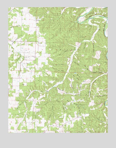
Leadmine, MO USGS Topographic Map
Click on map above to begin viewing in our Map Viewer.

This topographic map contains these locations and features:
Feature Name Type Latitude Longitude GNIS ID View Map
Bailey ChapelChurchN37.7556°W92.9346°742139View Map
Barkley School (historical)SchoolN37.7920°W92.8816°713651View Map
Berry Ford (historical)Populated PlaceN37.8642°W92.8794°740673View Map
Big HollowValleyN37.8100°W92.9244°714174View Map
Bob HollowValleyN37.8325°W92.9177°714465View Map
Buzzard Cave HollowValleyN37.7817°W92.9796°715147View Map
Elm HollowValleyN37.8106°W92.9277°717526View Map
Excell School (historical)SchoolN37.8139°W92.9227°717701View Map
Herrick FordPopulated PlaceN37.8609°W92.9127°740925View Map
Hickory Hill School (historical)SchoolN37.8039°W92.9952°719480View Map
Jakes CreekStreamN37.8595°W92.9055°735669View Map
Jantz HollowValleyN37.8409°W92.9030°720259View Map
Jugtown HollowValleyN37.8092°W92.8799°720453View Map
Katell BranchStreamN37.8148°W92.9794°738282View Map
King SpringSpringN37.8527°W92.8865°720617View Map
Kirk CemeteryCemeteryN37.8250°W92.9818°734990View Map
Kirk ChapelChurchN37.8245°W92.9807°720645View Map
Lane BranchStreamN37.8267°W92.9832°720795View Map
Lead Mine State ForestForestN37.8506°W92.9171°742235View Map
LeadminePopulated PlaceN37.8367°W92.9621°720865View Map
Leadmine SchoolSchoolN37.8289°W92.9671°720866View Map
Louisburg Volunteer Fire Department Station 2BuildingN37.7783°W92.9200°2621658View Map
Mill HollowValleyN37.8211°W92.9194°722353View Map
Mustang BranchStreamN37.8186°W92.9832°738281View Map
Osborn BluffCliffN37.8303°W92.8780°723861View Map
Pearl BranchStreamN37.8186°W92.9832°738280View Map
Persimmon HollowValleyN37.8420°W92.8946°724248View Map
Pleasant Hill ChurchChurchN37.8092°W92.9810°724531View Map
Rambo MineMineN37.7981°W92.9821°742236View Map
Sawmill HollowValleyN37.7848°W92.9491°726075View Map
Smelter HollowValleyN37.7814°W92.9485°726569View Map
Tom Lock HollowValleyN37.7817°W92.9496°727708View Map
Township of MillerCivilN37.8317°W92.9210°766569View Map
Turner BluffCliffN37.8547°W92.8792°727892View Map
Union Victory School (historical)SchoolN37.8325°W92.8813°728051View Map
Webster BluffCliffN37.8673°W92.8938°738278View Map
Webster SpringSpringN37.8562°W92.8952°728472View Map
WestfieldPopulated PlaceN37.8620°W92.9644°738279View Map
Whiteoak HollowValleyN37.8175°W92.9241°728780View Map
Wolfpen HollowValleyN37.8395°W92.9944°729080View Map

Note: Coordinates in the location and feature list above are referenced to NAD83 datum.


Copyright (C) 2008-2024 Ryan Niemi / Sunset Dynamics ... All Rights Reserved