TopoQuest Logo
Do you find TopoQuest useful?
Help keep TopoQuest running and adding new maps/features by donating!
Bitcoin:  19c7KJd3qBynnjoSw5npx9KScwjBe4ifkT
Litecoin:  LXs6TkuXGGXo1vDsWCkWVdjQX94eUKd6ui
Home View Maps Find Maps Find Places Resources & Links


Bennett Springs, Missouri Topographic Map

USGS Map Title: Bennett Springs, MO
USGS Map MRC: 37092F7
DRG (GeoTIFF) Download: o37092f7.tif


Neighboring USGS Topographic Map Quads:


  Leadmine, MO  
37092G8
 

  Eldridge West, MO  
37092G7
 

  Eldridge East, MO  
37092G6
 

  Windyville, MO  
37092F8
 

  Bennett Springs, MO  
37092F7
 

  Lebanon, MO  
37092F6
 

  Long Lane, MO  
37092E8
 

  Phillipsburg, MO  
37092E7
 

  Brush Creek, MO  
37092E6


Map MRC Location:

N38°
W93°
N38°
W92°
H8 H7 H6 H5 H4 H3 H2 H1
G8 G7 G6 G5 G4 G3 G2 G1
F8 F7 F6 F5 F4 F3 F2 F1
E8 E7 E6 E5 E4 E3 E2 E1
D8 D7 D6 D5 D4 D3 D2 D1
C8 C7 C6 C5 C4 C3 C2 C1
B8 B7 B6 B5 B4 B3 B2 B1
A8 A7 A6 A5 A4 A3 A2 A1
N37°
W93°
N37°
W92°

Bennett Springs, MO USGS 1:24K Topographic Map Preview:
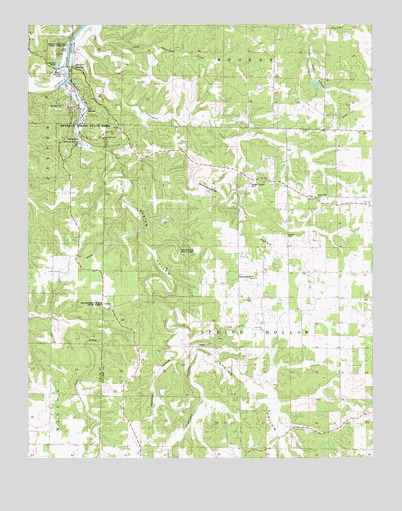
Bennett Springs, MO USGS Topographic Map
Click on map above to begin viewing in our Map Viewer.

This topographic map contains these locations and features:
Feature Name Type Latitude Longitude GNIS ID View Map
Atchley-Blackfoot CemeteryCemeteryN37.6773°W92.7927°742195View Map
Bennett CemeteryCemeteryN37.7414°W92.8655°742198View Map
Bennett SpringSpringN37.7166°W92.8566°738231View Map
Bennett Spring BranchStreamN37.7340°W92.8610°2726865View Map
Bennett Spring Fire Protection DistrictBuildingN37.7122°W92.8337°2621731View Map
Bennett Spring Natural TunnelTunnelN37.6856°W92.8199°742194View Map
Bennett Spring State ParkParkN37.7256°W92.8624°713956View Map
Bennett Spring State Public Access AreaAreaN37.7420°W92.8641°738233View Map
Bennett SpringsPopulated PlaceN37.7270°W92.8557°735505View Map
Bennett Springs Census Designated PlaceCensusN37.7254°W92.8533°2587052View Map
Blackfoot SchoolSchoolN37.6734°W92.7907°714325View Map
Conn School (historical)SchoolN37.7384°W92.8338°716196View Map
Danceyard CreekStreamN37.7473°W92.8568°716654View Map
Danceyard HollowValleyN37.7398°W92.8532°735019View Map
Dogwood HollowValleyN37.6548°W92.8132°716964View Map
Elam Lake DamDamN37.7350°W92.7718°763743View Map
Flag Pond SchoolSchoolN37.6275°W92.7555°717974View Map
Flatwoods ChurchChurchN37.6678°W92.8443°735615View Map
Flatwoods Church State ForestForestN37.6681°W92.8463°742193View Map
Flatwoods SchoolSchoolN37.6867°W92.8555°718005View Map
Gannon School (historical)SchoolN37.6325°W92.8160°718330View Map
Hackbill HollowValleyN37.6467°W92.8296°718955View Map
Lowery CemeteryCemeteryN37.6892°W92.7813°742196View Map
Mullicane SchoolSchoolN37.7242°W92.7668°723057View Map
Oak Grove ChurchChurchN37.6623°W92.7899°723582View Map
Pennel Lake DamDamN37.6717°W92.7852°764899View Map
Sand SpringSpringN37.7363°W92.8612°738232View Map
Sportsmen Outdoor ChapelChurchN37.7175°W92.8488°742197View Map
Spring HollowValleyN37.7334°W92.8613°713955View Map
Spring HollowValleyN37.6323°W92.7830°726942View Map
Spring Hollow CreekStreamN37.7338°W92.8609°734605View Map
Township of Spring HollowCivilN37.7050°W92.7674°766867View Map
Union Chapel (historical)ChurchN37.7228°W92.7643°735018View Map
Union ChurchChurchN37.6264°W92.8338°727987View Map
William Elam LakeReservoirN37.7328°W92.7705°763744View Map
Woodward HollowValleyN37.7100°W92.8424°729137View Map

Note: Coordinates in the location and feature list above are referenced to NAD83 datum.


Copyright (C) 2008-2024 Ryan Niemi / Sunset Dynamics ... All Rights Reserved