TopoQuest Logo
Do you find TopoQuest useful?
Help keep TopoQuest running and adding new maps/features by donating!
Bitcoin:  19c7KJd3qBynnjoSw5npx9KScwjBe4ifkT
Litecoin:  LXs6TkuXGGXo1vDsWCkWVdjQX94eUKd6ui
Home View Maps Find Maps Find Places Resources & Links


Leakesville SW, Mississippi Topographic Map

USGS Map Title: Leakesville SW, MS
USGS Map MRC: 31088A6
DRG (GeoTIFF) Download: o31088a6.tif


Neighboring USGS Topographic Map Quads:


  Neely, MS  
31088B7
 

  Jonathan, MS  
31088B6
 

  Leakesville, MS  
31088B5
 

  McLain, MS  
31088A7
 

  Leakesville SW, MS  
31088A6
 

  Vernal, MS  
31088A5
 

  Avent, MS  
30088H7
 

  Merrill, MS  
30088H6
 

  Lucedale, MS  
30088H5


Map MRC Location:

N32°
W89°
N32°
W88°
H8 H7 H6 H5 H4 H3 H2 H1
G8 G7 G6 G5 G4 G3 G2 G1
F8 F7 F6 F5 F4 F3 F2 F1
E8 E7 E6 E5 E4 E3 E2 E1
D8 D7 D6 D5 D4 D3 D2 D1
C8 C7 C6 C5 C4 C3 C2 C1
B8 B7 B6 B5 B4 B3 B2 B1
A8 A7 A6 A5 A4 A3 A2 A1
N31°
W89°
N31°
W88°

Leakesville SW, MS USGS 1:24K Topographic Map Preview:
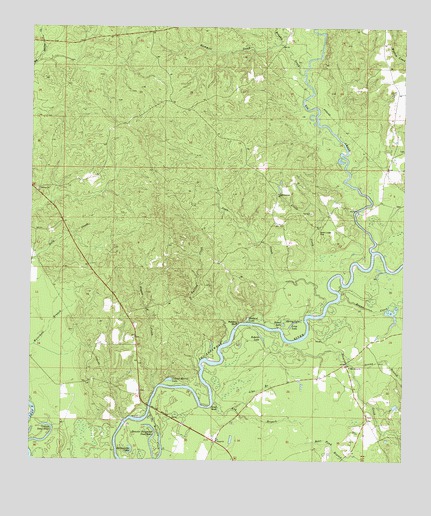
Leakesville SW, MS USGS Topographic Map
Click on map above to begin viewing in our Map Viewer.

This topographic map contains these locations and features:
Feature Name Type Latitude Longitude GNIS ID View Map
Ard BranchStreamN31.0166°W88.6878°666356View Map
Bear Pond BranchStreamN31.0055°W88.6570°666662View Map
Big CreekStreamN31.0602°W88.6350°692596View Map
Brushy CreekStreamN31.1119°W88.6584°667687View Map
Colemans Ferry (historical)CrossingN31.0391°W88.6798°686446View Map
Colonel Merrill LakeLakeN31.0233°W88.7032°668710View Map
Congregational ChurchChurchN31.0774°W88.6670°668767View Map
Conn CreekStreamN31.0424°W88.6570°668770View Map
Cowans Dead RiverLakeN31.0069°W88.7436°692994View Map
Coward Place CemeteryCemeteryN31.0130°W88.6367°707707View Map
Denny BranchStreamN31.0280°W88.6434°669229View Map
Dressler Hammond Dead RiverLakeN31.0100°W88.7097°669382View Map
Evans CreekStreamN31.0510°W88.6453°669833View Map
Gatling CreekStreamN31.0335°W88.6856°670336View Map
Grace ChurchChurchN31.0057°W88.6867°670562View Map
Green Lodge CemeteryCemeteryN31.0666°W88.6528°670676View Map
Hammill CreekStreamN31.1205°W88.6667°670866View Map
Hogan CreekStreamN31.0205°W88.7075°671266View Map
Lige BranchStreamN31.0149°W88.6817°672491View Map
Little CreekStreamN31.0588°W88.6525°672577View Map
Long LakeLakeN31.0392°W88.6625°672829View Map
McInnis CreekStreamN31.0144°W88.7098°673369View Map
McManus Post Office (historical)Post OfficeN31.0799°W88.6950°712205View Map
Midway ChurchChurchN31.0782°W88.7473°673544View Map
Miller BridgeBridgeN31.0141°W88.7059°673638View Map
Mount Zion Church (historical)ChurchN31.1163°W88.6425°686457View Map
New Hope Church (historical)ChurchN31.0219°W88.7403°686458View Map
Pine Grove CemeteryCemeteryN31.0274°W88.6434°707719View Map
Pine Grove ChurchChurchN31.0271°W88.6425°675821View Map
Rattlesnake LakeLakeN31.0024°W88.7158°676483View Map
Redbird LakeLakeN31.0411°W88.6770°676544View Map
Roberts BluffCliffN31.0402°W88.6798°676702View Map
Roberts LakeLakeN31.0358°W88.6724°676709View Map
Round LakeLakeN31.0396°W88.6651°676903View Map
Shell BluffCliffN31.0155°W88.6886°677638View Map
Skinner CreekStreamN31.0344°W88.6625°677865View Map
Spring LakeLakeN31.0405°W88.6591°678148View Map
Vernal School (historical)SchoolN31.0341°W88.6372°686464View Map
Williams CemeteryCemeteryN31.0735°W88.6275°707723View Map

Note: Coordinates in the location and feature list above are referenced to NAD83 datum.


Copyright (C) 2008-2025 Ryan Niemi / Sunset Dynamics ... All Rights Reserved