TopoQuest Logo
Do you find TopoQuest useful?
Help keep TopoQuest running and adding new maps/features by donating!
Bitcoin:  19c7KJd3qBynnjoSw5npx9KScwjBe4ifkT
Litecoin:  LXs6TkuXGGXo1vDsWCkWVdjQX94eUKd6ui
Home View Maps Find Maps Find Places Resources & Links


Neely, Mississippi Topographic Map

USGS Map Title: Neely, MS
USGS Map MRC: 31088B7
DRG (GeoTIFF) Download: o31088b7.tif


Neighboring USGS Topographic Map Quads:


  Richton, MS  
31088C8
 

  Brewer, MS  
31088C7
 

  Avera, MS  
31088C6
 

  Beaumont, MS  
31088B8
 

  Neely, MS  
31088B7
 

  Jonathan, MS  
31088B6
 

  Taylor Hill, MS  
31088A8
 

  McLain, MS  
31088A7
 

  Leakesville SW, MS  
31088A6


Map MRC Location:

N32°
W89°
N32°
W88°
H8 H7 H6 H5 H4 H3 H2 H1
G8 G7 G6 G5 G4 G3 G2 G1
F8 F7 F6 F5 F4 F3 F2 F1
E8 E7 E6 E5 E4 E3 E2 E1
D8 D7 D6 D5 D4 D3 D2 D1
C8 C7 C6 C5 C4 C3 C2 C1
B8 B7 B6 B5 B4 B3 B2 B1
A8 A7 A6 A5 A4 A3 A2 A1
N31°
W89°
N31°
W88°

Neely, MS USGS 1:24K Topographic Map Preview:
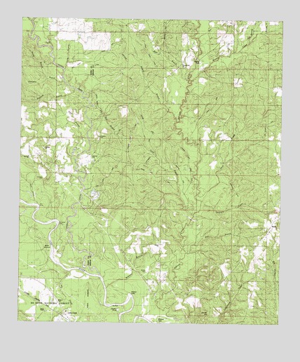
Neely, MS USGS Topographic Map
Click on map above to begin viewing in our Map Viewer.

This topographic map contains these locations and features:
Feature Name Type Latitude Longitude GNIS ID View Map
Allan BranchStreamN31.2024°W88.8423°692385View Map
Arlington Baptist ChurchChurchN31.1969°W88.8635°692410View Map
Arlington Volunteer Fire DepartmentBuildingN31.1928°W88.8729°2667932View Map
Bear BranchStreamN31.1538°W88.7948°692489View Map
Bee BranchStreamN31.2074°W88.8403°692520View Map
Bolton ChapelChurchN31.1299°W88.8620°704596View Map
Breland EddyRapidsN31.1369°W88.8214°692695View Map
Breland LakeLakeN31.1280°W88.8064°692698View Map
Buffalo CemeteryCemeteryN31.1466°W88.8134°705225View Map
Buffalo ChurchChurchN31.1574°W88.8070°692756View Map
Bull BranchStreamN31.2252°W88.7942°692762View Map
Dantzler PondLakeN31.1305°W88.8272°693050View Map
Fairhope ChurchChurchN31.1966°W88.8642°693194View Map
Fairhope Missionary Baptist ChurchChurchN31.1934°W88.8714°2596691View Map
Gaines CreekStreamN31.1446°W88.8359°693277View Map
Gee Dee HillsSummitN31.1274°W88.7845°693290View Map
Gin House BluffCliffN31.1657°W88.8559°704609View Map
Hillman HillsRidgeN31.1782°W88.7725°693483View Map
House of Prayer ChurchChurchN31.1327°W88.8562°704615View Map
Hurricane CreekStreamN31.1705°W88.7911°693564View Map
Ivory BranchStreamN31.1707°W88.7911°693592View Map
Leaf River Post Office (historical)Post OfficeN31.1544°W88.8278°712204View Map
Little CreekPopulated PlaceN31.1274°W88.8534°704622View Map
Long BranchStreamN31.2291°W88.8539°693810View Map
McSwain BranchStreamN31.1388°W88.8325°693936View Map
Mossy HammockIslandN31.1566°W88.8706°694046View Map
NeelyPopulated PlaceN31.1649°W88.7548°694151View Map
Neely Baptist ChurchChurchN31.1632°W88.7550°705238View Map
Neely Post OfficePost OfficeN31.1650°W88.7550°2768845View Map
Neely Volunteer Fire DepartmentBuildingN31.1650°W88.7543°2332866View Map
New Life in Christ Baptist ChurchChurchN31.1266°W88.8505°2596797View Map
Oak Grove ChurchChurchN31.1918°W88.8409°694227View Map
Oak Swamp CreekStreamN31.2407°W88.7664°694241View Map
Oakwood BranchStreamN31.2218°W88.8542°694246View Map
Pauls StumpsLocaleN31.1730°W88.8653°704634View Map
Picayune CreekStreamN31.2457°W88.7575°694363View Map
Pineland BranchStreamN31.2213°W88.8492°694392View Map
Pleasant Hill CemeteryCemeteryN31.2321°W88.7973°707720View Map
Pleasant Hill ChurchChurchN31.2316°W88.7973°694431View Map
Rancho AndeLocaleN31.2357°W88.7936°694510View Map
Red BluffCliffN31.1324°W88.8306°694522View Map
Redhill BranchStreamN31.2077°W88.8000°694541View Map
Reedy BranchStreamN31.2252°W88.8625°694547View Map
Skull CreekStreamN31.1796°W88.7881°694807View Map
Skull Creek HillsRangeN31.2002°W88.7667°705242View Map
Steep HollowValleyN31.1749°W88.8679°694888View Map
Sylvester CemeteryCemeteryN31.2013°W88.8375°705243View Map
Sylvester CemeteryCemeteryN31.1846°W88.8631°694924View Map
Sylvester CemeteryCemeteryN31.1938°W88.8414°704642View Map
Wooton CreekStreamN31.2238°W88.7934°695218View Map

Note: Coordinates in the location and feature list above are referenced to NAD83 datum.


Copyright (C) 2008-2025 Ryan Niemi / Sunset Dynamics ... All Rights Reserved