TopoQuest Logo
Do you find TopoQuest useful?
Help keep TopoQuest running and adding new maps/features by donating!
Bitcoin:  19c7KJd3qBynnjoSw5npx9KScwjBe4ifkT
Litecoin:  LXs6TkuXGGXo1vDsWCkWVdjQX94eUKd6ui
Home View Maps Find Maps Find Places Resources & Links


Learned, Mississippi Topographic Map

USGS Map Title: Learned, MS
USGS Map MRC: 32090B5
DRG (GeoTIFF) Download: o32090b5.tif


Neighboring USGS Topographic Map Quads:


  Bovina, MS  
32090C6
 

  Edwards, MS  
32090C5
 

  Raymond, MS  
32090C4
 

  Cayuga, MS  
32090B6
 

  Learned, MS  
32090B5
 

  Terry NW, MS  
32090B4
 

  Utica West, MS  
32090A6
 

  Utica East, MS  
32090A5
 

  Dabney Crossroads, MS  
32090A4


Map MRC Location:

N33°
W91°
N33°
W90°
H8 H7 H6 H5 H4 H3 H2 H1
G8 G7 G6 G5 G4 G3 G2 G1
F8 F7 F6 F5 F4 F3 F2 F1
E8 E7 E6 E5 E4 E3 E2 E1
D8 D7 D6 D5 D4 D3 D2 D1
C8 C7 C6 C5 C4 C3 C2 C1
B8 B7 B6 B5 B4 B3 B2 B1
A8 A7 A6 A5 A4 A3 A2 A1
N32°
W91°
N32°
W90°

Learned, MS USGS 1:24K Topographic Map Preview:
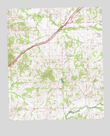
Learned, MS USGS Topographic Map
Click on map above to begin viewing in our Map Viewer.

This topographic map contains these locations and features:
Feature Name Type Latitude Longitude GNIS ID View Map
AdamsPopulated PlaceN32.1599°W90.5607°666147View Map
Adams LakeReservoirN32.1685°W90.5539°666155View Map
Adams Lake DamDamN32.1702°W90.5534°681049View Map
Antioch ChurchChurchN32.1593°W90.5045°666308View Map
Auburn (historical)LocaleN32.2154°W90.5876°688205View Map
Auburn CemeteryCemeteryN32.2160°W90.5873°666425View Map
Auburn School (historical)SchoolN32.2140°W90.5873°688206View Map
Bar Ridge ChurchChurchN32.1979°W90.6229°666514View Map
Biggs Gin (historical)LocaleN32.1374°W90.5620°688228View Map
Bitter CreekStreamN32.2121°W90.5340°667191View Map
Brocks Pond DamDamN32.1585°W90.5134°681031View Map
Brown Loam Branch Experiment StationLocaleN32.2060°W90.5132°711208View Map
Bryants Store (historical)LocaleN32.2332°W90.5379°688246View Map
Burleigh Hamilton SchoolSchoolN32.1582°W90.5043°667813View Map
Bush PondReservoirN32.2027°W90.5628°688248View Map
Cherry Grove ChurchChurchN32.2429°W90.5626°668370View Map
Crawford Pond DamDamN32.1318°W90.5468°681020View Map
Dillons Stand (historical)LocaleN32.2321°W90.5457°688308View Map
Dudley Nobel Pond DamDamN32.2035°W90.6118°681085View Map
Green Hill ChurchChurchN32.1738°W90.5776°670673View Map
Hamilton CreekStreamN32.1957°W90.5004°670861View Map
Hopewell ChurchChurchN32.2338°W90.5023°671421View Map
Hutchins School (historical)SchoolN32.1418°W90.5451°688406View Map
Joe Sanford FieldAirportN32.2454°W90.5827°2676425View Map
LearnedPopulated PlaceN32.1968°W90.5473°672345View Map
Learned Volunteer Fire DepartmentBuildingN32.1956°W90.5467°2667874View Map
LebanonPopulated PlaceN32.1668°W90.5129°672348View Map
Lebanon ChurchChurchN32.1490°W90.5232°672354View Map
Lebanon School (historical)SchoolN32.1665°W90.5123°688435View Map
Little Tallahalla CreekStreamN32.1374°W90.5112°672694View Map
McNair BranchStreamN32.1957°W90.5004°673412View Map
Moore Spring BranchStreamN32.2090°W90.5059°673787View Map
Morning StarPopulated PlaceN32.2199°W90.5737°673821View Map
Morning Star ChurchChurchN32.2188°W90.5740°688468View Map
Morrison CemeteryCemeteryN32.1904°W90.5670°673853View Map
Mount Olive Church (historical)ChurchN32.1385°W90.6112°688475View Map
Nalley CemeteryCemeteryN32.1854°W90.6012°674502View Map
New Salem ChurchChurchN32.1596°W90.5584°674832View Map
Oak Grove CemeteryCemeteryN32.1915°W90.5190°675011View Map
Oak Grove ChurchChurchN32.1927°W90.5448°675033View Map
OakleyPopulated PlaceN32.2176°W90.5032°675128View Map
Oakley State Farm (historical)LocaleN32.2182°W90.5251°688524View Map
Oakley Training SchoolSchoolN32.2190°W90.5045°675130View Map
Old Auburn (historical)LocaleN32.1857°W90.6176°688526View Map
Osborns Lake DamDamN32.1635°W90.5268°681039View Map
Osburn BranchStreamN32.1396°W90.5240°675319View Map
Pleasant Green ChurchChurchN32.2460°W90.6193°675966View Map
Reeves ChapelChurchN32.2335°W90.5195°676585View Map
Roach RidgeRidgeN32.1265°W90.5334°688571View Map
SalemPopulated PlaceN32.1682°W90.5412°692203View Map
Salem Baptist ChurchChurchN32.1690°W90.5404°688600View Map
Salem CemeteryCemeteryN32.1693°W90.5395°1805889View Map
Simms CreekStreamN32.2251°W90.5870°677821View Map
Snake CreekStreamN32.2274°W90.5104°677954View Map
Spring Ridge ChurchChurchN32.2315°W90.6223°678158View Map
Spring Ridge School (historical)SchoolN32.2321°W90.6223°688624View Map
Terrell CreekStreamN32.2254°W90.5501°678641View Map
Town of LearnedCivilN32.1972°W90.5487°2405996View Map
Turkey CreekStreamN32.2307°W90.5582°678951View Map
Twelvemile CreekStreamN32.2407°W90.5898°678996View Map
Welcome ChurchChurchN32.1749°W90.5840°679434View Map

Note: Coordinates in the location and feature list above are referenced to NAD83 datum.


Copyright (C) 2008-2024 Ryan Niemi / Sunset Dynamics ... All Rights Reserved