TopoQuest Logo
Do you find TopoQuest useful?
Help keep TopoQuest running and adding new maps/features by donating!
Bitcoin:  19c7KJd3qBynnjoSw5npx9KScwjBe4ifkT
Litecoin:  LXs6TkuXGGXo1vDsWCkWVdjQX94eUKd6ui
Home View Maps Find Maps Find Places Resources & Links


Utica East, Mississippi Topographic Map

USGS Map Title: Utica East, MS
USGS Map MRC: 32090A5
DRG (GeoTIFF) Download: o32090a5.tif


Neighboring USGS Topographic Map Quads:


  Cayuga, MS  
32090B6
 

  Learned, MS  
32090B5
 

  Terry NW, MS  
32090B4
 

  Utica West, MS  
32090A6
 

  Utica East, MS  
32090A5
 

  Dabney Crossroads, MS  
32090A4
 

  Dentville NW, MS  
31090H6
 

  Dentville, MS  
31090H5
 

  Gallman, MS  
31090H4


Map MRC Location:

N33°
W91°
N33°
W90°
H8 H7 H6 H5 H4 H3 H2 H1
G8 G7 G6 G5 G4 G3 G2 G1
F8 F7 F6 F5 F4 F3 F2 F1
E8 E7 E6 E5 E4 E3 E2 E1
D8 D7 D6 D5 D4 D3 D2 D1
C8 C7 C6 C5 C4 C3 C2 C1
B8 B7 B6 B5 B4 B3 B2 B1
A8 A7 A6 A5 A4 A3 A2 A1
N32°
W91°
N32°
W90°

Utica East, MS USGS 1:24K Topographic Map Preview:
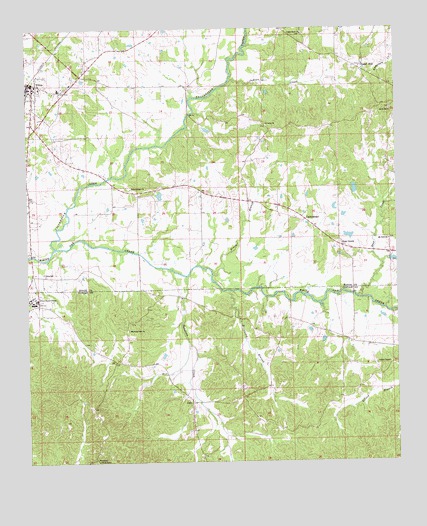
Utica East, MS USGS Topographic Map
Click on map above to begin viewing in our Map Viewer.

This topographic map contains these locations and features:
Feature Name Type Latitude Longitude GNIS ID View Map
Alabama School (historical)SchoolN32.1196°W90.5912°688194View Map
Bear CreekPopulated PlaceN32.0638°W90.5195°666635View Map
Bear CreekStreamN32.0474°W90.5134°666640View Map
Bear Creek ChurchChurchN32.0604°W90.5182°688213View Map
Beech School (historical)SchoolN32.0743°W90.5565°688218View Map
Brock Store (historical)LocaleN32.0688°W90.5662°688239View Map
Browning BranchStreamN32.0493°W90.5576°667635View Map
CarmichaelPopulated PlaceN32.0699°W90.5315°668068View Map
Chapel HillPopulated PlaceN32.1143°W90.5137°668316View Map
Eaton and Cooke Lake DamDamN32.1052°W90.5418°681013View Map
Hoodtown Lookout TowerTowerN32.0010°W90.6029°711249View Map
Husbands School (historical)SchoolN32.1054°W90.5448°688405View Map
Indian CreekStreamN32.1096°W90.5565°671678View Map
JackPopulated PlaceN32.0174°W90.5701°691961View Map
Johnson Pond DamDamN32.0752°W90.5134°681001View Map
Little Mount ChurchChurchN32.1015°W90.5018°672647View Map
Little Mount School (historical)SchoolN32.1029°W90.5029°688440View Map
Little Rock ChurchChurchN32.1235°W90.5312°672666View Map
Little Rock School (historical)SchoolN32.1232°W90.5312°688441View Map
Lowes ChapelChurchN32.0285°W90.5029°672930View Map
Mixon Elementary SchoolSchoolN32.1079°W90.6140°710224View Map
Morning Star CemeteryCemeteryN32.0385°W90.5912°708033View Map
Morning Star ChurchChurchN32.0382°W90.5909°673830View Map
Mount Zion ChurchChurchN32.0638°W90.5026°674348View Map
Nixon BranchStreamN32.0540°W90.5626°674928View Map
Pickett Pond DamDamN32.0652°W90.5151°680997View Map
Rather Ford BridgeBridgeN32.1007°W90.5698°688560View Map
Saddlers CreekStreamN32.0535°W90.5715°676994View Map
Saint John ChurchChurchN32.0977°W90.5437°677055View Map
Strawbridge ChurchChurchN32.0790°W90.5898°678345View Map
Tallahala (historical)LocaleN32.0877°W90.5501°688631View Map
Tallahalla CreekStreamN32.0621°W90.6157°678545View Map
Town of UticaCivilN32.1061°W90.6221°2406782View Map
UticaPopulated PlaceN32.1096°W90.6234°679161View Map
Utica Junior CollegeSchoolN32.0465°W90.6234°679162View Map
Utica Police DepartmentBuildingN32.1087°W90.6229°2754097View Map
Utica SchoolSchoolN32.0549°W90.6195°679163View Map
Water Valley Church (historical)ChurchN32.1157°W90.5845°688662View Map

Note: Coordinates in the location and feature list above are referenced to NAD83 datum.


Copyright (C) 2008-2025 Ryan Niemi / Sunset Dynamics ... All Rights Reserved