TopoQuest Logo
Do you find TopoQuest useful?
Help keep TopoQuest running and adding new maps/features by donating!
Bitcoin:  19c7KJd3qBynnjoSw5npx9KScwjBe4ifkT
Litecoin:  LXs6TkuXGGXo1vDsWCkWVdjQX94eUKd6ui
Home View Maps Find Maps Find Places Resources & Links


Edwards, Mississippi Topographic Map

USGS Map Title: Edwards, MS
USGS Map MRC: 32090C5
DRG (GeoTIFF) Download: o32090c5.tif


Neighboring USGS Topographic Map Quads:


  Oak Ridge, MS  
32090D6
 

  Queens Hill Lake, MS  
32090D5
 

  Brownsville, MS  
32090D4
 

  Bovina, MS  
32090C6
 

  Edwards, MS  
32090C5
 

  Raymond, MS  
32090C4
 

  Cayuga, MS  
32090B6
 

  Learned, MS  
32090B5
 

  Terry NW, MS  
32090B4


Map MRC Location:

N33°
W91°
N33°
W90°
H8 H7 H6 H5 H4 H3 H2 H1
G8 G7 G6 G5 G4 G3 G2 G1
F8 F7 F6 F5 F4 F3 F2 F1
E8 E7 E6 E5 E4 E3 E2 E1
D8 D7 D6 D5 D4 D3 D2 D1
C8 C7 C6 C5 C4 C3 C2 C1
B8 B7 B6 B5 B4 B3 B2 B1
A8 A7 A6 A5 A4 A3 A2 A1
N32°
W91°
N32°
W90°

Edwards, MS USGS 1:24K Topographic Map Preview:
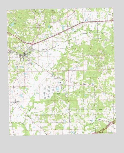
Edwards, MS USGS Topographic Map
Click on map above to begin viewing in our Map Viewer.

This topographic map contains these locations and features:
Feature Name Type Latitude Longitude GNIS ID View Map
Adams Egg Farm DamDamN32.2951°W90.5701°681173View Map
Armstrong PondReservoirN32.3581°W90.5760°666377View Map
Askew Pond DamDamN32.3585°W90.5801°681252View Map
Bakers CreekStreamN32.2613°W90.6090°666476View Map
Ballard School (historical)SchoolN32.2579°W90.5545°688210View Map
Beech Hill School (historical)SchoolN32.3738°W90.5968°688217View Map
Champion HillPopulated PlaceN32.3501°W90.5373°691762View Map
Champion Hill ChurchChurchN32.3421°W90.5223°668305View Map
Davis Lakes DamDamN32.3618°W90.5334°681257View Map
Dowing PondReservoirN32.2632°W90.5277°669372View Map
EdwardsPopulated PlaceN32.3301°W90.6057°669683View Map
Edwards Attendence CenterSchoolN32.3271°W90.6073°710205View Map
Edwards CemeteryCemeteryN32.3340°W90.5856°669686View Map
Edwards Post OfficePost OfficeN32.3293°W90.6036°2768567View Map
Edwards Town Police DepartmentBuildingN32.3295°W90.6043°2754275View Map
Fairchilds Mill (historical)LocaleN32.2529°W90.5159°688329View Map
Floyd Pond DamDamN32.3118°W90.6018°681189View Map
Friendship CemeteryCemeteryN32.3140°W90.6156°670208View Map
Galilee ChurchChurchN32.2554°W90.5243°670292View Map
Goode School (historical)SchoolN32.2843°W90.5379°688365View Map
Interchange 19CrossingN32.3410°W90.5957°691370View Map
Jackson CreekStreamN32.2818°W90.5954°671776View Map
L Nobels Lake DamDamN32.3201°W90.6168°681202View Map
Lake AdanacReservoirN32.3596°W90.6187°666156View Map
Lake Advance DamDamN32.3601°W90.6201°681253View Map
Little Zion ChurchChurchN32.2510°W90.6184°672344View Map
McClendon Pond DamDamN32.2635°W90.5034°681145View Map
Mount Moriah ChurchChurchN32.2840°W90.6162°674064View Map
Mount Moriah School (historical)SchoolN32.2838°W90.6173°688473View Map
Mount Shiloh ChurchChurchN32.3474°W90.6104°674265View Map
Mount Zion Church (historical)ChurchN32.2557°W90.6204°688484View Map
Nobles Lake DamDamN32.2518°W90.5484°681125View Map
Nortrust Farm Management DamDamN32.2951°W90.6051°681174View Map
Pilgrim Rest ChurchChurchN32.3065°W90.5676°675746View Map
Pleasant Hill ChurchChurchN32.3679°W90.5062°676068View Map
Ratliff ChapelChurchN32.3624°W90.5687°676479View Map
Ray Canada Lake DamDamN32.3185°W90.6084°681199View Map
Saint James ChurchChurchN32.3082°W90.5726°677033View Map
Saint Jeans School (historical)SchoolN32.3088°W90.5720°688595View Map
Sand Hill ChurchChurchN32.3724°W90.5465°673308View Map
Sand Hill School (historical)SchoolN32.3721°W90.5462°688603View Map
Town of EdwardsCivilN32.3326°W90.6056°2406426View Map
Vance Lake DamDamN32.3551°W90.5618°681248View Map
West Hinds Volunteer Fire DepartmentBuildingN32.3312°W90.6058°2668011View Map
Williams School (historical)SchoolN32.3365°W90.5643°688682View Map
WQMV-FM (Vicksburg)TowerN32.3563°W90.6120°680221View Map

Note: Coordinates in the location and feature list above are referenced to NAD83 datum.


Copyright (C) 2008-2025 Ryan Niemi / Sunset Dynamics ... All Rights Reserved