TopoQuest Logo
Do you find TopoQuest useful?
Help keep TopoQuest running and adding new maps/features by donating!
Bitcoin:  19c7KJd3qBynnjoSw5npx9KScwjBe4ifkT
Litecoin:  LXs6TkuXGGXo1vDsWCkWVdjQX94eUKd6ui
Home View Maps Find Maps Find Places Resources & Links


Leesburg, Mississippi Topographic Map

USGS Map Title: Leesburg, MS
USGS Map MRC: 32089D7
DRG (GeoTIFF) Download: o32089d7.tif


Neighboring USGS Topographic Map Quads:


  Shoccoe, MS  
32089E8
 

  Sharon SE, MS  
32089E7
 

  Ludlow, MS  
32089E6
 

  Goshen Springs, MS  
32089D8
 

  Leesburg, MS  
32089D7
 

  Forkville, MS  
32089D6
 

  Brandon, MS  
32089C8
 

  Pelahatchie, MS  
32089C7
 

  Morton, MS  
32089C6


Map MRC Location:

N33°
W90°
N33°
W89°
H8 H7 H6 H5 H4 H3 H2 H1
G8 G7 G6 G5 G4 G3 G2 G1
F8 F7 F6 F5 F4 F3 F2 F1
E8 E7 E6 E5 E4 E3 E2 E1
D8 D7 D6 D5 D4 D3 D2 D1
C8 C7 C6 C5 C4 C3 C2 C1
B8 B7 B6 B5 B4 B3 B2 B1
A8 A7 A6 A5 A4 A3 A2 A1
N32°
W90°
N32°
W89°

Leesburg, MS USGS 1:24K Topographic Map Preview:
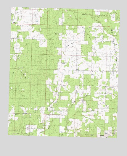
Leesburg, MS USGS Topographic Map
Click on map above to begin viewing in our Map Viewer.

This topographic map contains these locations and features:
Feature Name Type Latitude Longitude GNIS ID View Map
Abernathy (historical)Populated PlaceN32.3918°W89.8473°708985View Map
Barefoot School (historical)SchoolN32.3765°W89.7667°690053View Map
Barefoot SpringSpringN32.3793°W89.7634°690631View Map
Barefoot Springs CemeteryCemeteryN32.3765°W89.7656°708989View Map
Barefoot Springs ChurchChurchN32.3779°W89.7662°666517View Map
Bilbros CornerPopulated PlaceN32.4418°W89.7984°690632View Map
Chatman SchoolSchoolN32.4399°W89.7942°668359View Map
Church of ChristChurchN32.4243°W89.7556°690638View Map
Dry CreekStreamN32.3863°W89.8101°693122View Map
Harrell FieldAirportN32.4699°W89.8524°2676440View Map
Hollybush CemeteryCemeteryN32.4046°W89.8248°709061View Map
Hollybush ChurchChurchN32.4038°W89.8273°671337View Map
Hullburg Oil FieldOilfieldN32.4349°W89.8584°690648View Map
Hurricane CreekStreamN32.4935°W89.7837°693571View Map
Lake Harbor Volunteer Fire Department Station 2BuildingN32.4691°W89.8649°2667954View Map
LeesburgPopulated PlaceN32.4404°W89.7604°690919View Map
Leesburg Baptist ChurchChurchN32.4396°W89.7548°687052View Map
Leesburg CemeteryCemeteryN32.4404°W89.7556°709069View Map
Leesburg PrairieLakeN32.4523°W89.7625°690068View Map
Leesburg Volunteer Fire DepartmentBuildingN32.4407°W89.7854°2667972View Map
Mink BranchStreamN32.4149°W89.7731°673677View Map
Mount Pisgah CemeteryCemeteryN32.4751°W89.8665°709095View Map
Mount Pisgah ChurchChurchN32.4751°W89.8667°690655View Map
Mount Pleasant ChurchChurchN32.3960°W89.8673°690656View Map
Neal CemeteryCemeteryN32.3793°W89.7542°690657View Map
New Pisgah CemeteryCemeteryN32.4701°W89.8667°709100View Map
Oak Grove CemeteryCemeteryN32.4471°W89.8120°709103View Map
Oak Grove Missionary Baptist ChurchChurchN32.4476°W89.8137°675040View Map
Ormand SchoolSchoolN32.4032°W89.7817°675308View Map
Outten SchoolSchoolN32.3968°W89.8695°675336View Map
Pelahatchie CemeteryCemeteryN32.4007°W89.7801°690665View Map
PisgahPopulated PlaceN32.4699°W89.8701°675928View Map
Pisgah High SchoolSchoolN32.4860°W89.8731°675942View Map
Pole BranchStreamN32.4754°W89.7517°694447View Map
Prairie Rest ChurchChurchN32.4471°W89.8006°676314View Map
Red Cane CreekStreamN32.4976°W89.8056°676521View Map
Rehobeth CemeteryCemeteryN32.4237°W89.8140°709128View Map
Rehobeth School (historical)SchoolN32.4243°W89.8134°709129View Map
Rehoboth ChurchChurchN32.4232°W89.8154°676596View Map
Rollison PrairieLakeN32.4614°W89.8109°676831View Map
Round PrairieFlatN32.4660°W89.8506°676916View Map
Spring Hill CemeteryCemeteryN32.3782°W89.7798°678097View Map
Supervisor District 4CivilN32.3784°W89.8480°704463View Map
Ward BranchStreamN32.3810°W89.8445°679330View Map
West LeesburgPopulated PlaceN32.4418°W89.7895°711119View Map

Note: Coordinates in the location and feature list above are referenced to NAD83 datum.


Copyright (C) 2008-2025 Ryan Niemi / Sunset Dynamics ... All Rights Reserved