TopoQuest Logo
Do you find TopoQuest useful?
Help keep TopoQuest running and adding new maps/features by donating!
Bitcoin:  19c7KJd3qBynnjoSw5npx9KScwjBe4ifkT
Litecoin:  LXs6TkuXGGXo1vDsWCkWVdjQX94eUKd6ui
Home View Maps Find Maps Find Places Resources & Links


Lehman Lake, Wisconsin Topographic Map

USGS Map Title: Lehman Lake, WI
USGS Map MRC: 45088D2
DRG (GeoTIFF) Download: o45088d2.tif


Neighboring USGS Topographic Map Quads:


  Coleman Lake, WI  
45088E3
 

  Twelvefoot Falls, WI  
45088E2
 

  Town Corner Lake, WI  
45088E1
 

  Roaring Rapids, WI  
45088D3
 

  Lehman Lake, WI  
45088D2
 

  Athelstane, WI  
45088D1
 

  Thunder Mountain, WI  
45088C3
 

  High Falls Reservoir, WI  
45088C2
 

  Mount Tom, WI  
45088C1


Map MRC Location:

N46°
W89°
N46°
W88°
H8 H7 H6 H5 H4 H3 H2 H1
G8 G7 G6 G5 G4 G3 G2 G1
F8 F7 F6 F5 F4 F3 F2 F1
E8 E7 E6 E5 E4 E3 E2 E1
D8 D7 D6 D5 D4 D3 D2 D1
C8 C7 C6 C5 C4 C3 C2 C1
B8 B7 B6 B5 B4 B3 B2 B1
A8 A7 A6 A5 A4 A3 A2 A1
N45°
W89°
N45°
W88°

Lehman Lake, WI USGS 1:24K Topographic Map Preview:
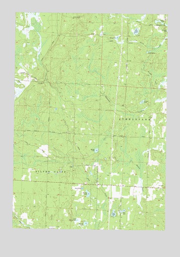
Lehman Lake, WI USGS Topographic Map
Click on map above to begin viewing in our Map Viewer.

This topographic map contains these locations and features:
Feature Name Type Latitude Longitude GNIS ID View Map
Deer LakeLakeN45.3860°W88.1600°1563837View Map
Duck LakeLakeN45.4960°W88.1321°1564152View Map
Eagle River School (historical)SchoolN45.4305°W88.1998°1845556View Map
Girard Junction Lookout TowerLocaleN45.4969°W88.2034°1577612View Map
Harwell LakeLakeN45.3785°W88.1901°1566116View Map
Heart LakeLakeN45.3988°W88.1934°1566248View Map
Horsehead LakeLakeN45.4937°W88.1262°1566718View Map
Intervale School (historical)SchoolN45.3939°W88.1618°1845574View Map
Lake SixteenLakeN45.4781°W88.1410°1574221View Map
Lehman LakeLakeN45.4898°W88.1510°1567953View Map
Little Spring LakeLakeN45.3804°W88.1972°1568424View Map
Lost LakeLakeN45.3844°W88.1674°1568658View Map
Murbou LakeLakeN45.3957°W88.1886°1570035View Map
Rosey LakeLakeN45.4861°W88.1662°1572618View Map
Spring LakeLakeN45.4208°W88.1821°1574673View Map
Town of AthelstaneCivilN45.4725°W88.1602°1582726View Map
Trout LakeLakeN45.4492°W88.1454°1575671View Map

Note: Coordinates in the location and feature list above are referenced to NAD83 datum.


Copyright (C) 2008-2025 Ryan Niemi / Sunset Dynamics ... All Rights Reserved