TopoQuest Logo
Do you find TopoQuest useful?
Help keep TopoQuest running and adding new maps/features by donating!
Bitcoin:  19c7KJd3qBynnjoSw5npx9KScwjBe4ifkT
Litecoin:  LXs6TkuXGGXo1vDsWCkWVdjQX94eUKd6ui
Home View Maps Find Maps Find Places Resources & Links


Town Corner Lake, Wisconsin Topographic Map

USGS Map Title: Town Corner Lake, WI
USGS Map MRC: 45088E1
DRG (GeoTIFF) Download: o45088e1.tif


Neighboring USGS Topographic Map Quads:


  Dunbar, WI  
45088F2
 

  Dunbar NE, WI  
45088F1
 

  Pembine, WI  
45087F8
 

  Twelvefoot Falls, WI  
45088E2
 

  Town Corner Lake, WI  
45088E1
 

  Amberg, WI  
45087E8
 

  Lehman Lake, WI  
45088D2
 

  Athelstane, WI  
45088D1
 

  Wausaukee North, WI  
45087D8


Map MRC Location:

N46°
W89°
N46°
W88°
H8 H7 H6 H5 H4 H3 H2 H1
G8 G7 G6 G5 G4 G3 G2 G1
F8 F7 F6 F5 F4 F3 F2 F1
E8 E7 E6 E5 E4 E3 E2 E1
D8 D7 D6 D5 D4 D3 D2 D1
C8 C7 C6 C5 C4 C3 C2 C1
B8 B7 B6 B5 B4 B3 B2 B1
A8 A7 A6 A5 A4 A3 A2 A1
N45°
W89°
N45°
W88°

Town Corner Lake, WI USGS 1:24K Topographic Map Preview:
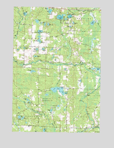
Town Corner Lake, WI USGS Topographic Map
Click on map above to begin viewing in our Map Viewer.

This topographic map contains these locations and features:
Feature Name Type Latitude Longitude GNIS ID View Map
Back LakeLakeN45.6133°W88.0505°1561058View Map
Barnes LakeLakeN45.6007°W88.0872°1561182View Map
Barr LakeLakeN45.5517°W88.0283°1561193View Map
Beecher ChurchChurchN45.5714°W88.0285°1561495View Map
Beecher LakeReservoirN45.5635°W88.0056°1792832View Map
Beecher Lake 3WR1552 DamDamN45.5633°W88.0007°1792831View Map
Bull FallsFallsN45.5958°W88.1212°1562390View Map
Camp LakeLakeN45.5826°W88.0912°1562625View Map
Chipmunk RapidsRapidsN45.5377°W88.0190°1563036View Map
Christian LakeLakeN45.5838°W88.1092°1563058View Map
Cole CreekStreamN45.6013°W88.1143°1563249View Map
Cole LakeLakeN45.5137°W88.1101°1563250View Map
Coons School (historical)SchoolN45.5194°W88.0721°1845553View Map
Dolan LakeLakeN45.5147°W88.1151°1564039View Map
East Pickerel PondLakeN45.6077°W88.0757°1564360View Map
East Twin LakeLakeN45.5901°W88.0866°1564383View Map
Elm Flats LakeLakeN45.5320°W88.1031°1564559View Map
Lillie LakeLakeN45.5291°W88.1003°1568034View Map
Lily LakeLakeN45.6179°W88.1085°1568049View Map
Lindquist LakeLakeN45.6151°W88.0586°1568140View Map
Lundgren LakeLakeN45.6160°W88.0449°1568808View Map
McDonald LakeLakeN45.5757°W88.0932°1569204View Map
Merriman LakeLakeN45.5605°W88.0968°1569374View Map
Merriman School (historical)SchoolN45.5644°W88.0985°1845595View Map
Minnie LakeLakeN45.6233°W88.0768°1569569View Map
Monson PondLakeN45.6058°W88.0438°1569666View Map
North Branch Pike RiverStreamN45.5052°W88.0084°1570390View Map
Northland International UniversitySchoolN45.5811°W88.0959°2713248View Map
Phillips LakeLakeN45.5830°W88.0821°1571298View Map
Pike Ridge School (historical)SchoolN45.5858°W88.0998°1845621View Map
Red Roof AirportAirportN45.5858°W88.0037°1581881View Map
Redman LakeLakeN45.5217°W88.0696°1572164View Map
Smeester School (historical)SchoolN45.5711°W88.0287°1845638View Map
South Branch Pike RiverStreamN45.5052°W88.0084°1574412View Map
Thoeming LakeLakeN45.6095°W88.0393°1575367View Map
Town Corner CreekStreamN45.5672°W88.0571°1575531View Map
Town Corner LakeLakeN45.5437°W88.0592°1575532View Map
Town Corner State Wildlife Management AreaParkN45.5339°W88.0773°1575533View Map
Upper LakeLakeN45.5644°W88.0126°1575974View Map
West Pickerel PondLakeN45.6078°W88.0802°1576543View Map
West Twin LakeLakeN45.5917°W88.0887°1576566View Map
Whiskey CreekStreamN45.5705°W88.1235°1576612View Map
Wiggins LakeLakeN45.6098°W88.0120°1576722View Map
Williams LakeLakeN45.5262°W88.0594°1576767View Map
Woempner LakeLakeN45.6108°W88.0916°1576927View Map
Young LakeLakeN45.6208°W88.0729°1577116View Map

Note: Coordinates in the location and feature list above are referenced to NAD83 datum.


Copyright (C) 2008-2025 Ryan Niemi / Sunset Dynamics ... All Rights Reserved