TopoQuest Logo
Do you find TopoQuest useful?
Help keep TopoQuest running and adding new maps/features by donating!
Bitcoin:  19c7KJd3qBynnjoSw5npx9KScwjBe4ifkT
Litecoin:  LXs6TkuXGGXo1vDsWCkWVdjQX94eUKd6ui
Home View Maps Find Maps Find Places Resources & Links


Barton, South Carolina Topographic Map

USGS Map Title: Barton, SC
USGS Map MRC: 32081H3
DRG (GeoTIFF) Download: o32081h3.tif


Neighboring USGS Topographic Map Quads:


  Martin, SC  
33081A4
 

  Allendale, SC  
33081A3
 

  Sycamore, SC  
33081A2
 

  Bull Pond, SC  
32081H4
 

  Barton, SC  
32081H3
 

  Fairfax, SC  
32081H2
 

  Brier Creek Landing, GA  
32081G4
 

  Solomons Crossroads, SC  
32081G3
 

  Gifford, SC  
32081G2


Map MRC Location:

N33°
W82°
N33°
W81°
H8 H7 H6 H5 H4 H3 H2 H1
G8 G7 G6 G5 G4 G3 G2 G1
F8 F7 F6 F5 F4 F3 F2 F1
E8 E7 E6 E5 E4 E3 E2 E1
D8 D7 D6 D5 D4 D3 D2 D1
C8 C7 C6 C5 C4 C3 C2 C1
B8 B7 B6 B5 B4 B3 B2 B1
A8 A7 A6 A5 A4 A3 A2 A1
N32°
W82°
N32°
W81°

Barton, SC USGS 1:24K Topographic Map Preview:
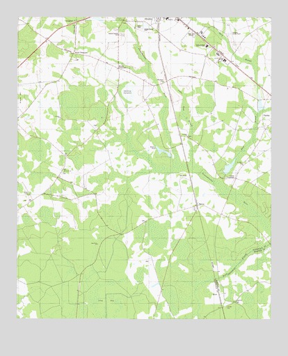
Barton, SC USGS Topographic Map
Click on map above to begin viewing in our Map Viewer.

This topographic map contains these locations and features:
Feature Name Type Latitude Longitude GNIS ID View Map
Allendale Correctional InstitutionBuildingN32.9689°W81.2688°2735631View Map
Allendale CountyCivilN32.9881°W81.3582°1247980View Map
Allendale County AirportAirportN32.9934°W81.2709°1251843View Map
Allendale County Golf ClubLocaleN32.9350°W81.2938°2489984View Map
Allendale County Sheriff's OfficeBuildingN32.9895°W81.2859°2334806View Map
Allendale Elementary SchoolSchoolN32.9997°W81.3014°1233093View Map
Allendale Fairfax High SchoolSchoolN32.9888°W81.2825°1220169View Map
Allendale Fairfax Middle SchoolSchoolN32.9823°W81.2730°1233095View Map
Allendale Law Enforcement CenterBuildingN32.9899°W81.2855°2334850View Map
Allendale Wastewater Treatment FacilityLocaleN32.9958°W81.3116°2490471View Map
BartonPopulated PlaceN32.9224°W81.2865°1220339View Map
Barton School (historical)SchoolN32.9210°W81.2926°1233098View Map
Bing High SchoolSchoolN32.9999°W81.3018°1220748View Map
Bostic Pond (historical)LakeN32.9691°W81.3148°1233103View Map
Buddenville School (historical)SchoolN32.9613°W81.3693°1233107View Map
Coalla (historical)Populated PlaceN32.9821°W81.2698°1233113View Map
Duck BranchStreamN32.9315°W81.2757°1222127View Map
Emanuel ChurchChurchN32.8827°W81.2668°1247664View Map
Fairfax DivisionCivilN32.8807°W81.3282°1938264View Map
Googe CemeteryCemeteryN32.9370°W81.3482°1852116View Map
Gopher Hall School (historical)SchoolN32.8829°W81.3015°1233119View Map
Harters PondLakeN32.9444°W81.3030°1223070View Map
Harters Pond Dam D-2572DamN32.9452°W81.3032°1239549View Map
Levy BaySwampN32.8771°W81.3304°1246342View Map
Little Duck BranchStreamN32.9385°W81.2893°1223986View Map
Lopers CrossroadsPopulated PlaceN32.9335°W81.2673°1227939View Map
Moores CrossroadsPopulated PlaceN32.9790°W81.3257°1246720View Map
Mount Zion CemeteryCemeteryN32.8799°W81.2718°1224812View Map
Mount Zion Church (historical)ChurchN32.8804°W81.2718°1232191View Map
Near River ChurchChurchN32.9060°W81.3351°1224938View Map
Near River School (historical)SchoolN32.9063°W81.3348°1233150View Map
New Home CemeteryCemeteryN32.9732°W81.3037°1224975View Map
New Home Church (historical)ChurchN32.9735°W81.3021°1233151View Map
Oneal Pond Dam D-2568DamN32.9368°W81.2698°1239553View Map
Oswald Field (historical)AirportN32.9952°W81.3465°1251842View Map
Oswalds Pond Dam D-2565DamN32.9968°W81.3298°1239554View Map
Pointe Salkehatchie Regional Industrial ParkLocaleN32.9707°W81.2607°2489486View Map
RousePopulated PlaceN32.8854°W81.2754°1231753View Map
Saint James ChurchChurchN32.9507°W81.2915°1226112View Map
Saint Lukes ChurchChurchN32.9393°W81.2640°1226172View Map
Saint Marks ChurchChurchN32.9585°W81.3540°1226194View Map
Saint Marks School (historical)SchoolN32.9588°W81.3540°1233154View Map
Sanders (historical)Populated PlaceN32.9646°W81.2984°1233160View Map
Sanders Pond Dam D-2567DamN32.9618°W81.2548°1239556View Map
Smart CemeteriesCemeteryN32.9271°W81.3687°1226681View Map
Smyrna CemeteryCemeteryN32.9365°W81.3515°1706318View Map
Smyrna ChurchChurchN32.9363°W81.3518°1226712View Map
South Carolina Department of Motor Vehicles Fairfax OfficeBuildingN32.9848°W81.2762°2490446View Map
Stillwood PlantationLocaleN32.9029°W81.3151°1233168View Map
Swallow SavannaSwampN32.9690°W81.3215°1251084View Map
Swallow Savanna CemeteryCemeteryN32.9929°W81.3243°1226985View Map
Woods CrossroadsPopulated PlaceN32.9852°W81.3476°1251506View Map

Note: Coordinates in the location and feature list above are referenced to NAD83 datum.


Copyright (C) 2008-2024 Ryan Niemi / Sunset Dynamics ... All Rights Reserved