TopoQuest Logo
Do you find TopoQuest useful?
Help keep TopoQuest running and adding new maps/features by donating!
Bitcoin:  19c7KJd3qBynnjoSw5npx9KScwjBe4ifkT
Litecoin:  LXs6TkuXGGXo1vDsWCkWVdjQX94eUKd6ui
Home View Maps Find Maps Find Places Resources & Links


Gifford, South Carolina Topographic Map

USGS Map Title: Gifford, SC
USGS Map MRC: 32081G2
DRG (GeoTIFF) Download: o32081g2.tif


Neighboring USGS Topographic Map Quads:


  Barton, SC  
32081H3
 

  Fairfax, SC  
32081H2
 

  Crocketville, SC  
32081H1
 

  Solomons Crossroads, SC  
32081G3
 

  Gifford, SC  
32081G2
 

  Hampton, SC  
32081G1
 

  Shirley, SC  
32081F3
 

  Furman, SC  
32081F2
 

  Grays, SC  
32081F1


Map MRC Location:

N33°
W82°
N33°
W81°
H8 H7 H6 H5 H4 H3 H2 H1
G8 G7 G6 G5 G4 G3 G2 G1
F8 F7 F6 F5 F4 F3 F2 F1
E8 E7 E6 E5 E4 E3 E2 E1
D8 D7 D6 D5 D4 D3 D2 D1
C8 C7 C6 C5 C4 C3 C2 C1
B8 B7 B6 B5 B4 B3 B2 B1
A8 A7 A6 A5 A4 A3 A2 A1
N32°
W82°
N32°
W81°

Gifford, SC USGS 1:24K Topographic Map Preview:
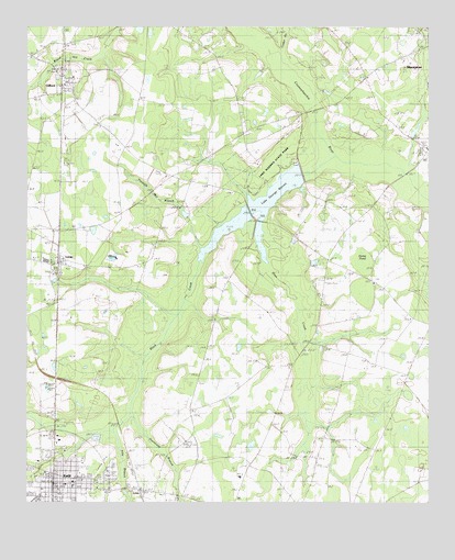
Gifford, SC USGS Topographic Map
Click on map above to begin viewing in our Map Viewer.

This topographic map contains these locations and features:
Feature Name Type Latitude Longitude GNIS ID View Map
Airsdale School (historical)SchoolN32.7818°W81.1820°1244856View Map
Black CreekStreamN32.8416°W81.1526°1220764View Map
Black Creek ChurchChurchN32.8210°W81.1645°1246898View Map
Brier CreekStreamN32.8285°W81.1734°1246986View Map
Browning CemeteryCemeteryN32.8402°W81.2143°1232140View Map
Browning ChurchChurchN32.8410°W81.2137°1221016View Map
Coosawhatchie School (historical)SchoolN32.8152°W81.1554°1232147View Map
EstillPopulated PlaceN32.7549°W81.2420°1222302View Map
Estill DivisionCivilN32.7800°W81.2111°1938262View Map
Estill Elementary SchoolSchoolN32.7558°W81.2355°1232150View Map
Estill Emergency Management ServicesBuildingN32.7563°W81.2427°2368420View Map
Estill Fire Department Station 20BuildingN32.7522°W81.2323°2368103View Map
Estill High SchoolSchoolN32.7802°W81.2391°1232151View Map
Estill Industrial ParkLocaleN32.7663°W81.2395°1232152View Map
Estill Police DepartmentBuildingN32.7509°W81.2409°2334870View Map
Estill Post OfficePost OfficeN32.7587°W81.2409°1252074View Map
Estill Public LibraryBuildingN32.7541°W81.2367°2490367View Map
Filly BranchStreamN32.7696°W81.2232°1222391View Map
GiffordPopulated PlaceN32.8596°W81.2390°1222698View Map
Gifford Fire Department Station 40BuildingN32.8635°W81.2404°2368100View Map
Gifford Post OfficePost OfficeN32.8609°W81.2376°2489831View Map
Gifford School (historical)SchoolN32.8596°W81.2409°1235311View Map
Gifford-Luray SchoolSchoolN32.8454°W81.2382°1251706View Map
Hampton CountyCivilN32.7763°W81.1407°1248004View Map
Hampton County Fire Department Station 20 EstillBuildingN32.7555°W81.2392°2368324View Map
Harpers AirportAirportN32.7568°W81.2282°1251891View Map
Hopewell Baptist ChurchChurchN32.8079°W81.1421°1223286View Map
Horse PondLakeN32.8121°W81.1434°1223323View Map
Hurricane BranchStreamN32.7741°W81.2165°1223409View Map
Johnson CrossingBridgeN32.8529°W81.1612°1232174View Map
Kingdom Hall of Jehovahs WitnessesChurchN32.8618°W81.1440°1232178View Map
Lake George WarrenReservoirN32.8352°W81.1665°1251608View Map
Lake George WarrenLakeN32.8317°W81.1723°1227775View Map
Lake WarrenReservoirN32.8252°W81.1748°1238754View Map
Lake Warren State ParkParkN32.8377°W81.1748°1227776View Map
Lawtonville Baptist ChurchChurchN32.7549°W81.2376°2490238View Map
LenaPopulated PlaceN32.7535°W81.2151°1246334View Map
Long Branch ChurchChurchN32.8491°W81.2273°1246455View Map
Lovett ChurchChurchN32.7524°W81.2040°1232183View Map
LurayPopulated PlaceN32.8138°W81.2398°1246484View Map
Luray Post OfficePost OfficeN32.8135°W81.2397°1252076View Map
Luray School (historical)SchoolN32.8118°W81.2373°1235312View Map
Millville SchoolSchoolN32.8591°W81.1407°1224583View Map
Mount Olive ChurchChurchN32.8432°W81.1254°1232189View Map
New CrossingBridgeN32.8357°W81.1307°1249792View Map
Patrick Henry AcademySchoolN32.7569°W81.1835°1232194View Map
Saint Peters ChurchChurchN32.8688°W81.2468°1250685View Map
South Carolina Noname 25001 D-2603 DamDamN32.8352°W81.1665°1238701View Map
South Carolina Noname 25001 D-2603 DamDamN32.8252°W81.1748°1238753View Map
Speaks MillPopulated PlaceN32.7729°W81.1434°1231816View Map
Sweet Rose ChurchChurchN32.7816°W81.1954°1251090View Map
Town of EstillCivilN32.7539°W81.2412°2406461View Map
Town of GiffordCivilN32.8600°W81.2385°2406566View Map
Town of LurayCivilN32.8142°W81.2403°2406059View Map
Trowells Mill BranchStreamN32.8216°W81.1962°1227218View Map
Wish Well Church (historical)ChurchN32.8266°W81.2184°1248900View Map
Wishwell SchoolSchoolN32.8268°W81.2179°1227666View Map

Note: Coordinates in the location and feature list above are referenced to NAD83 datum.


Copyright (C) 2008-2024 Ryan Niemi / Sunset Dynamics ... All Rights Reserved