TopoQuest Logo
Do you find TopoQuest useful?
Help keep TopoQuest running and adding new maps/features by donating!
Bitcoin:  19c7KJd3qBynnjoSw5npx9KScwjBe4ifkT
Litecoin:  LXs6TkuXGGXo1vDsWCkWVdjQX94eUKd6ui
Home View Maps Find Maps Find Places Resources & Links


Leroy, Indiana Topographic Map

USGS Map Title: Leroy, IN
USGS Map MRC: 41087C3
DRG (GeoTIFF) Download: o41087c3.tif


Neighboring USGS Topographic Map Quads:


  Saint John, IN  
41087D4
 

  Crown Point, IN  
41087D3
 

  Palmer, IN  
41087D2
 

  Lowell, IN  
41087C4
 

  Leroy, IN  
41087C3
 

  Hebron, IN  
41087C2
 

  Schneider, IN  
41087B4
 

  Shelby, IN  
41087B3
 

  DeMotte, IN  
41087B2


Map MRC Location:

N42°
W88°
N42°
W87°
H8 H7 H6 H5 H4 H3 H2 H1
G8 G7 G6 G5 G4 G3 G2 G1
F8 F7 F6 F5 F4 F3 F2 F1
E8 E7 E6 E5 E4 E3 E2 E1
D8 D7 D6 D5 D4 D3 D2 D1
C8 C7 C6 C5 C4 C3 C2 C1
B8 B7 B6 B5 B4 B3 B2 B1
A8 A7 A6 A5 A4 A3 A2 A1
N41°
W88°
N41°
W87°

Leroy, IN USGS 1:24K Topographic Map Preview:
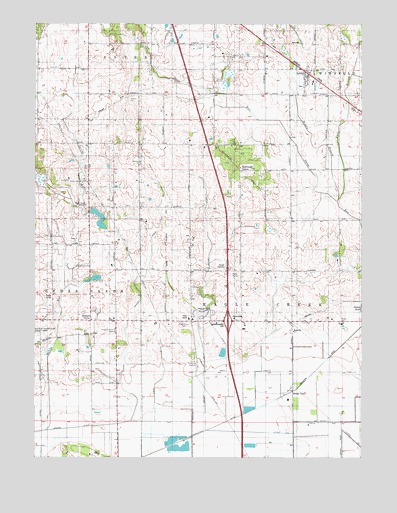
Leroy, IN USGS Topographic Map
Click on map above to begin viewing in our Map Viewer.

This topographic map contains these locations and features:
Feature Name Type Latitude Longitude GNIS ID View Map
Apple Valley EstatesPopulated PlaceN41.2911°W87.3108°2515249View Map
Bryant DitchCanalN41.2964°W87.3086°431703View Map
Center Elementary SchoolSchoolN41.3045°W87.2775°432342View Map
DinwiddiePopulated PlaceN41.2895°W87.3011°433566View Map
Eagle CreekStreamN41.2706°W87.2750°449517View Map
East Branch Stony RunStreamN41.3248°W87.2592°433868View Map
Ebert DitchCanalN41.2728°W87.3267°433987View Map
Griesel DitchCanalN41.2650°W87.3361°435494View Map
Indiana State Police Department District 13BuildingN41.2900°W87.3159°2758407View Map
LeroyPopulated PlaceN41.3600°W87.2720°449683View Map
Leroy Community ParkParkN41.3575°W87.2720°450214View Map
Little DitchCanalN41.2609°W87.2667°438042View Map
Middle Branch Stony RunStreamN41.3239°W87.2595°439088View Map
Orchard GrovePopulated PlaceN41.2898°W87.3536°440682View Map
Orchard Grove CemeteryCemeteryN41.2865°W87.3443°440683View Map
Plum Grove CemeteryCemeteryN41.2891°W87.3181°441369View Map
Range LinePopulated PlaceN41.2695°W87.2761°441765View Map
Southeast GrovePopulated PlaceN41.3331°W87.2967°443873View Map
Spring RunStreamN41.2581°W87.3706°443998View Map
Township of Eagle CreekCivilN41.2821°W87.2838°453270View Map
WWJY-FM (Crown Point)TowerN41.3234°W87.3561°449033View Map

Note: Coordinates in the location and feature list above are referenced to NAD83 datum.


Copyright (C) 2008-2025 Ryan Niemi / Sunset Dynamics ... All Rights Reserved