TopoQuest Logo
Do you find TopoQuest useful?
Help keep TopoQuest running and adding new maps/features by donating!
Bitcoin:  19c7KJd3qBynnjoSw5npx9KScwjBe4ifkT
Litecoin:  LXs6TkuXGGXo1vDsWCkWVdjQX94eUKd6ui
Home View Maps Find Maps Find Places Resources & Links


Lick Point, Idaho Topographic Map

USGS Map Title: Lick Point, ID
USGS Map MRC: 45115H4
DRG (GeoTIFF) Download: o45115h4.tif


Neighboring USGS Topographic Map Quads:


  Goddard Point, ID  
46115A5
 

  Stillman Point, ID  
46115A4
 

  Selway Falls, ID  
46115A3
 

  Iron Mountain, ID  
45115H5
 

  Lick Point, ID  
45115H4
 

  Anderson Butte, ID  
45115H3
 

  Center Star Mountain, ID  
45115G5
 

  Elk City, ID  
45115G4
 

  Black Hawk Mountain, ID  
45115G3


Map MRC Location:

N46°
W116°
N46°
W115°
H8 H7 H6 H5 H4 H3 H2 H1
G8 G7 G6 G5 G4 G3 G2 G1
F8 F7 F6 F5 F4 F3 F2 F1
E8 E7 E6 E5 E4 E3 E2 E1
D8 D7 D6 D5 D4 D3 D2 D1
C8 C7 C6 C5 C4 C3 C2 C1
B8 B7 B6 B5 B4 B3 B2 B1
A8 A7 A6 A5 A4 A3 A2 A1
N45°
W116°
N45°
W115°

Lick Point, ID USGS 1:24K Topographic Map Preview:
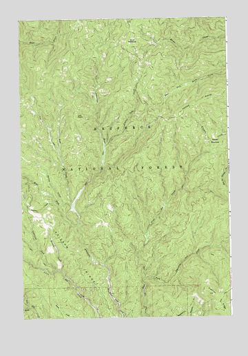
Lick Point, ID USGS Topographic Map
Click on map above to begin viewing in our Map Viewer.

This topographic map contains these locations and features:
Feature Name Type Latitude Longitude GNIS ID View Map
Buck MeadowsFlatN45.9910°W115.4324°378381View Map
Ericson CreekStreamN45.8946°W115.4765°381490View Map
Ericson RidgeRidgeN45.8907°W115.4601°396469View Map
Flatiron RidgeRidgeN45.8827°W115.3826°381849View Map
Flint CreekStreamN45.8916°W115.4276°381865View Map
Horse Creek Administrative Research AreaParkN45.9957°W115.3768°398498View Map
Horse Creek Administrative Research SiteLocaleN45.9819°W115.4046°400559View Map
Lick CreekStreamN45.9230°W115.4696°384611View Map
Lick PointSummitN45.9602°W115.4668°396793View Map
Lightning Fork Little Elk CreekStreamN45.8952°W115.4793°384641View Map
Limber Luke CreekStreamN45.9466°W115.4496°384654View Map
Manes PlaceLocaleN45.9213°W115.4721°394321View Map
Marten MeadowsFlatN45.9482°W115.3826°386504View Map
Rumpus CreekStreamN45.9219°W115.4790°389722View Map
Spring CreekStreamN45.9219°W115.4693°391179View Map
West Fork American RiverStreamN45.9132°W115.4662°393038View Map
West Fork Big Elk CreekStreamN45.8796°W115.4951°393051View Map
YorkPopulated PlaceN45.9091°W115.4796°394322View Map

Note: Coordinates in the location and feature list above are referenced to NAD83 datum.


Copyright (C) 2008-2025 Ryan Niemi / Sunset Dynamics ... All Rights Reserved