TopoQuest Logo
Do you find TopoQuest useful?
Help keep TopoQuest running and adding new maps/features by donating!
Bitcoin:  19c7KJd3qBynnjoSw5npx9KScwjBe4ifkT
Litecoin:  LXs6TkuXGGXo1vDsWCkWVdjQX94eUKd6ui
Home View Maps Find Maps Find Places Resources & Links


Elk City, Idaho Topographic Map

USGS Map Title: Elk City, ID
USGS Map MRC: 45115G4
DRG (GeoTIFF) Download: o45115g4.tif


Neighboring USGS Topographic Map Quads:


  Iron Mountain, ID  
45115H5
 

  Lick Point, ID  
45115H4
 

  Anderson Butte, ID  
45115H3
 

  Center Star Mountain, ID  
45115G5
 

  Elk City, ID  
45115G4
 

  Black Hawk Mountain, ID  
45115G3
 

  Orogrande, ID  
45115F5
 

  Moose Butte, ID  
45115F4
 

  Trapper Creek, ID  
45115F3


Map MRC Location:

N46°
W116°
N46°
W115°
H8 H7 H6 H5 H4 H3 H2 H1
G8 G7 G6 G5 G4 G3 G2 G1
F8 F7 F6 F5 F4 F3 F2 F1
E8 E7 E6 E5 E4 E3 E2 E1
D8 D7 D6 D5 D4 D3 D2 D1
C8 C7 C6 C5 C4 C3 C2 C1
B8 B7 B6 B5 B4 B3 B2 B1
A8 A7 A6 A5 A4 A3 A2 A1
N45°
W116°
N45°
W115°

Elk City, ID USGS 1:24K Topographic Map Preview:
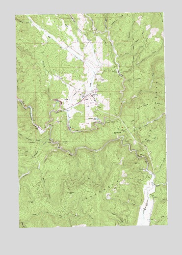
Elk City, ID USGS Topographic Map
Click on map above to begin viewing in our Map Viewer.

This topographic map contains these locations and features:
Feature Name Type Latitude Longitude GNIS ID View Map
Alamance MineMineN45.8413°W115.4176°376492View Map
American Hill LakeLakeN45.8130°W115.4332°398994View Map
American RiverStreamN45.8082°W115.4751°376596View Map
Baboon CreekStreamN45.8357°W115.4093°376793View Map
Beartrap RanchLocaleN45.8713°W115.4879°394595View Map
Big Campbell CreekStreamN45.8027°W115.4732°377448View Map
Big Elk CreekStreamN45.8405°W115.4346°399785View Map
Box Sing CreekStreamN45.8396°W115.4140°378155View Map
Buffalo GulchValleyN45.8188°W115.4629°378442View Map
Buster MineMineN45.8360°W115.4290°378589View Map
Cal-Idaho PitMineN45.8119°W115.4662°378692View Map
Cole CreekStreamN45.7596°W115.3951°379567View Map
Deadwood CreekStreamN45.7960°W115.4668°380347View Map
E ManesLocaleN45.8485°W115.4393°400574View Map
East Fork American RiverStreamN45.8641°W115.4237°381043View Map
East Fork Relief CreekStreamN45.7535°W115.4974°381160View Map
Elk CityPopulated PlaceN45.8269°W115.4368°396453View Map
Elk City AirportAirportN45.8221°W115.4393°400812View Map
Elk City Census Designated PlaceCensusN45.8267°W115.4378°2585570View Map
Elk City Elementary-Junior High SchoolSchoolN45.8288°W115.4357°401313View Map
Elk City Lard CommLocaleN45.8544°W115.4165°394597View Map
Elk City Post OfficePost OfficeN45.8265°W115.4365°2781809View Map
Elk City Ranger StationLocaleN45.8291°W115.4329°394577View Map
Elk City Volunteer Fire DepartmentBuildingN45.8274°W115.4431°2619168View Map
Elk CreekStreamN45.8182°W115.4587°381339View Map
French GulchValleyN45.7796°W115.3871°382070View Map
Galena CreekStreamN45.7663°W115.3912°382146View Map
Glass CreekStreamN45.8138°W115.4148°382290View Map
Gold PointPopulated PlaceN45.7830°W115.3937°396568View Map
Gold Point MineMineN45.7819°W115.3948°400575View Map
GrangevilleLocaleN45.7657°W115.4899°400578View Map
Grangeville MineMineN45.7652°W115.4876°382517View Map
Idaho CountyCivilN45.8442°W115.4675°395699View Map
Irish CreekStreamN45.8141°W115.4162°383745View Map
J ManesLocaleN45.8585°W115.4501°394600View Map
JonesLocaleN45.8594°W115.4360°394596View Map
Kirks ForkStreamN45.8224°W115.4101°384259View Map
Little Campbell CreekStreamN45.8019°W115.4754°384763View Map
Little Elk CreekStreamN45.8405°W115.4346°384821View Map
Little Red Horse CreekStreamN45.7977°W115.3973°384923View Map
Loon CreekStreamN45.7535°W115.3954°386123View Map
MaxwellLocaleN45.8560°W115.4585°394598View Map
Monroe CreekStreamN45.8705°W115.4857°387090View Map
Mother Lode HillSummitN45.8049°W115.4201°396930View Map
North Fork Queen CreekStreamN45.8510°W115.4043°387755View Map
PhelpsLocaleN45.8238°W115.4612°400579View Map
Queen CreekStreamN45.8499°W115.4157°388985View Map
Red Horse CreekStreamN45.7941°W115.4010°389196View Map
Red Horse RidgeRidgeN45.8213°W115.3868°389198View Map
Red RiverStreamN45.8085°W115.4751°389231View Map
Shearer MillLocaleN45.8066°W115.4801°394601View Map
Siegel CreekStreamN45.7735°W115.3873°390407View Map
Sultan ShaftMineN45.8419°W115.4246°391607View Map
Swale CreekStreamN45.8491°W115.4465°391700View Map
Sweeny HillSummitN45.8277°W115.4501°397231View Map
Telephone CreekStreamN45.8644°W115.4221°391898View Map
UleryLocaleN45.8510°W115.4424°394599View Map
Wheeler CreekStreamN45.7863°W115.4821°393277View Map
Wheeler MountainSummitN45.7702°W115.4579°393278View Map
Whitaker CreekStreamN45.8535°W115.4173°393308View Map

Note: Coordinates in the location and feature list above are referenced to NAD83 datum.


Copyright (C) 2008-2025 Ryan Niemi / Sunset Dynamics ... All Rights Reserved