TopoQuest Logo
Do you find TopoQuest useful?
Help keep TopoQuest running and adding new maps/features by donating!
Bitcoin:  19c7KJd3qBynnjoSw5npx9KScwjBe4ifkT
Litecoin:  LXs6TkuXGGXo1vDsWCkWVdjQX94eUKd6ui
Home View Maps Find Maps Find Places Resources & Links


Center Star Mountain, Idaho Topographic Map

USGS Map Title: Center Star Mountain, ID
USGS Map MRC: 45115G5
DRG (GeoTIFF) Download: o45115g5.tif


Neighboring USGS Topographic Map Quads:


  Pilot Knob, ID  
45115H6
 

  Iron Mountain, ID  
45115H5
 

  Lick Point, ID  
45115H4
 

  Golden, ID  
45115G6
 

  Center Star Mountain, ID  
45115G5
 

  Elk City, ID  
45115G4
 

  North Pole, ID  
45115F6
 

  Orogrande, ID  
45115F5
 

  Moose Butte, ID  
45115F4


Map MRC Location:

N46°
W116°
N46°
W115°
H8 H7 H6 H5 H4 H3 H2 H1
G8 G7 G6 G5 G4 G3 G2 G1
F8 F7 F6 F5 F4 F3 F2 F1
E8 E7 E6 E5 E4 E3 E2 E1
D8 D7 D6 D5 D4 D3 D2 D1
C8 C7 C6 C5 C4 C3 C2 C1
B8 B7 B6 B5 B4 B3 B2 B1
A8 A7 A6 A5 A4 A3 A2 A1
N45°
W116°
N45°
W115°

Center Star Mountain, ID USGS 1:24K Topographic Map Preview:
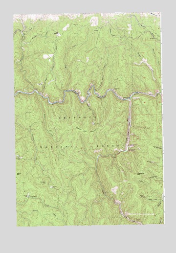
Center Star Mountain, ID USGS Topographic Map
Click on map above to begin viewing in our Map Viewer.

This topographic map contains these locations and features:
Feature Name Type Latitude Longitude GNIS ID View Map
Allison CreekStreamN45.8296°W115.5832°376554View Map
Baner CreekStreamN45.7635°W115.5035°376925View Map
Bear CreekStreamN45.8632°W115.6160°377119View Map
Bear Creek CampgroundLocaleN45.8638°W115.6171°394113View Map
Black Lady MineMineN45.7869°W115.5096°377752View Map
Center Star CreekStreamN45.8232°W115.5646°379140View Map
Center Star MineMineN45.8102°W115.5590°379141View Map
Center Star MountainSummitN45.8049°W115.5587°396263View Map
Coeur d'Alene MineMineN45.7913°W115.6224°379486View Map
Crooked RiverStreamN45.8238°W115.5301°380092View Map
Crooked River Number Five CampgroundLocaleN45.7935°W115.5310°394109View Map
Crooked River Number Three CampgroundLocaleN45.7966°W115.5299°394108View Map
Deadwood MountainSummitN45.7802°W115.5229°380353View Map
Dutch Oven CreekStreamN45.8299°W115.5571°380961View Map
Elk City Mining CompanyLocaleN45.8644°W115.5324°394112View Map
Fourmile MineMineN45.7680°W115.6151°381968View Map
Golden Fleece MineMineN45.8086°W115.5983°2576283View Map
Haystack MineMineN45.7730°W115.5946°382999View Map
Haystack MountainSummitN45.7760°W115.5993°396633View Map
Idaho Champion Group ProspectsMineN45.7541°W115.5232°394110View Map
Lucky Strike MineMineN45.7777°W115.5107°386275View Map
Maurice CreekStreamN45.8396°W115.5010°386545View Map
Moose CreekStreamN45.8299°W115.5796°387168View Map
Mud SpringsPopulated PlaceN45.8635°W115.5862°396935View Map
Newsome CreekStreamN45.8291°W115.6149°387544View Map
Proux MountainSummitN45.7810°W115.6246°397072View Map
Rabbit CreekStreamN45.8282°W115.6046°388998View Map
South Fork MineMineN45.8302°W115.5410°390975View Map
The NarrowsValleyN45.8632°W115.6165°391977View Map
Trail CreekStreamN45.8280°W115.6018°392281View Map
Vicory CreekStreamN45.8574°W115.6154°392726View Map
Wagner MineMineN45.7669°W115.5174°392761View Map
West Fork Newsome CreekStreamN45.8646°W115.6179°393156View Map
Whiskey CreekStreamN45.8294°W115.5012°393291View Map
Whiskey GulchValleyN45.8613°W115.5357°393296View Map
Zenith MineMineN45.7755°W115.5179°393780View Map

Note: Coordinates in the location and feature list above are referenced to NAD83 datum.


Copyright (C) 2008-2025 Ryan Niemi / Sunset Dynamics ... All Rights Reserved