TopoQuest Logo
Do you find TopoQuest useful?
Help keep TopoQuest running and adding new maps/features by donating!
Bitcoin:  19c7KJd3qBynnjoSw5npx9KScwjBe4ifkT
Litecoin:  LXs6TkuXGGXo1vDsWCkWVdjQX94eUKd6ui
Home View Maps Find Maps Find Places Resources & Links


Lignite Creek, Montana Topographic Map

USGS Map Title: Lignite Creek, MT
USGS Map MRC: 46105C8
DRG (GeoTIFF) Download: o46105c8.tif


Neighboring USGS Topographic Map Quads:


  Butterfly Creek, MT  
46106D1
 

  Big Hill, MT  
46105D8
 

  Miles City, MT  
46105D7
 

  Horton, MT  
46106C1
 

  Lignite Creek, MT  
46105C8
 

  Paddy Fay Creek, MT  
46105C7
 

  Moon Creek School, MT  
46106B1
 

  Jack Creek NW, MT  
46105B8
 

  Circle L Creek, MT  
46105B7


Map MRC Location:

N47°
W106°
N47°
W105°
H8 H7 H6 H5 H4 H3 H2 H1
G8 G7 G6 G5 G4 G3 G2 G1
F8 F7 F6 F5 F4 F3 F2 F1
E8 E7 E6 E5 E4 E3 E2 E1
D8 D7 D6 D5 D4 D3 D2 D1
C8 C7 C6 C5 C4 C3 C2 C1
B8 B7 B6 B5 B4 B3 B2 B1
A8 A7 A6 A5 A4 A3 A2 A1
N46°
W106°
N46°
W105°

Lignite Creek, MT USGS 1:24K Topographic Map Preview:
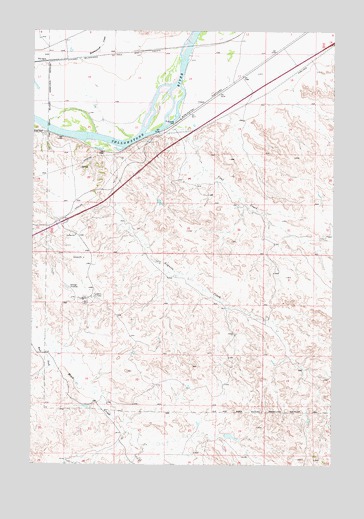
Lignite Creek, MT USGS Topographic Map
Click on map above to begin viewing in our Map Viewer.

This topographic map contains these locations and features:
Feature Name Type Latitude Longitude GNIS ID View Map
06N46E04CDB_01 WellWellN46.2992°W105.9797°815221View Map
06N46E04DCA_01 WellWellN46.2992°W105.9719°815220View Map
06N46E12ABDA01 WellWellN46.2936°W105.9097°815149View Map
06N46E22CDBA01 WellWellN46.2536°W105.9578°814817View Map
07N46E12DBC_01 WellWellN46.3733°W105.9136°815836View Map
07N46E24ACBD01 WellWellN46.3494°W105.9131°815643View Map
07N47E31CCAA01 WellWellN46.3133°W105.8986°815353View Map
Coal CreekStreamN46.3486°W105.9428°769969View Map
Fort Keogh Livestock and Range Research StationLocaleN46.3333°W105.8761°1721485View Map
Interchange 128CrossingN46.3194°W105.9889°1721479View Map
Lignite (historical)LocaleN46.3394°W105.9667°1716860View Map
Lignite CreekStreamN46.3408°W105.9667°773335View Map
Miles City Air Force Station (historical)MilitaryN46.2967°W105.9786°2089511View Map
Paragon BridgeBridgeN46.3708°W105.9358°1716938View Map
Reservation CreekStreamN46.3656°W105.9806°775710View Map
UlmerPopulated PlaceN46.3544°W105.9294°777906View Map
West Fork Moon CreekStreamN46.2861°W105.9978°778259View Map

Note: Coordinates in the location and feature list above are referenced to NAD83 datum.


Copyright (C) 2008-2025 Ryan Niemi / Sunset Dynamics ... All Rights Reserved