TopoQuest Logo
Do you find TopoQuest useful?
Help keep TopoQuest running and adding new maps/features by donating!
Bitcoin:  19c7KJd3qBynnjoSw5npx9KScwjBe4ifkT
Litecoin:  LXs6TkuXGGXo1vDsWCkWVdjQX94eUKd6ui
Home View Maps Find Maps Find Places Resources & Links


Paddy Fay Creek, Montana Topographic Map

USGS Map Title: Paddy Fay Creek, MT
USGS Map MRC: 46105C7
DRG (GeoTIFF) Download: o46105c7.tif


Neighboring USGS Topographic Map Quads:


  Big Hill, MT  
46105D8
 

  Miles City, MT  
46105D7
 

  Government Hill, MT  
46105D6
 

  Lignite Creek, MT  
46105C8
 

  Paddy Fay Creek, MT  
46105C7
 

  Whitney Creek, MT  
46105C6
 

  Jack Creek NW, MT  
46105B8
 

  Circle L Creek, MT  
46105B7
 

  Horse Creek, MT  
46105B6


Map MRC Location:

N47°
W106°
N47°
W105°
H8 H7 H6 H5 H4 H3 H2 H1
G8 G7 G6 G5 G4 G3 G2 G1
F8 F7 F6 F5 F4 F3 F2 F1
E8 E7 E6 E5 E4 E3 E2 E1
D8 D7 D6 D5 D4 D3 D2 D1
C8 C7 C6 C5 C4 C3 C2 C1
B8 B7 B6 B5 B4 B3 B2 B1
A8 A7 A6 A5 A4 A3 A2 A1
N46°
W106°
N46°
W105°

Paddy Fay Creek, MT USGS 1:24K Topographic Map Preview:
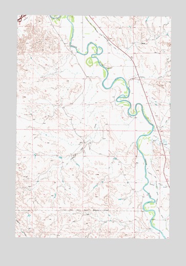
Paddy Fay Creek, MT USGS Topographic Map
Click on map above to begin viewing in our Map Viewer.

This topographic map contains these locations and features:
Feature Name Type Latitude Longitude GNIS ID View Map
06N47E03ADDC01 WellWellN46.3039°W105.8219°815270View Map
06N47E23DABC01 WellWellN46.2600°W105.8017°814884View Map
06N48E08CCCA01 WellWellN46.2842°W105.7564°815060View Map
07N47E10DDAD01 WellWellN46.3706°W105.8072°815808View Map
07N47E13BBCC01 WellWellN46.3242°W105.8406°815447View Map
07N47E13DDBB01 WellWellN46.3572°W105.7858°815692View Map
07N47E24AAD_01 WellWellN46.3556°W105.7839°815683View Map
07N47E24CABB01 WellWellN46.3464°W105.7956°815626View Map
07N47E24DBAB01 WellWellN46.3464°W105.7872°815625View Map
07N47E36AABC01 WellWellN46.3244°W105.7817°815457View Map
07N47E36ADDD01 WellWellN46.3181°W105.7794°815397View Map
Cowles CreekStreamN46.3350°W105.7844°770238View Map
Interchange 135CrossingN46.3736°W105.8722°1721478View Map
Log CreekStreamN46.3111°W105.7642°773544View Map
Mill CreekStreamN46.3078°W105.7733°774226View Map
North Woman CreekStreamN46.2819°W105.7678°777129View Map
Paddy Fay CreekStreamN46.3275°W105.7939°775056View Map
Pumpkin CreekStreamN46.2517°W105.7547°789231View Map

Note: Coordinates in the location and feature list above are referenced to NAD83 datum.


Copyright (C) 2008-2024 Ryan Niemi / Sunset Dynamics ... All Rights Reserved