TopoQuest Logo
Do you find TopoQuest useful?
Help keep TopoQuest running and adding new maps/features by donating!
Bitcoin:  19c7KJd3qBynnjoSw5npx9KScwjBe4ifkT
Litecoin:  LXs6TkuXGGXo1vDsWCkWVdjQX94eUKd6ui
Home View Maps Find Maps Find Places Resources & Links


Circle L Creek, Montana Topographic Map

USGS Map Title: Circle L Creek, MT
USGS Map MRC: 46105B7
DRG (GeoTIFF) Download: o46105b7.tif


Neighboring USGS Topographic Map Quads:


  Lignite Creek, MT  
46105C8
 

  Paddy Fay Creek, MT  
46105C7
 

  Whitney Creek, MT  
46105C6
 

  Jack Creek NW, MT  
46105B8
 

  Circle L Creek, MT  
46105B7
 

  Horse Creek, MT  
46105B6
 

  Garland School, MT  
46105A8
 

  Jack Creek, MT  
46105A7
 

  Beebe SW, MT  
46105A6


Map MRC Location:

N47°
W106°
N47°
W105°
H8 H7 H6 H5 H4 H3 H2 H1
G8 G7 G6 G5 G4 G3 G2 G1
F8 F7 F6 F5 F4 F3 F2 F1
E8 E7 E6 E5 E4 E3 E2 E1
D8 D7 D6 D5 D4 D3 D2 D1
C8 C7 C6 C5 C4 C3 C2 C1
B8 B7 B6 B5 B4 B3 B2 B1
A8 A7 A6 A5 A4 A3 A2 A1
N46°
W106°
N46°
W105°

Circle L Creek, MT USGS 1:24K Topographic Map Preview:
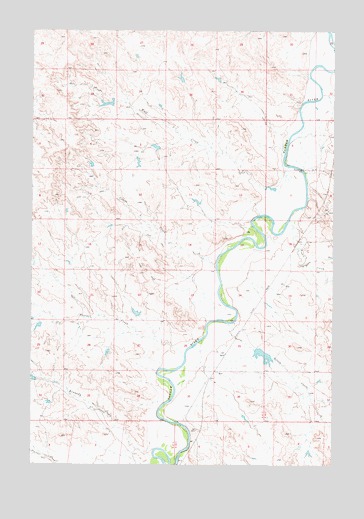
Circle L Creek, MT USGS Topographic Map
Click on map above to begin viewing in our Map Viewer.

This topographic map contains these locations and features:
Feature Name Type Latitude Longitude GNIS ID View Map
04N48E06DACB01 WellWellN46.1281°W105.8056°814116View Map
05N47E25BAAB01 WellWellN46.1658°W105.7919°814341View Map
05N47E26AACA01 WellWellN46.1644°W105.8033°814328View Map
05N48E05BCBB01 WellWellN46.2208°W105.7583°814645View Map
05N48E18ACBC01 WellWellN46.1903°W105.7678°814496View Map
Circle L CreekStreamN46.1817°W105.7989°769882View Map
Dry CreekStreamN46.2094°W105.7625°770793View Map
Etna (historical)Populated PlaceN46.1875°W105.7811°1716884View Map
Etna Post Office (historical)Post OfficeN46.1875°W105.7811°1716885View Map
Fortune Number 9 DamDamN46.1650°W105.8739°796767View Map
Kennedy CreekStreamN46.1250°W105.8269°772986View Map
Moffitt Number 1 DamDamN46.1583°W105.7806°796314View Map
Moffitt Number 2 DamDamN46.1700°W105.8306°796766View Map
Nelson CreekStreamN46.1656°W105.7939°774576View Map
Prat CreekStreamN46.1956°W105.7686°775447View Map
Thorpe CreekStreamN46.1561°W105.8122°777595View Map
Wolf CreekStreamN46.2108°W105.7692°778630View Map
Woodard Number 4 DamDamN46.2167°W105.8239°796768View Map

Note: Coordinates in the location and feature list above are referenced to NAD83 datum.


Copyright (C) 2008-2025 Ryan Niemi / Sunset Dynamics ... All Rights Reserved