TopoQuest Logo
Do you find TopoQuest useful?
Help keep TopoQuest running and adding new maps/features by donating!
Bitcoin:  19c7KJd3qBynnjoSw5npx9KScwjBe4ifkT
Litecoin:  LXs6TkuXGGXo1vDsWCkWVdjQX94eUKd6ui
Home View Maps Find Maps Find Places Resources & Links


Ligonier, Indiana Topographic Map

USGS Map Title: Ligonier, IN
USGS Map MRC: 41085D5
DRG (GeoTIFF) Download: o41085d5.tif


Neighboring USGS Topographic Map Quads:


  Millersburg, IN  
41085E6
 

  Topeka, IN  
41085E5
 

  Oliver Lake, IN  
41085E4
 

  Lake Wawasee, IN  
41085D6
 

  Ligonier, IN  
41085D5
 

  Albion, IN  
41085D4
 

  North Webster, IN  
41085C6
 

  Ormas, IN  
41085C5
 

  Merriam, IN  
41085C4


Map MRC Location:

N42°
W86°
N42°
W85°
H8 H7 H6 H5 H4 H3 H2 H1
G8 G7 G6 G5 G4 G3 G2 G1
F8 F7 F6 F5 F4 F3 F2 F1
E8 E7 E6 E5 E4 E3 E2 E1
D8 D7 D6 D5 D4 D3 D2 D1
C8 C7 C6 C5 C4 C3 C2 C1
B8 B7 B6 B5 B4 B3 B2 B1
A8 A7 A6 A5 A4 A3 A2 A1
N41°
W86°
N41°
W85°

Ligonier, IN USGS 1:24K Topographic Map Preview:
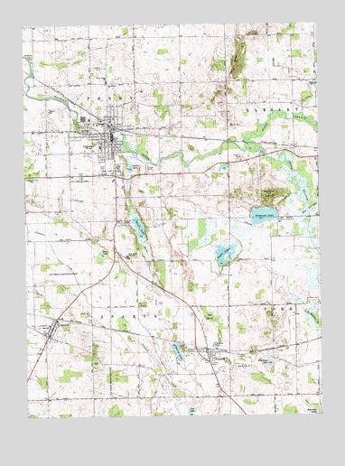
Ligonier, IN USGS Topographic Map
Click on map above to begin viewing in our Map Viewer.

This topographic map contains these locations and features:
Feature Name Type Latitude Longitude GNIS ID View Map
Bowman LakeLakeN41.3757°W85.5018°431412View Map
City of LigonierCivilN41.4652°W85.5946°2395706View Map
CromwellPopulated PlaceN41.4006°W85.6158°433147View Map
Cromwell Elementary SchoolSchoolN41.4039°W85.6153°447311View Map
Cromwell Police DepartmentBuildingN41.4010°W85.6156°2758338View Map
Davis LakeLakeN41.4267°W85.5926°433359View Map
Diamond HillSummitN41.4453°W85.5225°433529View Map
Diamond LakeLakeN41.4386°W85.5236°433530View Map
Eagle LakeLakeN41.4266°W85.5404°433850View Map
Engle LakeLakeN41.4353°W85.5767°434199View Map
Hull AirportAirportN41.4833°W85.5946°2677058View Map
Indian LakeLakeN41.4548°W85.5799°436768View Map
Jacobs DitchCanalN41.4750°W85.5055°436907View Map
KimmellPopulated PlaceN41.3953°W85.5483°437309View Map
Kimmell Census Designated PlaceCensusN41.3950°W85.5487°2631624View Map
LigonierPopulated PlaceN41.4659°W85.5875°437883View Map
Ligonier Airport (historical)AirportN41.4500°W85.6055°449247View Map
Ligonier Fire DepartmentBuildingN41.4633°W85.5887°2625739View Map
Ligonier PitMineN41.4739°W85.5411°2649533View Map
Ligonier Police DepartmentBuildingN41.4635°W85.5872°2758117View Map
Longwood Rest ParkParkN41.4517°W85.6228°438295View Map
Noble County Emergency Medical Services - Cromwell QuartersBuildingN41.4137°W85.6022°2719347View Map
North Branch Elkhart RiverStreamN41.4603°W85.5308°440222View Map
North Side ChurchChurchN41.4803°W85.5886°440295View Map
Oak Park CemeteryCemeteryN41.4539°W85.5853°440446View Map
Perry Elementary SchoolSchoolN41.4820°W85.5897°441025View Map
Red MarshSwampN41.4064°W85.5469°441823View Map
Smalley DitchCanalN41.4831°W85.5105°443647View Map
South Branch Elkhart RiverStreamN41.4606°W85.5303°443783View Map
Sparta LakeLakeN41.3956°W85.5609°443918View Map
Sparta Lake DitchCanalN41.4159°W85.5703°443919View Map
Sparta Township Fire DepartmentBuildingN41.4017°W85.6159°2625738View Map
The KnobsSummitN41.4867°W85.5328°444669View Map
The SpreadSwampN41.4406°W85.5036°444678View Map
Town of CromwellCivilN41.4032°W85.6142°2396668View Map
Township of PerryCivilN41.4808°W85.5962°453724View Map
Township of SpartaCivilN41.3947°W85.5961°453858View Map
Valley CemeteryCemeteryN41.3921°W85.5969°445193View Map
West Noble High SchoolSchoolN41.4259°W85.5814°450609View Map
West Noble High SchoolSchoolN41.4612°W85.5933°447308View Map
West Noble Middle SchoolSchoolN41.4612°W85.5933°447309View Map
Whirledge LakeLakeN41.3920°W85.5219°445906View Map

Note: Coordinates in the location and feature list above are referenced to NAD83 datum.


Copyright (C) 2008-2024 Ryan Niemi / Sunset Dynamics ... All Rights Reserved