TopoQuest Logo
Do you find TopoQuest useful?
Help keep TopoQuest running and adding new maps/features by donating!
Bitcoin:  19c7KJd3qBynnjoSw5npx9KScwjBe4ifkT
Litecoin:  LXs6TkuXGGXo1vDsWCkWVdjQX94eUKd6ui
Home View Maps Find Maps Find Places Resources & Links


Millersburg, Indiana Topographic Map

USGS Map Title: Millersburg, IN
USGS Map MRC: 41085E6
DRG (GeoTIFF) Download: o41085e6.tif


Neighboring USGS Topographic Map Quads:


  Bristol, IN  
41085F7
 

  Middlebury, IN  
41085F6
 

  Shipshewana, IN  
41085F5
 

  Goshen, IN  
41085E7
 

  Millersburg, IN  
41085E6
 

  Topeka, IN  
41085E5
 

  Milford, IN  
41085D7
 

  Lake Wawasee, IN  
41085D6
 

  Ligonier, IN  
41085D5


Map MRC Location:

N42°
W86°
N42°
W85°
H8 H7 H6 H5 H4 H3 H2 H1
G8 G7 G6 G5 G4 G3 G2 G1
F8 F7 F6 F5 F4 F3 F2 F1
E8 E7 E6 E5 E4 E3 E2 E1
D8 D7 D6 D5 D4 D3 D2 D1
C8 C7 C6 C5 C4 C3 C2 C1
B8 B7 B6 B5 B4 B3 B2 B1
A8 A7 A6 A5 A4 A3 A2 A1
N41°
W86°
N41°
W85°

Millersburg, IN USGS 1:24K Topographic Map Preview:
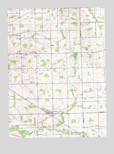
Millersburg, IN USGS Topographic Map
Click on map above to begin viewing in our Map Viewer.

This topographic map contains these locations and features:
Feature Name Type Latitude Longitude GNIS ID View Map
Brown CemeteryCemeteryN41.5167°W85.6989°431607View Map
Burr Oak ChurchChurchN41.5159°W85.6353°431864View Map
Clinton Brick ChurchChurchN41.5898°W85.6958°432672View Map
Clinton Christian Day SchoolSchoolN41.6000°W85.7353°432674View Map
Clinton ChurchChurchN41.5848°W85.6858°432675View Map
Clinton Community SchoolSchoolN41.5831°W85.7175°432676View Map
Clinton Frame ChurchChurchN41.5712°W85.7333°432678View Map
Clinton Township Fire DepartmentBuildingN41.5276°W85.6922°2625811View Map
Clinton Union CemeteryCemeteryN41.5695°W85.7392°432680View Map
Dry Run DitchCanalN41.5006°W85.7458°432205View Map
Eldridge CemeteryCemeteryN41.6247°W85.6605°434064View Map
Fair Haven ChurchChurchN41.6037°W85.7239°434285View Map
Fish LakeLakeN41.5792°W85.6637°434512View Map
Ladon FarmsLocaleN41.6167°W85.7286°2708241View Map
Loyal AcresLocaleN41.6214°W85.7419°2708243View Map
Maplebranch FarmLocaleN41.6228°W85.6939°2708250View Map
McAllister DitchCanalN41.5575°W85.6750°438778View Map
Miller CemeteryCemeteryN41.6206°W85.7378°439195View Map
Miller FarmsLocaleN41.6242°W85.6392°2708253View Map
MillersburgPopulated PlaceN41.5278°W85.6944°449696View Map
Millersburg Elementary SchoolSchoolN41.5259°W85.6975°446603View Map
Nisley CemeteryCemeteryN41.5853°W85.7353°440183View Map
Phillips DitchCanalN41.5320°W85.6480°441090View Map
Pleasant Grove ChurchChurchN41.5556°W85.7233°441268View Map
Rowe-Eden DitchCanalN41.6084°W85.6333°442368View Map
Saint Johns ChurchChurchN41.5906°W85.6569°442601View Map
Silver Street ChurchChurchN41.5825°W85.7353°443512View Map
Stony CreekPopulated PlaceN41.5348°W85.6500°446714View Map
Stony CreekStreamN41.5139°W85.6911°444224View Map
Town of MillersburgCivilN41.5277°W85.6964°2396764View Map
Township of ClintonCivilN41.5664°W85.7132°453231View Map

Note: Coordinates in the location and feature list above are referenced to NAD83 datum.


Copyright (C) 2008-2024 Ryan Niemi / Sunset Dynamics ... All Rights Reserved