TopoQuest Logo
Do you find TopoQuest useful?
Help keep TopoQuest running and adding new maps/features by donating!
Bitcoin:  19c7KJd3qBynnjoSw5npx9KScwjBe4ifkT
Litecoin:  LXs6TkuXGGXo1vDsWCkWVdjQX94eUKd6ui
Home View Maps Find Maps Find Places Resources & Links


Topeka, Indiana Topographic Map

USGS Map Title: Topeka, IN
USGS Map MRC: 41085E5
DRG (GeoTIFF) Download: o41085e5.tif


Neighboring USGS Topographic Map Quads:


  Middlebury, IN  
41085F6
 

  Shipshewana, IN  
41085F5
 

  Lagrange, IN  
41085F4
 

  Millersburg, IN  
41085E6
 

  Topeka, IN  
41085E5
 

  Oliver Lake, IN  
41085E4
 

  Lake Wawasee, IN  
41085D6
 

  Ligonier, IN  
41085D5
 

  Albion, IN  
41085D4


Map MRC Location:

N42°
W86°
N42°
W85°
H8 H7 H6 H5 H4 H3 H2 H1
G8 G7 G6 G5 G4 G3 G2 G1
F8 F7 F6 F5 F4 F3 F2 F1
E8 E7 E6 E5 E4 E3 E2 E1
D8 D7 D6 D5 D4 D3 D2 D1
C8 C7 C6 C5 C4 C3 C2 C1
B8 B7 B6 B5 B4 B3 B2 B1
A8 A7 A6 A5 A4 A3 A2 A1
N41°
W86°
N41°
W85°

Topeka, IN USGS 1:24K Topographic Map Preview:
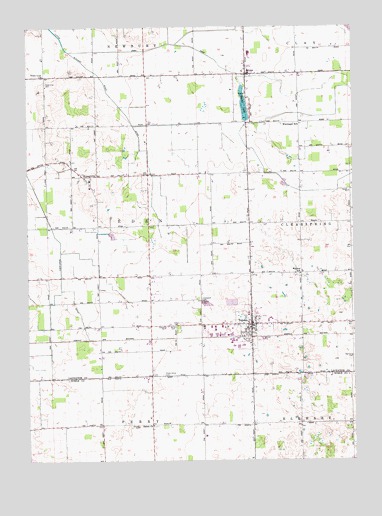
Topeka, IN USGS Topographic Map
Click on map above to begin viewing in our Map Viewer.

This topographic map contains these locations and features:
Feature Name Type Latitude Longitude GNIS ID View Map
Bontrager DitchCanalN41.6203°W85.5694°449601View Map
Byler DitchCanalN41.5776°W85.5119°449603View Map
Eden CemeteryCemeteryN41.5395°W85.5666°434006View Map
EmmaPopulated PlaceN41.6112°W85.5411°434168View Map
Emma CreekStreamN41.6181°W85.6086°446715View Map
Emma LakeLakeN41.6025°W85.5416°434169View Map
Erb DitchCanalN41.6203°W85.5694°449602View Map
Gerber CemeteryCemeteryN41.5389°W85.5681°435032View Map
Hawpatch CemeteryCemeteryN41.5467°W85.5582°435907View Map
HoneyvillePopulated PlaceN41.5817°W85.6017°436400View Map
Honeyville Elementary SchoolSchoolN41.5814°W85.6008°447450View Map
Little Elkhart River DitchCanalN41.5898°W85.5792°438055View Map
Maple Grove CemeteryCemeteryN41.5248°W85.5736°438547View Map
Miller FieldAirportN41.5110°W85.5519°2676918View Map
Poynter SchoolSchoolN41.6120°W85.5217°441531View Map
Salem ChurchChurchN41.5103°W85.5778°442900View Map
Steinberg CemeteryCemeteryN41.5301°W85.5006°444118View Map
TopekaPopulated PlaceN41.5392°W85.5397°444816View Map
Topeka Elementary SchoolSchoolN41.5375°W85.5333°447451View Map
Topeka Police DepartmentBuildingN41.5393°W85.5390°2758060View Map
Topeka Volunteer Fire DepartmentBuildingN41.5390°W85.5395°2626293View Map
Town Line CemeteryCemeteryN41.6088°W85.6177°444830View Map
Town Line ChurchChurchN41.6109°W85.6186°444831View Map
Town of TopekaCivilN41.5395°W85.5474°2397697View Map
Township of EdenCivilN41.5676°W85.5979°453271View Map
Walnut SchoolSchoolN41.5537°W85.5205°445442View Map
Westview Junior-Senior High SchoolSchoolN41.6170°W85.5394°447449View Map
Wortinger SchoolSchoolN41.5973°W85.5203°446332View Map
Yoder Airport (historical)AirportN41.6079°W85.5257°2676900View Map

Note: Coordinates in the location and feature list above are referenced to NAD83 datum.


Copyright (C) 2008-2025 Ryan Niemi / Sunset Dynamics ... All Rights Reserved