TopoQuest Logo
Do you find TopoQuest useful?
Help keep TopoQuest running and adding new maps/features by donating!
Bitcoin:  19c7KJd3qBynnjoSw5npx9KScwjBe4ifkT
Litecoin:  LXs6TkuXGGXo1vDsWCkWVdjQX94eUKd6ui
Home View Maps Find Maps Find Places Resources & Links


Bass Creek, Minnesota Topographic Map

USGS Map Title: Bass Creek, MN
USGS Map MRC: 45092G7
DRG (GeoTIFF) Download: o45092g7.tif


Neighboring USGS Topographic Map Quads:


  Beroun, MN  
45092H8
 

  Cedar Lake, MN  
45092H7
 

  Lake Clayton, MN  
45092H6
 

  Pine City, MN  
45092G8
 

  Bass Creek, MN  
45092G7
 

  Grantsburg, WI  
45092G6
 

  Rush City, MN  
45092F8
 

  Randall, WI  
45092F7
 

  Trade River, WI  
45092F6


Map MRC Location:

N46°
W93°
N46°
W92°
H8 H7 H6 H5 H4 H3 H2 H1
G8 G7 G6 G5 G4 G3 G2 G1
F8 F7 F6 F5 F4 F3 F2 F1
E8 E7 E6 E5 E4 E3 E2 E1
D8 D7 D6 D5 D4 D3 D2 D1
C8 C7 C6 C5 C4 C3 C2 C1
B8 B7 B6 B5 B4 B3 B2 B1
A8 A7 A6 A5 A4 A3 A2 A1
N45°
W93°
N45°
W92°

Bass Creek, MN USGS 1:24K Topographic Map Preview:
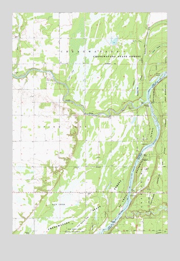
Bass Creek, MN USGS Topographic Map
Click on map above to begin viewing in our Map Viewer.

This topographic map contains these locations and features:
Feature Name Type Latitude Longitude GNIS ID View Map
Bass CreekStreamN45.8350°W92.8338°639668View Map
Chengwatanna Wildlife Structure DamDamN45.8600°W92.7902°1777213View Map
Green SwampSwampN45.8530°W92.7599°644425View Map
Long Meadows LakeLakeN45.7537°W92.8234°1815003View Map
Milburn ChurchChurchN45.8172°W92.8677°647839View Map
Raspberry LandingLocaleN45.7566°W92.7919°1843164View Map
Redhorse CreekStreamN45.8341°W92.7624°649895View Map
Saint Croix PitMineN45.7872°W92.7675°2634494View Map
Sandrock Cliff CampgroundLocaleN45.7930°W92.7694°1843177View Map
School Number 1573SchoolN45.8241°W92.8691°651401View Map
School Number 1580SchoolN45.8100°W92.8374°651403View Map
School Number 1589SchoolN45.7727°W92.8208°651405View Map
Seven IslandsIslandN45.8386°W92.7549°651861View Map
Snake RiverStreamN45.8241°W92.7646°658321View Map
Snake River CampgroundLocaleN45.8228°W92.7806°2069881View Map
Snake River LandingLocaleN45.8230°W92.7652°1815004View Map
Soderbeck LandingLocaleN45.8236°W92.7635°1843186View Map
Township of ChengwatanaCivilN45.8684°W92.8250°663789View Map
West Fork Redhorse CreekStreamN45.8572°W92.7671°1815005View Map
Wood RiverStreamN45.7630°W92.7849°1576973View Map

Note: Coordinates in the location and feature list above are referenced to NAD83 datum.


Copyright (C) 2008-2024 Ryan Niemi / Sunset Dynamics ... All Rights Reserved