TopoQuest Logo
Do you find TopoQuest useful?
Help keep TopoQuest running and adding new maps/features by donating!
Bitcoin:  19c7KJd3qBynnjoSw5npx9KScwjBe4ifkT
Litecoin:  LXs6TkuXGGXo1vDsWCkWVdjQX94eUKd6ui
Home View Maps Find Maps Find Places Resources & Links


Rush City, Minnesota Topographic Map

USGS Map Title: Rush City, MN
USGS Map MRC: 45092F8
DRG (GeoTIFF) Download: o45092f8.tif


Neighboring USGS Topographic Map Quads:


  Henriette, MN  
45093G1
 

  Pine City, MN  
45092G8
 

  Bass Creek, MN  
45092G7
 

  Rush Lake, MN  
45093F1
 

  Rush City, MN  
45092F8
 

  Randall, WI  
45092F7
 

  Stark, MN  
45093E1
 

  North Branch, MN  
45092E8
 

  Sunrise, MN  
45092E7


Map MRC Location:

N46°
W93°
N46°
W92°
H8 H7 H6 H5 H4 H3 H2 H1
G8 G7 G6 G5 G4 G3 G2 G1
F8 F7 F6 F5 F4 F3 F2 F1
E8 E7 E6 E5 E4 E3 E2 E1
D8 D7 D6 D5 D4 D3 D2 D1
C8 C7 C6 C5 C4 C3 C2 C1
B8 B7 B6 B5 B4 B3 B2 B1
A8 A7 A6 A5 A4 A3 A2 A1
N45°
W93°
N45°
W92°

Rush City, MN USGS 1:24K Topographic Map Preview:
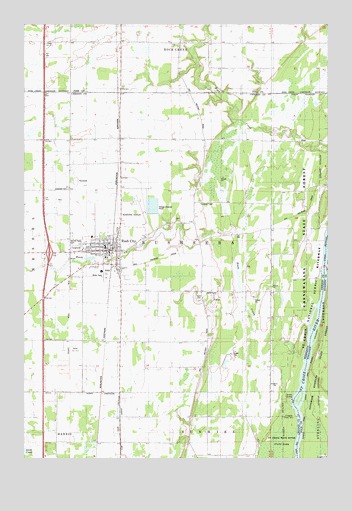
Rush City, MN USGS Topographic Map
Click on map above to begin viewing in our Map Viewer.

This topographic map contains these locations and features:
Feature Name Type Latitude Longitude GNIS ID View Map
Brookside Golf ClubLocaleN45.6833°W92.9986°2069075View Map
C E Jacobson Elementary SchoolSchoolN45.6888°W92.9722°2069058View Map
Calvary CemeteryCemeteryN45.6874°W92.9817°1814995View Map
Chisago County FairgroundsLocaleN45.6847°W92.9800°2069073View Map
Chisago County Historical Society MuseumBuildingN45.6847°W92.9800°2069074View Map
City of Rush CityCivilN45.6877°W92.9655°665486View Map
County Ditch Number NineCanalN45.6405°W92.9585°1814992View Map
County Ditch Number SixCanalN45.6666°W92.9813°1814994View Map
Covenant CemeteryCemeteryN45.7027°W92.9821°642401View Map
East Rock Creek ChurchChurchN45.7441°W92.9177°643101View Map
Evangelical Covenant ChurchChurchN45.6861°W92.9764°2069057View Map
First Lutheran ChurchChurchN45.6836°W92.9703°2069054View Map
Gee Family CemeteryCemeteryN45.6880°W92.9180°2069071View Map
Heinrich Pioneer CemeteryCemeteryN45.7015°W92.8843°2069072View Map
Hillcrest Health Care CenterHospitalN45.6825°W92.9611°2069059View Map
Interchange 159CrossingN45.6842°W92.9889°2069158View Map
Lakes Region Emergency Medical Services Rush CityBuildingN45.6838°W92.9735°2721302View Map
Landers LandingLocaleN45.6422°W92.8899°1814993View Map
Minnesota Correctional Facility Rush CityBuildingN45.7071°W92.9483°2756208View Map
Rush CityLocaleN45.6869°W92.9642°2069060View Map
Rush CityPopulated PlaceN45.6855°W92.9655°650391View Map
Rush City Area ClinicHospitalN45.6842°W92.9728°2069052View Map
Rush City Baptist ChurchChurchN45.6842°W92.9786°2069053View Map
Rush City Branch LibraryBuildingN45.6844°W92.9647°2069051View Map
Rush City City HallBuildingN45.6856°W92.9644°2069062View Map
Rush City Fire DepartmentBuildingN45.6840°W92.9664°2666461View Map
Rush City High SchoolSchoolN45.6904°W92.9764°2069049View Map
Rush City ParkParkN45.6853°W92.9642°2069061View Map
Rush City Police DepartmentBuildingN45.6855°W92.9666°2758629View Map
Rush City Post OfficePost OfficeN45.6839°W92.9656°2069050View Map
Rush City Regional AirportAirportN45.6986°W92.9542°660387View Map
Rush CreekStreamN45.6527°W92.8844°650395View Map
Rush Creek DamDamN45.6816°W92.9719°1776727View Map
Rush Meadows Mobile Home ParkPopulated PlaceN45.6778°W92.9583°2069070View Map
Sacred Heart Catholic ChurchChurchN45.6842°W92.9675°2069055View Map
Saint John's Lutheran ChurchChurchN45.6842°W92.9756°2069056View Map
Stenger's Mobile Home ParkPopulated PlaceN45.6856°W92.9653°2069853View Map
Taylor CemeteryCemeteryN45.6705°W92.9280°653043View Map
Township of RushsebaCivilN45.6888°W92.9291°665491View Map

Note: Coordinates in the location and feature list above are referenced to NAD83 datum.


Copyright (C) 2008-2024 Ryan Niemi / Sunset Dynamics ... All Rights Reserved