TopoQuest Logo
Do you find TopoQuest useful?
Help keep TopoQuest running and adding new maps/features by donating!
Bitcoin:  19c7KJd3qBynnjoSw5npx9KScwjBe4ifkT
Litecoin:  LXs6TkuXGGXo1vDsWCkWVdjQX94eUKd6ui
Home View Maps Find Maps Find Places Resources & Links


Randall, Wisconsin Topographic Map

USGS Map Title: Randall, WI
USGS Map MRC: 45092F7
DRG (GeoTIFF) Download: o45092f7.tif


Neighboring USGS Topographic Map Quads:


  Pine City, MN  
45092G8
 

  Bass Creek, MN  
45092G7
 

  Grantsburg, WI  
45092G6
 

  Rush City, MN  
45092F8
 

  Randall, WI  
45092F7
 

  Trade River, WI  
45092F6
 

  North Branch, MN  
45092E8
 

  Sunrise, MN  
45092E7
 

  Cushing, WI  
45092E6


Map MRC Location:

N46°
W93°
N46°
W92°
H8 H7 H6 H5 H4 H3 H2 H1
G8 G7 G6 G5 G4 G3 G2 G1
F8 F7 F6 F5 F4 F3 F2 F1
E8 E7 E6 E5 E4 E3 E2 E1
D8 D7 D6 D5 D4 D3 D2 D1
C8 C7 C6 C5 C4 C3 C2 C1
B8 B7 B6 B5 B4 B3 B2 B1
A8 A7 A6 A5 A4 A3 A2 A1
N45°
W93°
N45°
W92°

Randall, WI USGS 1:24K Topographic Map Preview:
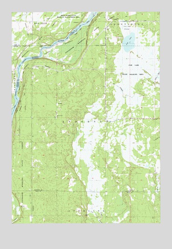
Randall, WI USGS Topographic Map
Click on map above to begin viewing in our Map Viewer.

This topographic map contains these locations and features:
Feature Name Type Latitude Longitude GNIS ID View Map
BensonPopulated PlaceN45.7172°W92.8558°1577514View Map
Cold CreekStreamN45.6275°W92.8016°1563235View Map
County Trunk O FlowageReservoirN45.6862°W92.7949°1793592View Map
Fish LakeLakeN45.7319°W92.7761°1564998View Map
Fish Lake County Highway O H12.152 DamDamN45.6866°W92.7952°1793591View Map
Fish Lake Meadow State Natural AreaParkN45.7202°W92.7713°2061900View Map
LindPopulated PlaceN45.7400°W92.7955°1577704View Map
Pleasant Prairie ChurchChurchN45.6883°W92.8372°1571623View Map
RandallPopulated PlaceN45.6958°W92.8352°1577783View Map
Rock CreekStreamN45.7130°W92.8685°650186View Map
Rock Marsh State Wildlife Management AreaParkN45.7452°W92.8238°1814996View Map
Saint Croix Ash Swamp State Natural AreaParkN45.7369°W92.8163°2061905View Map
Saint Croix Seeps State Natural AreaParkN45.6875°W92.8735°2061906View Map
Sterling Lookout TowerTowerN45.6297°W92.8130°1581347View Map
Stevens CreekStreamN45.7291°W92.8449°652625View Map
Town of AndersonCivilN45.6857°W92.7626°1582693View Map
Town Road FlowageReservoirN45.7402°W92.7780°1843195View Map

Note: Coordinates in the location and feature list above are referenced to NAD83 datum.


Copyright (C) 2008-2025 Ryan Niemi / Sunset Dynamics ... All Rights Reserved