TopoQuest Logo
Do you find TopoQuest useful?
Help keep TopoQuest running and adding new maps/features by donating!
Bitcoin:  19c7KJd3qBynnjoSw5npx9KScwjBe4ifkT
Litecoin:  LXs6TkuXGGXo1vDsWCkWVdjQX94eUKd6ui
Home View Maps Find Maps Find Places Resources & Links


Limestone, Florida Topographic Map

USGS Map Title: Limestone, FL
USGS Map MRC: 27081C8
DRG (GeoTIFF) Download: o27081c8.tif


Neighboring USGS Topographic Map Quads:


  Myakka Head, FL  
27082D1
 

  Ona, FL  
27081D8
 

  Zolfo Springs, FL  
27081D7
 

  Edgeville, FL  
27082C1
 

  Limestone, FL  
27081C8
 

  Gardner, FL  
27081C7
 

  Murdock NE, FL  
27082B1
 

  Nocatee, FL  
27081B8
 

  Arcadia, FL  
27081B7


Map MRC Location:

N28°
W82°
N28°
W81°
H8 H7 H6 H5 H4 H3 H2 H1
G8 G7 G6 G5 G4 G3 G2 G1
F8 F7 F6 F5 F4 F3 F2 F1
E8 E7 E6 E5 E4 E3 E2 E1
D8 D7 D6 D5 D4 D3 D2 D1
C8 C7 C6 C5 C4 C3 C2 C1
B8 B7 B6 B5 B4 B3 B2 B1
A8 A7 A6 A5 A4 A3 A2 A1
N27°
W82°
N27°
W81°

Limestone, FL USGS 1:24K Topographic Map Preview:
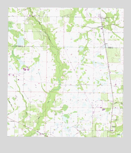
Limestone, FL USGS Topographic Map
Click on map above to begin viewing in our Map Viewer.

This topographic map contains these locations and features:
Feature Name Type Latitude Longitude GNIS ID View Map
Brandy BranchStreamN27.2528°W81.9731°294240View Map
Bunker Railroad StationLocaleN27.2520°W81.9840°300245View Map
KinseyPopulated PlaceN27.3403°W81.8948°295393View Map
Lamp Grounds CemeteryCemeteryN27.2578°W81.8887°300244View Map
LansingPopulated PlaceN27.2567°W81.8890°295403View Map
LilyPopulated PlaceN27.3664°W81.9656°294836View Map
Lily ChurchChurchN27.3645°W81.9798°285519View Map
LimestonePopulated PlaceN27.3656°W81.8990°285531View Map
Limestone Census Designated PlaceCensusN27.3673°W81.9048°2583361View Map
Oak Hill ChurchChurchN27.2670°W81.8837°294283View Map
Oak Hill SchoolSchoolN27.2603°W81.8873°294284View Map
Ott's LandingAirportN27.3038°W81.8824°309237View Map
Pine LevelPopulated PlaceN27.2653°W81.9918°295540View Map
Pine Level Campground CemeteryCemeteryN27.2650°W81.9984°1989827View Map
Saint Paul Missionary Baptist ChurchChurchN27.3639°W81.8964°2451434View Map
Union Baptist ChurchChurchN27.3644°W81.9796°2451435View Map

Note: Coordinates in the location and feature list above are referenced to NAD83 datum.


Copyright (C) 2008-2025 Ryan Niemi / Sunset Dynamics ... All Rights Reserved