TopoQuest Logo
Do you find TopoQuest useful?
Help keep TopoQuest running and adding new maps/features by donating!
Bitcoin:  19c7KJd3qBynnjoSw5npx9KScwjBe4ifkT
Litecoin:  LXs6TkuXGGXo1vDsWCkWVdjQX94eUKd6ui
Home View Maps Find Maps Find Places Resources & Links


Nocatee, Florida Topographic Map

USGS Map Title: Nocatee, FL
USGS Map MRC: 27081B8
DRG (GeoTIFF) Download: o27081b8.tif


Neighboring USGS Topographic Map Quads:


  Edgeville, FL  
27082C1
 

  Limestone, FL  
27081C8
 

  Gardner, FL  
27081C7
 

  Murdock NE, FL  
27082B1
 

  Nocatee, FL  
27081B8
 

  Arcadia, FL  
27081B7
 

  Murdock SE, FL  
27082A1
 

  Fort Ogden, FL  
27081A8
 

  Arcadia SE, FL  
27081A7


Map MRC Location:

N28°
W82°
N28°
W81°
H8 H7 H6 H5 H4 H3 H2 H1
G8 G7 G6 G5 G4 G3 G2 G1
F8 F7 F6 F5 F4 F3 F2 F1
E8 E7 E6 E5 E4 E3 E2 E1
D8 D7 D6 D5 D4 D3 D2 D1
C8 C7 C6 C5 C4 C3 C2 C1
B8 B7 B6 B5 B4 B3 B2 B1
A8 A7 A6 A5 A4 A3 A2 A1
N27°
W82°
N27°
W81°

Nocatee, FL USGS 1:24K Topographic Map Preview:
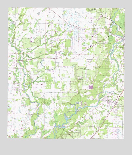
Nocatee, FL USGS Topographic Map
Click on map above to begin viewing in our Map Viewer.

This topographic map contains these locations and features:
Feature Name Type Latitude Longitude GNIS ID View Map
Arcadia Village Adult Mobile Home CommunityPopulated PlaceN27.2293°W81.8901°2447567View Map
Arcadia West DivisionCivilN27.1748°W81.9429°1935687View Map
Bee Gum LakeLakeN27.1584°W81.9267°294237View Map
Belgium (historical)Populated PlaceN27.2375°W81.8909°294630View Map
Buzzard Roost BranchStreamN27.2320°W81.9918°294242View Map
Church of ChristChurchN27.2057°W81.8751°2447577View Map
Church of God of ProphecyChurchN27.2310°W81.9226°2447579View Map
Desoto County Fire and Rescue Station 4BuildingN27.2010°W81.9776°2644560View Map
First Baptist Church of NocateeChurchN27.1569°W81.8850°2447584View Map
Grass LakeLakeN27.1250°W81.9567°294253View Map
Johnson LakeLakeN27.1499°W81.9376°294264View Map
Joshua CreekStreamN27.1623°W81.9009°294265View Map
Mc Donald's FieldAirportN27.1994°W81.9123°309239View Map
McBride BranchStreamN27.2487°W81.8798°294275View Map
Mount Efen ChurchChurchN27.1823°W81.9234°294278View Map
New Hope Christian ChurchChurchN27.2307°W81.9060°2447587View Map
NocateePopulated PlaceN27.1603°W81.8823°294280View Map
Nocatee Elementary SchoolSchoolN27.1531°W81.8832°297726View Map
Nocatee Post OfficePost OfficeN27.1598°W81.8843°2783437View Map
Owens CemeteryCemeteryN27.1837°W81.9231°294286View Map
TryonPopulated PlaceN27.2481°W81.9531°300246View Map
Upper Room Church of GodChurchN27.1483°W81.8925°2447594View Map
WXKT-FM (Arcadia)TowerN27.1839°W81.9490°308944View Map

Note: Coordinates in the location and feature list above are referenced to NAD83 datum.


Copyright (C) 2008-2025 Ryan Niemi / Sunset Dynamics ... All Rights Reserved