TopoQuest Logo
Do you find TopoQuest useful?
Help keep TopoQuest running and adding new maps/features by donating!
Bitcoin:  19c7KJd3qBynnjoSw5npx9KScwjBe4ifkT
Litecoin:  LXs6TkuXGGXo1vDsWCkWVdjQX94eUKd6ui
Home View Maps Find Maps Find Places Resources & Links


Lincoln, California Topographic Map

USGS Map Title: Lincoln, CA
USGS Map MRC: 38121H3
DRG (GeoTIFF) Download: o38121h3.tif


Neighboring USGS Topographic Map Quads:


  Wheatland, CA  
39121A4
 

  Camp Far West, CA  
39121A3
 

  Wolf, CA  
39121A2
 

  Sheridan, CA  
38121H4
 

  Lincoln, CA  
38121H3
 

  Gold Hill, CA  
38121H2
 

  Pleasant Grove, CA  
38121G4
 

  Roseville, CA  
38121G3
 

  Rocklin, CA  
38121G2


Map MRC Location:

N39°
W122°
N39°
W121°
H8 H7 H6 H5 H4 H3 H2 H1
G8 G7 G6 G5 G4 G3 G2 G1
F8 F7 F6 F5 F4 F3 F2 F1
E8 E7 E6 E5 E4 E3 E2 E1
D8 D7 D6 D5 D4 D3 D2 D1
C8 C7 C6 C5 C4 C3 C2 C1
B8 B7 B6 B5 B4 B3 B2 B1
A8 A7 A6 A5 A4 A3 A2 A1
N38°
W122°
N38°
W121°

Lincoln, CA USGS 1:24K Topographic Map Preview:
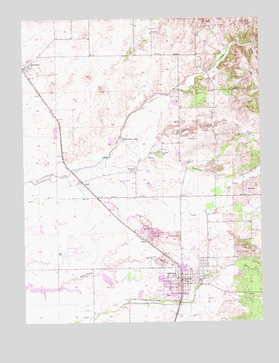
Lincoln, CA USGS Topographic Map
Click on map above to begin viewing in our Map Viewer.

This topographic map contains these locations and features:
Feature Name Type Latitude Longitude GNIS ID View Map
BrockLocaleN38.9446°W121.3555°219863View Map
Carlin C Coppin Elementary SchoolSchoolN38.9016°W121.2851°1723414View Map
Chamberlain RanchLocaleN38.9505°W121.3241°220892View Map
City of Lincoln 2008 DamDamN38.8866°W121.3161°1664441View Map
ClaytonPopulated PlaceN38.9080°W121.3122°1658288View Map
Doty CreekStreamN38.9391°W121.3413°1670545View Map
Doty RavineValleyN38.9432°W121.3225°222540View Map
EwingPopulated PlaceN38.9327°W121.3455°223303View Map
Fairoaks School (historical)SchoolN38.9266°W121.3680°1670547View Map
Glen Edwards Elementary SchoolSchoolN38.8877°W121.3000°1723428View Map
Glen Edwards Middle SchoolSchoolN38.8884°W121.2996°1723429View Map
LincolnPopulated PlaceN38.8916°W121.2930°277539View Map
Lincoln CemeteryCemeteryN38.8854°W121.3020°2773305View Map
Lincoln City HallBuildingN38.8916°W121.2905°1723438View Map
Lincoln Clay MineMineN38.9108°W121.3075°2678370View Map
Lincoln High SchoolSchoolN38.8951°W121.2988°1723440View Map
Lincoln Koi FarmLocaleN38.9822°W121.2531°2674756View Map
Lincoln Police DepartmentBuildingN38.8949°W121.2938°2751053View Map
Lincoln Post OfficePost OfficeN38.8850°W121.2910°1723441View Map
Lincoln Public LibraryBuildingN38.8921°W121.2913°1723442View Map
Lincoln Quarry (historical)MineN38.8947°W121.2619°2678371View Map
Lincoln Regional Airport/Karl Harder FieldAirportN38.9068°W121.3505°1653604View Map
Manzanita CemeteryCemeteryN38.9443°W121.3044°228034View Map
McBean Memorial ParkParkN38.8896°W121.2858°1723443View Map
Placer County Fire Department Station 33 / Lincoln City Fire Department Station 1BuildingN38.8900°W121.2841°2621968View Map
Placer County Fire Department Station 34 / Lincoln City Fire Department Station 2BuildingN38.8857°W121.3142°2621868View Map
Placer County Fire Department Station 70 - Lincoln StationBuildingN38.9256°W121.2622°2621969View Map
Sheridan Census Designated PlaceCensusN38.9690°W121.3560°2583137View Map
Sheridan Russian CemeteryCemeteryN38.9741°W121.3597°1723462View Map
Sheridan SchoolSchoolN38.9829°W121.3734°1723463View Map
Sunnybrook FarmLocaleN38.9377°W121.3186°235788View Map
West Valley DivisionCivilN38.8946°W121.3451°1935376View Map
Whisky RunStreamN38.9891°W121.2563°237627View Map

Note: Coordinates in the location and feature list above are referenced to NAD83 datum.


Copyright (C) 2008-2024 Ryan Niemi / Sunset Dynamics ... All Rights Reserved