TopoQuest Logo
Do you find TopoQuest useful?
Help keep TopoQuest running and adding new maps/features by donating!
Bitcoin:  19c7KJd3qBynnjoSw5npx9KScwjBe4ifkT
Litecoin:  LXs6TkuXGGXo1vDsWCkWVdjQX94eUKd6ui
Home View Maps Find Maps Find Places Resources & Links


Lincoln, Missouri Topographic Map

USGS Map Title: Lincoln, MO
USGS Map MRC: 38093D3
DRG (GeoTIFF) Download: o38093d3.tif


Neighboring USGS Topographic Map Quads:


  Green Ridge South, MO  
38093E4
 

  Ionia, MO  
38093E3
 

  Bahner, MO  
38093E2
 

  Lincoln NW, MO  
38093D4
 

  Lincoln, MO  
38093D3
 

  Cole Camp, MO  
38093D2
 

  Shawnee Bend, MO  
38093C4
 

  Lincoln SE, MO  
38093C3
 

  Lakeview Heights, MO  
38093C2


Map MRC Location:

N39°
W94°
N39°
W93°
H8 H7 H6 H5 H4 H3 H2 H1
G8 G7 G6 G5 G4 G3 G2 G1
F8 F7 F6 F5 F4 F3 F2 F1
E8 E7 E6 E5 E4 E3 E2 E1
D8 D7 D6 D5 D4 D3 D2 D1
C8 C7 C6 C5 C4 C3 C2 C1
B8 B7 B6 B5 B4 B3 B2 B1
A8 A7 A6 A5 A4 A3 A2 A1
N38°
W94°
N38°
W93°

Lincoln, MO USGS 1:24K Topographic Map Preview:
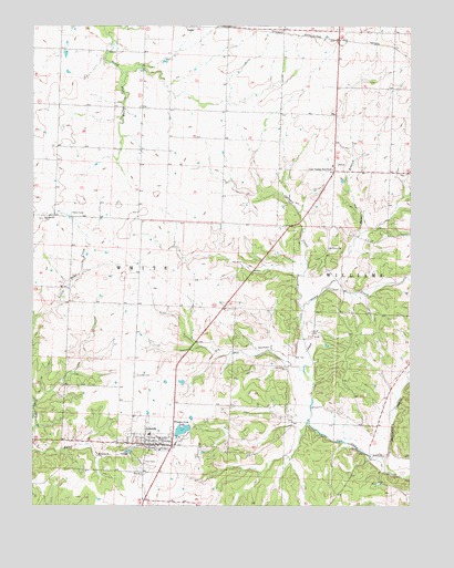
Lincoln, MO USGS Topographic Map
Click on map above to begin viewing in our Map Viewer.

This topographic map contains these locations and features:
Feature Name Type Latitude Longitude GNIS ID View Map
Bauer BranchStreamN38.4317°W93.2788°713742View Map
Carman CreekStreamN38.4259°W93.2858°715403View Map
City of LincolnCivilN38.3940°W93.3314°2395712View Map
Cole Camp JunctionPopulated PlaceN38.4628°W93.2755°716092View Map
Fordney School (historical)SchoolN38.3984°W93.2644°745356View Map
Golden School (historical)SchoolN38.4639°W93.3191°745352View Map
Hutsler School (historical)SchoolN38.3909°W93.3183°745357View Map
Immanuel ChurchChurchN38.4500°W93.3713°720088View Map
Immanuel Lutheran CemeteryCemeteryN38.4497°W93.3715°2681307View Map
Karr Lake DamDamN38.4150°W93.3352°763364View Map
LincolnPopulated PlaceN38.3909°W93.3346°721074View Map
Lincoln CemeteryCemeteryN38.4089°W93.3408°721076View Map
Lincoln Community Fire District Fire StationBuildingN38.3902°W93.3330°2621218View Map
Lincoln Municipal AirportAirportN38.3989°W93.3320°758790View Map
Lincoln Post OfficePost OfficeN38.3907°W93.3337°2783187View Map
McMurdo School (historical)SchoolN38.4306°W93.3138°745354View Map
Mount Olivet ChurchChurchN38.4422°W93.2771°722836View Map
Mount Olivet Church CemeteryCemeteryN38.4417°W93.2770°2681311View Map
Pierce School (historical)SchoolN38.4503°W93.3724°745351View Map
Plain View School (historical)SchoolN38.4622°W93.2658°745353View Map
Raymond (historical)LocaleN38.4142°W93.2885°744913View Map
Rocky Ridge School (historical)SchoolN38.4250°W93.2741°745355View Map
Timber Line LakeReservoirN38.3947°W93.3256°763590View Map
Timber Line Lake DamDamN38.3950°W93.3235°763589View Map
Williams CreekStreamN38.3867°W93.2585°728895View Map
Zion CemeteryCemeteryN38.3864°W93.3383°729235View Map
Zion ChurchChurchN38.3834°W93.3391°729244View Map

Note: Coordinates in the location and feature list above are referenced to NAD83 datum.


Copyright (C) 2008-2025 Ryan Niemi / Sunset Dynamics ... All Rights Reserved