TopoQuest Logo
Do you find TopoQuest useful?
Help keep TopoQuest running and adding new maps/features by donating!
Bitcoin:  19c7KJd3qBynnjoSw5npx9KScwjBe4ifkT
Litecoin:  LXs6TkuXGGXo1vDsWCkWVdjQX94eUKd6ui
Home View Maps Find Maps Find Places Resources & Links


Ionia, Missouri Topographic Map

USGS Map Title: Ionia, MO
USGS Map MRC: 38093E3
DRG (GeoTIFF) Download: o38093e3.tif


Neighboring USGS Topographic Map Quads:


  Green Ridge North, MO  
38093F4
 

  Sedalia West, MO  
38093F3
 

  Sedalia East, MO  
38093F2
 

  Green Ridge South, MO  
38093E4
 

  Ionia, MO  
38093E3
 

  Bahner, MO  
38093E2
 

  Lincoln NW, MO  
38093D4
 

  Lincoln, MO  
38093D3
 

  Cole Camp, MO  
38093D2


Map MRC Location:

N39°
W94°
N39°
W93°
H8 H7 H6 H5 H4 H3 H2 H1
G8 G7 G6 G5 G4 G3 G2 G1
F8 F7 F6 F5 F4 F3 F2 F1
E8 E7 E6 E5 E4 E3 E2 E1
D8 D7 D6 D5 D4 D3 D2 D1
C8 C7 C6 C5 C4 C3 C2 C1
B8 B7 B6 B5 B4 B3 B2 B1
A8 A7 A6 A5 A4 A3 A2 A1
N38°
W94°
N38°
W93°

Ionia, MO USGS 1:24K Topographic Map Preview:
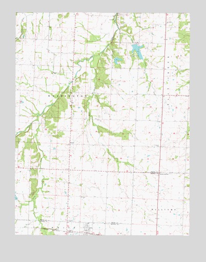
Ionia, MO USGS Topographic Map
Click on map above to begin viewing in our Map Viewer.

This topographic map contains these locations and features:
Feature Name Type Latitude Longitude GNIS ID View Map
Center View School (historical)SchoolN38.5797°W93.3066°745443View Map
Christian CemeteryCemeteryN38.5079°W93.3370°715812View Map
Cottage School (historical)SchoolN38.5997°W93.3338°745442View Map
Flat Creek Methodist CemeteryCemeteryN38.5236°W93.3639°722252View Map
Henry CreekStreamN38.6011°W93.3188°719385View Map
IoniaPopulated PlaceN38.5042°W93.3241°720156View Map
Ionia Post OfficePost OfficeN38.5027°W93.3235°2782739View Map
Knight Lake DamDamN38.5984°W93.3035°764012View Map
Lake TeboReservoirN38.6039°W93.2877°764015View Map
ManilaPopulated PlaceN38.5511°W93.3363°741039View Map
New Bethel CemeteryCemeteryN38.6188°W93.2670°2702639View Map
New Bethel United Methodist ChurchChurchN38.6195°W93.2669°723186View Map
Number 130 ReservoirReservoirN38.5980°W93.3024°764013View Map
Pettis County Fire District 1 Station 5BuildingN38.5789°W93.2565°2620678View Map
Pleasant View School (historical)SchoolN38.5236°W93.3744°745445View Map
Point Pleasant CemeteryCemeteryN38.5502°W93.2717°724691View Map
Prairie Flower School (historical)SchoolN38.5059°W93.2699°745344View Map
South Flat CreekStreamN38.5650°W93.3594°726723View Map
South Side School (historical)SchoolN38.5639°W93.2608°745444View Map
Tebo CreekStreamN38.6164°W93.3010°727511View Map
Tebo Lake DamDamN38.6067°W93.2885°764014View Map
Town of IoniaCivilN38.5037°W93.3235°2397008View Map
Township of WashingtonCivilN38.5686°W93.3441°767175View Map
Wesner Lake DamDamN38.6067°W93.2819°764474View Map
Windsor JunctionPopulated PlaceN38.5347°W93.2722°741364View Map

Note: Coordinates in the location and feature list above are referenced to NAD83 datum.


Copyright (C) 2008-2024 Ryan Niemi / Sunset Dynamics ... All Rights Reserved