TopoQuest Logo
Do you find TopoQuest useful?
Help keep TopoQuest running and adding new maps/features by donating!
Bitcoin:  19c7KJd3qBynnjoSw5npx9KScwjBe4ifkT
Litecoin:  LXs6TkuXGGXo1vDsWCkWVdjQX94eUKd6ui
Home View Maps Find Maps Find Places Resources & Links


Linden, Indiana Topographic Map

USGS Map Title: Linden, IN
USGS Map MRC: 40086B8
DRG (GeoTIFF) Download: o40086b8.tif


Neighboring USGS Topographic Map Quads:


  Westpoint, IN  
40087C1
 

  Romney, IN  
40086C8
 

  Stockwell, IN  
40086C7
 

  Wingate, IN  
40087B1
 

  Linden, IN  
40086B8
 

  Kirkpatrick, IN  
40086B7
 

  Waynetown, IN  
40087A1
 

  Crawfordsville, IN  
40086A8
 

  Darlington, IN  
40086A7


Map MRC Location:

N41°
W87°
N41°
W86°
H8 H7 H6 H5 H4 H3 H2 H1
G8 G7 G6 G5 G4 G3 G2 G1
F8 F7 F6 F5 F4 F3 F2 F1
E8 E7 E6 E5 E4 E3 E2 E1
D8 D7 D6 D5 D4 D3 D2 D1
C8 C7 C6 C5 C4 C3 C2 C1
B8 B7 B6 B5 B4 B3 B2 B1
A8 A7 A6 A5 A4 A3 A2 A1
N40°
W87°
N40°
W86°

Linden, IN USGS 1:24K Topographic Map Preview:
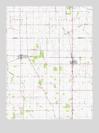
Linden, IN USGS Topographic Map
Click on map above to begin viewing in our Map Viewer.

This topographic map contains these locations and features:
Feature Name Type Latitude Longitude GNIS ID View Map
Cherry GrovePopulated PlaceN40.1356°W86.9045°432442View Map
Coal Creek Township Volunteer Fire Department Station 2BuildingN40.1935°W86.9801°2626279View Map
Dewey DitchCanalN40.2139°W86.9481°433523View Map
Grimes Farm Strip (historical)AirportN40.2486°W86.9506°449329View Map
LindenPopulated PlaceN40.1881°W86.9039°437951View Map
Linden - Madison Township Volunteer Fire DepartmentBuildingN40.1874°W86.9010°2625779View Map
Linden Conservation ClubLocaleN40.2275°W86.8933°452355View Map
Linden Elementary SchoolSchoolN40.1875°W86.9000°447353View Map
Lofland DitchCanalN40.2317°W86.9278°438219View Map
Mount Pleasant CemeteryCemeteryN40.1425°W86.9261°439662View Map
New RichmondPopulated PlaceN40.1956°W86.9789°440105View Map
RomneyPopulated PlaceN40.2495°W86.9042°442271View Map
Romney Fraley DitchCanalN40.2306°W86.8847°442272View Map
Stoddard DitchCanalN40.2145°W86.9042°444186View Map
Town of LindenCivilN40.1890°W86.9028°2396718View Map
Town of New RichmondCivilN40.1943°W86.9778°2396808View Map
Wilkins Strip Airport (historical)AirportN40.1900°W86.9222°449248View Map
Wilson Killen CemeteryCemeteryN40.1606°W86.9513°446149View Map
WLFQ-FM (Crawfordsville)TowerN40.1348°W86.9033°448987View Map

Note: Coordinates in the location and feature list above are referenced to NAD83 datum.


Copyright (C) 2008-2024 Ryan Niemi / Sunset Dynamics ... All Rights Reserved