TopoQuest Logo
Do you find TopoQuest useful?
Help keep TopoQuest running and adding new maps/features by donating!
Bitcoin:  19c7KJd3qBynnjoSw5npx9KScwjBe4ifkT
Litecoin:  LXs6TkuXGGXo1vDsWCkWVdjQX94eUKd6ui
Home View Maps Find Maps Find Places Resources & Links


Wingate, Indiana Topographic Map

USGS Map Title: Wingate, IN
USGS Map MRC: 40087B1
DRG (GeoTIFF) Download: o40087b1.tif


Neighboring USGS Topographic Map Quads:


  Attica, IN  
40087C2
 

  Westpoint, IN  
40087C1
 

  Romney, IN  
40086C8
 

  Mellott, IN  
40087B2
 

  Wingate, IN  
40087B1
 

  Linden, IN  
40086B8
 

  Hillsboro, IN  
40087A2
 

  Waynetown, IN  
40087A1
 

  Crawfordsville, IN  
40086A8


Map MRC Location:

N41°
W88°
N41°
W87°
H8 H7 H6 H5 H4 H3 H2 H1
G8 G7 G6 G5 G4 G3 G2 G1
F8 F7 F6 F5 F4 F3 F2 F1
E8 E7 E6 E5 E4 E3 E2 E1
D8 D7 D6 D5 D4 D3 D2 D1
C8 C7 C6 C5 C4 C3 C2 C1
B8 B7 B6 B5 B4 B3 B2 B1
A8 A7 A6 A5 A4 A3 A2 A1
N40°
W88°
N40°
W87°

Wingate, IN USGS 1:24K Topographic Map Preview:
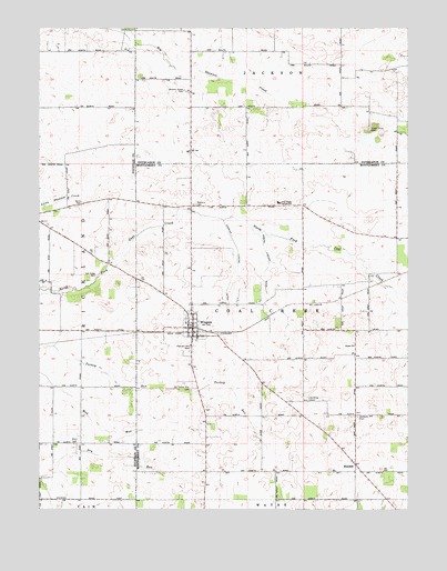
Wingate, IN USGS Topographic Map
Click on map above to begin viewing in our Map Viewer.

This topographic map contains these locations and features:
Feature Name Type Latitude Longitude GNIS ID View Map
Babcocks Airport (historical)AirportN40.1703°W87.0639°449395View Map
Center ChurchChurchN40.1673°W87.0178°432322View Map
Charles Ludlow DitchCanalN40.1889°W87.0575°432419View Map
Coal Creek Central SchoolSchoolN40.2048°W87.0436°432707View Map
Coal Creek Township Volunteer Fire DepartmentBuildingN40.1729°W87.0731°2626280View Map
Dry Run CemeteryCemeteryN40.1421°W87.1129°443447View Map
ElmdalePopulated PlaceN40.1367°W87.0175°434127View Map
Joseph Ludlow DitchCanalN40.1798°W87.0467°437131View Map
Meharry AG Service AirportAirportN40.2039°W87.0558°449393View Map
Meharry CemeteryCemeteryN40.2041°W87.0725°438968View Map
Oak Ridge CemeteryCemeteryN40.1859°W87.1060°440450View Map
Oakland CemeteryCemeteryN40.1491°W87.0170°440464View Map
Old Turkey Run CemeteryCemeteryN40.1563°W87.0737°440609View Map
Pleasant Hill CemeteryCemeteryN40.1671°W87.0735°441271View Map
Quirk CemeteryCemeteryN40.2047°W87.1109°441703View Map
Sugar Grove CemeteryCemeteryN40.2239°W87.0130°444340View Map
Tally CemeteryCemeteryN40.1523°W87.0231°444554View Map
Town of WingateCivilN40.1724°W87.0725°2397750View Map
Townsend Airport (historical)AirportN40.1631°W87.0503°449394View Map
Township of Coal CreekCivilN40.1712°W87.0076°453236View Map
Wheeler Grove CemeteryCemeteryN40.2338°W87.0759°445888View Map
Willhite CemeteryCemeteryN40.1536°W87.0334°446048View Map
WingatePopulated PlaceN40.1723°W87.0728°446183View Map
Wolf CreekStreamN40.2198°W87.1147°446240View Map

Note: Coordinates in the location and feature list above are referenced to NAD83 datum.


Copyright (C) 2008-2024 Ryan Niemi / Sunset Dynamics ... All Rights Reserved