TopoQuest Logo
Do you find TopoQuest useful?
Help keep TopoQuest running and adding new maps/features by donating!
Bitcoin:  19c7KJd3qBynnjoSw5npx9KScwjBe4ifkT
Litecoin:  LXs6TkuXGGXo1vDsWCkWVdjQX94eUKd6ui
Home View Maps Find Maps Find Places Resources & Links


Lindley, Missouri Topographic Map

USGS Map Title: Lindley, MO
USGS Map MRC: 40093A3
DRG (GeoTIFF) Download: o40093a3.tif


Neighboring USGS Topographic Map Quads:


  Galt, MO  
40093B4
 

  Osgood, MO  
40093B3
 

  Milan West, MO  
40093B2
 

  Laredo, MO  
40093A4
 

  Lindley, MO  
40093A3
 

  Browning, MO  
40093A2
 

  Chula, MO  
39093H4
 

  Eversonville, MO  
39093H3
 

  Linneus, MO  
39093H2


Map MRC Location:

N41°
W94°
N41°
W93°
H8 H7 H6 H5 H4 H3 H2 H1
G8 G7 G6 G5 G4 G3 G2 G1
F8 F7 F6 F5 F4 F3 F2 F1
E8 E7 E6 E5 E4 E3 E2 E1
D8 D7 D6 D5 D4 D3 D2 D1
C8 C7 C6 C5 C4 C3 C2 C1
B8 B7 B6 B5 B4 B3 B2 B1
A8 A7 A6 A5 A4 A3 A2 A1
N40°
W94°
N40°
W93°

Lindley, MO USGS 1:24K Topographic Map Preview:
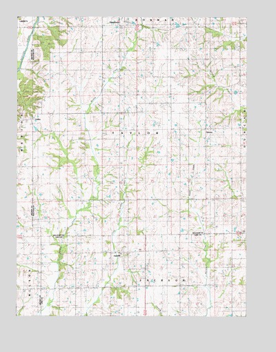
Lindley, MO USGS Topographic Map
Click on map above to begin viewing in our Map Viewer.

This topographic map contains these locations and features:
Feature Name Type Latitude Longitude GNIS ID View Map
Baker LakeReservoirN40.1234°W93.3135°761451View Map
Baker Lake DamDamN40.1234°W93.3135°761450View Map
Climax School (historical)SchoolN40.0181°W93.2960°715990View Map
Duffield School (historical)SchoolN40.0534°W93.3338°717157View Map
Fairview SchoolSchoolN40.0178°W93.3438°717817View Map
Green Valley School (historical)SchoolN40.1045°W93.2583°733956View Map
Hamilton SchoolSchoolN40.0784°W93.2727°719043View Map
HasevillePopulated PlaceN40.0264°W93.3213°738033View Map
Haseville CemeteryCemeteryN40.0263°W93.3185°2702412View Map
Haseville ChurchChurchN40.0256°W93.3197°719198View Map
LindleyPopulated PlaceN40.0820°W93.3683°754220View Map
Lindley CemeteryCemeteryN40.0900°W93.3627°1782148View Map
Lindley School (historical)SchoolN40.0836°W93.3716°746927View Map
Mount Zion CemeteryCemeteryN40.0478°W93.3236°1852366View Map
Mount Zion ChurchChurchN40.0478°W93.3247°722968View Map
North Bethel School (historical)SchoolN40.1006°W93.3294°723431View Map
ParsonsPopulated PlaceN40.0786°W93.2719°740030View Map
Russell SchoolSchoolN40.0486°W93.2802°725687View Map
Smith CemeteryCemeteryN40.0003°W93.3346°726604View Map
Strong and Stewart LakeReservoirN40.1217°W93.2881°761166View Map
Strong and Stewart Lake DamDamN40.1217°W93.2885°761165View Map
Township of TaylorCivilN40.0777°W93.3101°767451View Map
Whaley SchoolSchoolN40.0995°W93.2916°728674View Map

Note: Coordinates in the location and feature list above are referenced to NAD83 datum.


Copyright (C) 2008-2025 Ryan Niemi / Sunset Dynamics ... All Rights Reserved