TopoQuest Logo
Do you find TopoQuest useful?
Help keep TopoQuest running and adding new maps/features by donating!
Bitcoin:  19c7KJd3qBynnjoSw5npx9KScwjBe4ifkT
Litecoin:  LXs6TkuXGGXo1vDsWCkWVdjQX94eUKd6ui
Home View Maps Find Maps Find Places Resources & Links


Browning, Missouri Topographic Map

USGS Map Title: Browning, MO
USGS Map MRC: 40093A2
DRG (GeoTIFF) Download: o40093a2.tif


Neighboring USGS Topographic Map Quads:


  Osgood, MO  
40093B3
 

  Milan West, MO  
40093B2
 

  Milan East, MO  
40093B1
 

  Lindley, MO  
40093A3
 

  Browning, MO  
40093A2
 

  Milan SE, MO  
40093A1
 

  Eversonville, MO  
39093H3
 

  Linneus, MO  
39093H2
 

  Shelby, MO  
39093H1


Map MRC Location:

N41°
W94°
N41°
W93°
H8 H7 H6 H5 H4 H3 H2 H1
G8 G7 G6 G5 G4 G3 G2 G1
F8 F7 F6 F5 F4 F3 F2 F1
E8 E7 E6 E5 E4 E3 E2 E1
D8 D7 D6 D5 D4 D3 D2 D1
C8 C7 C6 C5 C4 C3 C2 C1
B8 B7 B6 B5 B4 B3 B2 B1
A8 A7 A6 A5 A4 A3 A2 A1
N40°
W94°
N40°
W93°

Browning, MO USGS 1:24K Topographic Map Preview:
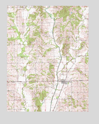
Browning, MO USGS Topographic Map
Click on map above to begin viewing in our Map Viewer.

This topographic map contains these locations and features:
Feature Name Type Latitude Longitude GNIS ID View Map
BrowningPopulated PlaceN40.0353°W93.1624°714793View Map
Browning Fire DepartmentBuildingN40.0349°W93.1515°2621436View Map
Browning Post OfficePost OfficeN40.0351°W93.1659°2782819View Map
Browning Rural Fire DepartmentBuildingN40.0349°W93.1515°2621435View Map
Brushy BranchStreamN40.0817°W93.2258°714881View Map
Calhoun CemeteryCemeteryN40.0331°W93.2296°715196View Map
City of BrowningCivilN40.0348°W93.1600°2393438View Map
Clem Springs School (historical)SchoolN40.1203°W93.1555°733961View Map
CoraPopulated PlaceN40.1097°W93.1305°740764View Map
Dry Ridge CemeteryCemeteryN40.0172°W93.2074°717129View Map
East Locust CreekStreamN40.0439°W93.1738°717320View Map
Fields CemeteryCemeteryN40.1008°W93.1744°717902View Map
Fields Lake DamDamN40.1067°W93.1902°761751View Map
Gray Lake DamDamN40.0884°W93.1869°761750View Map
Hatcher CemeteryCemeteryN40.0667°W93.1827°1852344View Map
Hooker CemeteryCemeteryN40.0250°W93.2494°719776View Map
Hooker School (historical)SchoolN40.0247°W93.2485°733976View Map
Hoover CemeteryCemeteryN40.0539°W93.1827°719786View Map
Jenkins CemeteryCemeteryN40.0161°W93.1519°720292View Map
Jenkins School (historical)SchoolN40.0142°W93.1516°733978View Map
Jones DamDamN40.1167°W93.1502°760838View Map
Jones LakeReservoirN40.1167°W93.1502°760839View Map
Little East Locust CreekStreamN40.0620°W93.1499°721227View Map
Locust Valley ChurchChurchN40.0356°W93.2338°721399View Map
Mairs BranchStreamN40.0256°W93.1755°721770View Map
McCulla CemeteryCemeteryN40.0772°W93.1333°722071View Map
Mundell School (historical)SchoolN40.0256°W93.2083°733977View Map
North Hooker School (historical)SchoolN40.0647°W93.2352°733959View Map
Prather CemeteryCemeteryN40.0289°W93.1921°724904View Map
Schrock CemeteryCemeteryN40.1047°W93.1966°726120View Map
Scottsville School (historical)SchoolN40.0834°W93.2055°733958View Map
Smith School (historical)SchoolN40.0645°W93.1972°733960View Map
Township of DuncanCivilN40.0891°W93.1829°767444View Map
Warren School (historical)SchoolN40.1017°W93.2091°733957View Map
White Oak CemeteryCemeteryN40.0881°W93.1552°1877396View Map
White Oak ChurchChurchN40.0881°W93.1552°728745View Map
White Oak Grove School (historical)SchoolN40.0886°W93.1544°733962View Map

Note: Coordinates in the location and feature list above are referenced to NAD83 datum.


Copyright (C) 2008-2024 Ryan Niemi / Sunset Dynamics ... All Rights Reserved